The National Geologic Map Database is migrating to a new infrastructure. We apologize for any service disruptions during this process.
|
|---|


- Usage in publication:
-
- Packard rhyolite*
- Modifications:
-
- First used
- Dominant lithology:
-
- Rhyolite
- AAPG geologic province:
-
- Great Basin province
- Wasatch uplift
Summary:
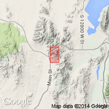
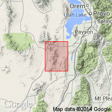
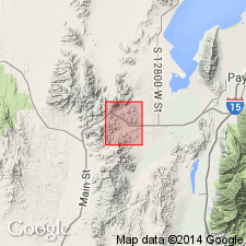
First published use as a map unit. Mapped with Swansea rhyolite. Intent to name, source of name, and type locality not stated. Occurs in northern and northeast part of quad in Utah Co, UT on the Wasatch uplift and in Juab Co, UT in the Great Basin province. Also occurs in three areas in southern part of quad, mostly in Juab Co, but also in Utah Co. Packard Peak [source of name] located in T10S, R2W in both Utah and Juab Cos. Probably was a viscous lava. Much of the rhyolite shows flow brecciation. Very little fragmental material. Tintic andesite shown in map unit list as younger than Packard. Center of eruption probably underlies Packard Peak. Assigned a Tertiary age.
Source: GNU records (USGS DDS-6; Denver GNULEX).
- Usage in publication:
-
- Packard rhyolite*
- Modifications:
-
- Overview
- AAPG geologic province:
-
- Wasatch uplift
- Great Basin province
Summary:
Covers an area of 18 to 20 sq mi north and south of Eureka in Utah Co on the Wasatch uplift and in Juab Co in the Great Basin province. Is 800 to 1,000 ft thick at Packard Peak. Occurs as small dikes and as a mass. Distinguished by presence of quartz phenocrysts. Prevailingly pink but locally is gray, brown, and purple. Glassy phases are gray to black. Detailed lithologic description. Chemical analyses. Classified as a toscanose. Assigned a post-Eocene, Tertiary age. Geologic map.
Source: GNU records (USGS DDS-6; Denver GNULEX).

- Usage in publication:
-
- Packard quartz latite*
- Modifications:
-
- Revised
- AAPG geologic province:
-
- Great Basin province
Summary:
Disconformably underlies the middle Eocene Laguna Springs latite (new) in Juab Co, UT in Great Basin province. Geologic map.
Source: GNU records (USGS DDS-6; Denver GNULEX).
- Usage in publication:
-
- Packard Quartz Latite*
- Modifications:
-
- Age modified
- Revised
- Geochronologic dating
- AAPG geologic province:
-
- Wasatch uplift
Summary:
Age changed from Oligocene to early Oligocene based on K-Ar age of 32.8 +/-1.0 and 32.07 +/-1.0 m.y. or Oligocene on biotite and sanidine from the porphyritic unit of Packard from the Central Standard shaft (SW1/4 SW1/4 sec 3, T10S, R2W), Utah Co, UT on the Wasatch uplift. Underlies 60 percent of quad. Geologic map. Forms an eastward thickening wedge of lavas and pyroclastic rocks. Thickest section is in drillhole (S1/2 SE1/4 sec 11, T10S, R2W) that bottomed at depth of 2,700 ft, all in Packard. Had an estimated volume of about 5 cubic mi. Divided into lower vitrophyre, middle porphyritic, and upper vitrophyre units. Chemical analyses. The only intrusive unit with similar composition is the Swansea stock. Source not known with certainty; probably a buried caldera filled in by younger rocks; probably erupted from vents 3.5 mi to south-southwest. Was succeeded by Copperopolis Latite (new) of Tintic Mountain Volcanic Group (new). Was preceded by the Apex Conglomerate.
Source: GNU records (USGS DDS-6; Denver GNULEX).
- Usage in publication:
-
- Packard Quartz Latite*
- Modifications:
-
- Not used
Summary:
Is an equivalent of the Fernow Quartz Latite that is not used in the Juab-Sevier Valley areas, UT in the Great Basin province. Rocks assigned to Packard equivalent by Meibos (1983) called basal unit chiefly of ash-flow and welded tuffs of Goldens Ranch Formation (adopted).
Source: GNU records (USGS DDS-6; Denver GNULEX).
For more information, please contact Nancy Stamm, Geologic Names Committee Secretary.
Asterisk (*) indicates published by U.S. Geological Survey authors.
"No current usage" (†) implies that a name has been abandoned or has fallen into disuse. Former usage and, if known, replacement name given in parentheses ( ).
Slash (/) indicates name conflicts with nomenclatural guidelines (CSN, 1933; ACSN, 1961, 1970; NACSN, 1983, 2005, 2021). May be explained within brackets ([ ]).