- Usage in publication:
-
- Overbrook sandstone
- Modifications:
-
- Original reference
Summary:
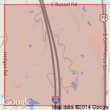
Pg. 45, 53. Overbrook sandstone. Three oil-bearing sandstones of Springer formation were expected at a depth of 1,000 to 3,500 feet in N.C. Joliff No. 1 well, in sec. 24, T. 5 S., R. 1 E. They are as follows: Primrose sandstone series, which was not expected to produce oil, at a depth of 100 feet; Lake Ardmore sandstone at 750 feet; Overbrook or City Lake sandstone at 1,250 feet; and Castle Rock sandstone at about 2,250 feet.
Source: US geologic names lexicon (USGS Bull. 896, p. 1579).
- Usage in publication:
-
- Overbrook sandstone member
- Modifications:
-
- Revised
- AAPG geologic province:
-
- South Oklahoma folded belt
Summary:
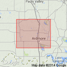
Pg. 13. Overbrook sandstone member of Springer formation. About 1,000 feet above Rod Club member (basal member of Springer formation) is the white massive Overbrook sandstone, ranging in thickness from 45 to 100 feet, which is thoroughly saturated with asphalt along several miles of its outcrop in T. 3 S., R. 1 W., where it posesses its maximum thickness and was formerly quarried for asphalt. From 300 to 500 feet higher in section is Lake Ardmore member of Springer formation. [Fossiliferous (fucoids, CALAMITES).] Age is Pennsylvanian.
Source: US geologic names lexicon (USGS Bull. 896, p. 1579).
- Usage in publication:
-
- Overbrook sandstone member
- Modifications:
-
- [Principal reference]
- Dominant lithology:
-
- Sandstone
- AAPG geologic province:
-
- South Oklahoma folded belt
Summary:
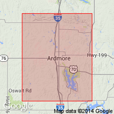
Pg. 17. Overbrook sandstone member of Springer formation. Typically medium fine-grained, white, massive varying to slabby, practically free of shale partings; locally contains well developed ripple marks. Thickness 45 to 100 feet. Lies about 1,000 feet above Rod Club member and 300 to 500 feet below Lake Ardmore member (both of Springer). Fossiliferous (fucoids, CALAMITES). Age is Pennsylvanian. Report includes geologic map, columnar section, fossil list.
Named from outcrop across middle of N/2 sec. 6, T. 6 S., R. 2 E., 0.25 mi east of village of Overbrook, at north edge of Love Co., Ardmore basin, central southern OK. [US geologic names lexicon (USGS Bull. 1200, p. 2878) states outcrop is half a mile east of Overbrook.]
Source: US geologic names lexicon (USGS Bull. 896, p. 1579); supplemental information from GNU records (USGS DDS-6; Denver GNULEX).
- Usage in publication:
-
- Overbrook sandstone
- Modifications:
-
- Revised
Summary:
Chart 6 (column 37). Shown on Pennsylvanian correlation chart as Overbrook sandstone; here Springer is considered a group. Age is Early Pennsylvanian.
Source: US geologic names lexicon (USGS Bull. 1200, p. 2878).
- Usage in publication:
-
- Overbrook sandstone
- Modifications:
-
- Overview
Summary:
Pg. 6 (fig. 2), 11. Overbrook sandstone of Springer group. Is 800 to 1,000 feet above Rod Club sandstone. Thickness 45 to 105 feet. Typically medium fine-grained, white and massive, varying to slabby or thin-bedded, some outcrops devoid of shale partings. From 500 to 700 feet below Lake Ardmore formation (redefined). Age is Early Pennsylvanian.
Source: US geologic names lexicon (USGS Bull. 1200, p. 2878).
- Usage in publication:
-
- Overbrook Sandstone*
- Modifications:
-
- Revised
- Adopted
Summary:
Pg. A30-A31, A54, A56-A57 (fig. 5). Overbrook Sandstone of Springer Group. Overbrook Sandstone Member of Roth (1928) adopted, raised in rank to Overbrook Sandstone, and assigned to Springer Group as one of five named formations. Overlies Goddard Shale of Springer (and its upper shale member); underlies Rod Club Sandstone of Springer. Present in southern Arbuckle Mountains, south-central Oklahoma. Age is Late Mississippian (late Chesterian; late Namurian A of Europe); foram zone 18 and ammonoid zone CRAVENOCERAS INVOLUTUM. [See also Mackenzie Gordon, Jr., and G.C. Stone, 1976, Arkansas Geol. Commission Symposium on the geology of the Ouachita Mountains, v. 1.]
Source: Publication.
For more information, please contact Nancy Stamm, Geologic Names Committee Secretary.
Asterisk (*) indicates published by U.S. Geological Survey authors.
"No current usage" (†) implies that a name has been abandoned or has fallen into disuse. Former usage and, if known, replacement name given in parentheses ( ).
Slash (/) indicates name conflicts with nomenclatural guidelines (CSN, 1933; ACSN, 1961, 1970; NACSN, 1983, 2005, 2021). May be explained within brackets ([ ]).

