- Usage in publication:
-
- Oran sandstone lentil
- Modifications:
-
- Original reference
- Dominant lithology:
-
- Sandstone
- AAPG geologic province:
-
- Bend arch
Summary:
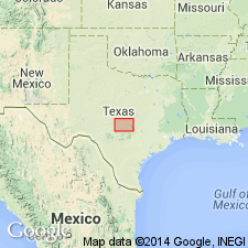
Pg. 96, 97, 99, 100. Oran sandstone lentil of Brownwood shale member of Graford formation of Canyon group. A fairly continuous sandstone locally present in lower part of Brownwood shale in Palo Pinto County, Texas. [The town of Oran is in Palo Pinto County.] Consists of (descending): (1) light-brown massive thick-bedded sandstone, 3 feet thick, weathering to dark rusty-brown massive irregular blocks, in most places loosely cemented; (2) massive brown sandstone, 50 feet thick, loosely cemented in some portions, other portions very friable; slightly closer-grained than overlying bed. Rests on sandstone very similar to No. 2 of Oran lentil, but containing much more iron. Top of Oran sandstone lies 227 feet below top of Brownwood member in escarpment due west of Strawn oil field, central northern Texas. Age is Pennsylvanian.
Source: US geologic names lexicon (USGS Bull. 896, p. 1555).

- Usage in publication:
-
- Oran Sandstone
- Modifications:
-
- Areal extent
- AAPG geologic province:
-
- Fort Worth syncline
Summary:
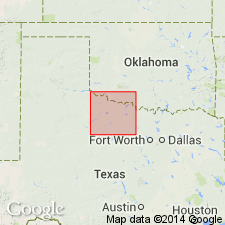
Mapped [as an unranked unit] in Palo Pinto Formation of Canyon Group. Palo Pinto is mapped as the basal formation of Canyon Group in the southeastern part of the mapped area, north-central TX (ascending): Palo Pinto Formation, Wolf Mountain Shale, Winchell Limestone, Placid Shale, Ranger Limestone, Colony Creek Shale, and Home Creek Limestone. Farther east, Canyon is divided into (ascending): Willow Point Formation, Jasper Creek Formation and its Chico Ridge Limestone [unranked], Ventioner Formation, Ranger Limestone, and Colony Creek Shale. Only upper part of Palo Pinto crops out in map area. Oran consists of sandstone, tan and brown, fine to medium grained, ferruginous, locally cross-bedded, has channel-fill bodies in lower part, massive upward, forms rounded bench, fossil plant fragments common in lower part. Thickness as much as 30 ft. Age is Missouri (Late Pennsylvanian). Geologic map.
Source: GNU records (USGS DDS-6; Denver GNULEX).
For more information, please contact Nancy Stamm, Geologic Names Committee Secretary.
Asterisk (*) indicates published by U.S. Geological Survey authors.
"No current usage" (†) implies that a name has been abandoned or has fallen into disuse. Former usage and, if known, replacement name given in parentheses ( ).
Slash (/) indicates name conflicts with nomenclatural guidelines (CSN, 1933; ACSN, 1961, 1970; NACSN, 1983, 2005, 2021). May be explained within brackets ([ ]).

