

- Usage in publication:
-
- Olcese sand
- Modifications:
-
- Named
- Dominant lithology:
-
- Sand
- AAPG geologic province:
-
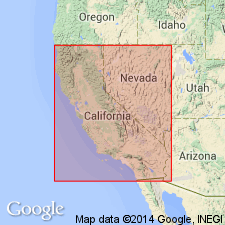
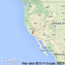
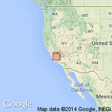
- San Joaquin basin
Summary:
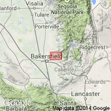
[Probably named for Olcese oil leases in Round Mountain field, Kern Co, CA.] [no type designated] "Named parenthetically as 'Middle Temblor Sandstone (Olcese sand of the Round Mountain area)' [Addicott, 1970]." Consists mainly of unconsolidated medium-grained to coarse gray sand containing numerous seashell fragments and occasional pebble and siltstone beds, lower part commonly of finer texture with some clay and silty materials and strongly sulphurous. Thickness is 242 feet. Underlies Round Mountain silt "(Upper Temblor)" in Mount Poso oil field, Kern Co, CA. Is Miocene age.
Source: GNU records (USGS DDS-6; Menlo GNULEX).
- Usage in publication:
-
- Olcese Sand*
- Modifications:
-
- Adopted
- Biostratigraphic dating
- AAPG geologic province:
-
- San Joaquin basin
Summary:
Olcese Sand of Diepenbrock (1933) is adopted. Also referred to as Olcese Sandstone Member of Temblor Formation by Kleinpell (1938). "Designation of type locality, a well at the west edge of Mount Poso oil field is attributed to Keen (1943) by Keroher and other (1966, p.2816) is in error and is therefore not taken into consideration here." Electric logs from Shell Oil Co. Freeman lease (SW/4 sec.20 T28S R29E, Kern Co, CA) are collectively designated as reference electric logs. Measured section of Olcese Sand was made at center of sec.7 T28S R29E Woody 15' quad. Contact with underlying Freeman Silt is gradational. Underlies Round Mountain Silt. Age is Middle Miocene based on gastropods ("Temblor Stage").
Source: GNU records (USGS DDS-6; Menlo GNULEX).
- Usage in publication:
-
- Olcese Sand*
- Modifications:
-
- Age modified
- AAPG geologic province:
-
- San Joaquin basin
Summary:
Abrupt changes in benthic-foraminiferal fauna suggest unconformity with Olcese and near Saucesian-Relizian boundary. Unit intertongues with underlying Freeman Silt and overlying Round Mountain Silt in basin. South of Kern River outcrops unconformably overlie Walker Formation, and farther south in Tejon Hills unit unconformably overlies basement rocks. Age is early Miocene based on microfauna assemblage of Saucesian and Relizian ages.
Source: GNU records (USGS DDS-6; Menlo GNULEX).
- Usage in publication:
-
- Olcese Sand*
- Modifications:
-
- Areal extent
- AAPG geologic province:
-
- San Joaquin basin
Summary:
Olcese Sand questionably extended to northwest to Coalinga-Kettleman Hills area based on data from three wells (Terra Resources Piexoto No.1, Canus Petroleum Hansen Farms No.1, and Chevron USA Mills58-8).
Source: GNU records (USGS DDS-6; Menlo GNULEX).
- Usage in publication:
-
- Olcese Sand*
- Modifications:
-
- Age modified
- AAPG geologic province:
-
- San Joaquin basin
Summary:
Age is shown as early and middle Miocene. [No new age information but new interpretations extend age into middle Miocene. Age based on Saucesian and Relizian benthic foraminifers, in part. Relizian now known to extend into middle Miocene age. Age also based on 15.5 Ma K-Ar age on pumice bed within unit, which according to DNAG and Berggren and others (1985) now falls within middle Miocene.]
Source: GNU records (USGS DDS-6; Menlo GNULEX).
For more information, please contact Nancy Stamm, Geologic Names Committee Secretary.
Asterisk (*) indicates published by U.S. Geological Survey authors.
"No current usage" (†) implies that a name has been abandoned or has fallen into disuse. Former usage and, if known, replacement name given in parentheses ( ).
Slash (/) indicates name conflicts with nomenclatural guidelines (CSN, 1933; ACSN, 1961, 1970; NACSN, 1983, 2005, 2021). May be explained within brackets ([ ]).