The National Geologic Map Database is migrating to a new infrastructure. We apologize for any service disruptions during this process.
|
|---|


- Usage in publication:
-
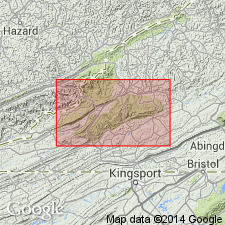
- Norton formation*
- Modifications:
-
- Named
- Dominant lithology:
-
- Shale
- Sandstone
- Clay
- Coal
- AAPG geologic province:
-
- Appalachian basin
Summary:
Named as a formation in Pottsville group. Named for Norton, Wise Co., southwestern VA. Consists of shales, sandstones, clays, and coals. Thickness is 1280 to 1310 ft. Underlies Gladeville sandstone and overlies Lee conglomerate in Big Stone Gap coal field of VA and KY. Age is Pennsylvanian.
Source: GNU records (USGS DDS-6; Reston GNULEX).

- Usage in publication:
-
- Norton Formation
- Modifications:
-
- Overview
- AAPG geologic province:
-
- Appalachian basin
Summary:
The Norton Formation is informally separated into a lower unit, composed of beds below the Kennedy coal bed, and an upper unit, composed of beds above the Kennedy. Unit crops out in most of eastern Wise Co. and along a narrow strip from central Wise Co. through Lee Co. In Dickenson Co. the formation crops out in the eastern and central portions and along the southeastern slope of Pine Mountain. Formation also crops out in all of Buchanan Co., except the northwestern tip. The Norton is a heterogeneous sequence of medium- to dark-gray siltstone and shale, and lesser amounts of sandstone. Within the type area, overlies the Bee Rock Sandstone Member of the Lee formation. Where the lower part of the Bee Rock grades laterally into the McClure Sandstone, the lower boundary of the Norton is moved to the Middlesboro Member--the next lower quartzarenite of the Lee Formation. Thickness varies from 700 ft where the Bee Rock is present to 1250 ft east of the Bee Rock pinchout. Where the Bee Rock is absent, the lower unit of the Norton generally contains (ascending) the Upper Seaboard coal bed, Tiller coal bed, Council Sandstone Member, Jawbone coal bed, Raven Marker bed, Raven Nos. 1, 2, and 3 coal beds, and the Aily coal bed. The upper unit contains (ascending) the Kennedy, Puncheon Camp, Big Fork, Lower Banner, Upper Banner, Splash Dam, and Hagy coal beds, the Eagle Shale Member, and the Norton coal bed. The Eagle Shale Member is equivalent to the Betsie Shale. Age of the Norton is Early and Middle Pennsylvanian.
Source: GNU records (USGS DDS-6; Reston GNULEX).

- Usage in publication:
-
- Norton Formation*
- Modifications:
-
- Overview
- AAPG geologic province:
-
- Appalachian basin
Summary:
Norton Formation is used in VA. Includes strata between Lee Formation and Gladeville Sandstone, and includes several named coals from Tiller coal (lowest) to Norton (highest).
Source: GNU records (USGS DDS-6; Reston GNULEX).
For more information, please contact Nancy Stamm, Geologic Names Committee Secretary.
Asterisk (*) indicates published by U.S. Geological Survey authors.
"No current usage" (†) implies that a name has been abandoned or has fallen into disuse. Former usage and, if known, replacement name given in parentheses ( ).
Slash (/) indicates name conflicts with nomenclatural guidelines (CSN, 1933; ACSN, 1961, 1970; NACSN, 1983, 2005, 2021). May be explained within brackets ([ ]).