


- Usage in publication:
-
- Newala limestone
- Modifications:
-
- Named
- Dominant lithology:
-
- Limestone
- Dolomite
- AAPG geologic province:
-
- Appalachian basin
Summary:
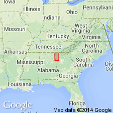
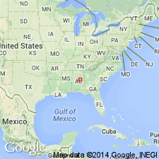
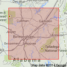
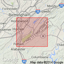
Named the Newala limestone for Newala P.O., Shelby Co., central AL. Consists predominantly of limestone but contains some dolomite. Limestone is thick-bedded, compact or noncrystalline, dark gray, pearl gray, and bluish gray with little or no chert. Thickness is about 1000 ft in Cahaba Valley. Contains fossils representative of the Beekmantown. Overlies the Longview limestone and underlies the Odenville limestone. Best exposures of this unit are about 0.5 mi northwest of Pelham, Shelby Co., AL. The Newala is of Early Ordovician age.
Source: GNU records (USGS DDS-6; Reston GNULEX).
- Usage in publication:
-
- Newala limestone
- Modifications:
-
- Areal extent
- AAPG geologic province:
-
- Appalachian basin
Summary:
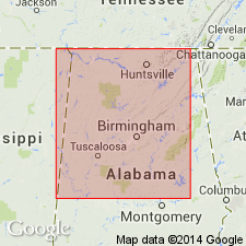
Geographically extended the Newala limestone to northwestern GA. Thickness is estimated to be between 250 and 300 ft. Overlies the Longview limestone and underlies the Murfreesboro limestone but locally may underlie the Rockmart slate.
Source: GNU records (USGS DDS-6; Reston GNULEX).
- Usage in publication:
-
- Newala formation
- Modifications:
-
- Areal extent
- Revised
- AAPG geologic province:
-
- Appalachian basin
Summary:
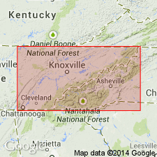
Geographically extended the Newala into eastern TN and revised it to the Newala formation of the Knox group. Newala formation is used where the Kingsport and Mascot formations cannot be separated.
Source: GNU records (USGS DDS-6; Reston GNULEX).
- Usage in publication:
-
- Newala Formation*
- Modifications:
-
- Areal extent
- AAPG geologic province:
-
- Appalachian basin
Summary:
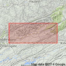
Geographically extended the Newala Formation of the Knox Group to the subsurface of southwestern VA where it is recognized in the Bales well, Lee Co. Consists of very finely crystalline light gray dolomite containing zones of chert. Overlies the Longview Formation and underlies the Middle Ordovician succession. Newala is top formation in Knox Group.
Source: GNU records (USGS DDS-6; Reston GNULEX).
- Usage in publication:
-
- Newala Dolomite*
- Modifications:
-
- Areal extent
- AAPG geologic province:
-
- Appalachian basin
Summary:
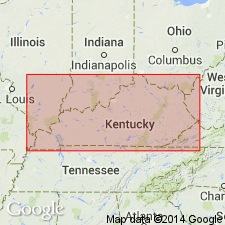
Geographically extended the Newala Dolomite of the Knox Group into the subsurface of southeastern and south-central KY. Consists mainly of dolomite with some chert. Unit is top formation of Knox Group; overlies the Longview Dolomite and underlies the Dot Formation. The Newala is of Early Ordovician age.
Source: GNU records (USGS DDS-6; Reston GNULEX).

- Usage in publication:
-
- Newala Limestone
- Modifications:
-
- Overview
- AAPG geologic province:
-
- Appalachian basin
Summary:
The Newala Limestone of the Knox Group in AL consists of dark gray, light gray, and bluish gray compact or noncrystalline, thick-bedded, micritic or peloidal limestone and some dolomite. Dolomite occurs as beds as much as 20 ft thick or as mottling. Thickness of the Newala ranges from 200 to 1000 ft. Overlies the Longview Limestone of the Knox Group and unconformably underlies the Mosheim Limestone Member of the Lenoir Limestone. The Newala is of Early Ordovician (Canadian) age.
Source: GNU records (USGS DDS-6; Reston GNULEX).
- Usage in publication:
-
- Newala Limestone*
- Modifications:
-
- Overview
- Dominant lithology:
-
- Limestone
- AAPG geologic province:
-
- Appalachian basin
Summary:
The uppermost unit of the Sylacauga Marble Group (Tull, 1982), the Gantts Quarry Formation of Tull (1985), contains Early Ordovician conodonts that confirm correlation with the Newala Limestone, Kingsport Formation, and Mascot Dolomite of the Appalachian foreland.
Source: GNU records (USGS DDS-6; Reston GNULEX).
- Usage in publication:
-
- Newala Limestone*
- Modifications:
-
- Age modified
- Overview
- AAPG geologic province:
-
- Appalachian basin
Summary:
Paleotopographic depression in the Newala Limestone is filled with argillaceous, light brown dolostone here named the Cottingham Creek Member of the Lenoir Limestone. Clasts of the Cottingham Creek, some as much as 30 cm in diameter, all appear to have been derived from the Newala. Walls of the depression are very irregular and the contact between the Newala and rocks filling the depression is sharp. Biostratigraphic and lithostratigraphic data from the Newala Limestone (Lower Ordovician) and the disconformably overlying Lenoir Limestone (Middle Ordovician) at Pratt Ferry, AL, indicate that the upper Newala is late Early Ordovician (late Canadian). Newala conformably overlies the Longview Limestone.
Source: GNU records (USGS DDS-6; Reston GNULEX).
- Usage in publication:
-
- Newala Dolomite, Formation, Limestone
- Modifications:
-
- Areal extent
- AAPG geologic province:
-
- Appalachian basin
GNU Staff, 1992, GNU Staff remark.: U.S. Geological Survey Digital Data Series, DDS-6, 1 CD-ROM., release 3
Summary:
Based on the abandonment of the Longview Dolomite and the revision of the Kingsport and Mascot Dolomites by Harris (1969), the Newala Formation should not be used in TN. Previously, the Newala Formation was used where the Kingsport and Mascot could not be separated. With the revision by Harris, both the Kingsport and Mascot have been expanded and do not represent the same stratigraphic interval as before. Unfortunately, Harris (1969) did not discuss the implications of this revision to the Newala. Further study of the Newala needs to be implemented to find the stratigraphic equivalents of the Newala in TN in relation to the type section in AL.
Source: GNU records (USGS DDS-6; Reston GNULEX).
- Usage in publication:
-
- Newala Limestone
- Modifications:
-
- Revised
- AAPG geologic province:
-
- Appalachian basin
Summary:
The Odenville Limestone is reinstated as a formal stratigraphic unit at the top of the Knox Group in AL. Consequently, the Newala as described in this report is stratigraphically reduced for it no longer includes the uppermost rocks herein assigned to the Odenville.
Source: GNU records (USGS DDS-6; Reston GNULEX).
- Usage in publication:
-
- Newala Limestone
- Modifications:
-
- Overview
- Reference
- AAPG geologic province:
-
- Appalachian basin
Summary:
Author supports recommendation of Shaw (1987: Emory Univ. M.S. thesis) that a reference section at the Blue Circle Industries Quarry be established as the original type section of Butts (1926) has been destroyed by quarrying and the Newala Post office no longer stands nor is found on present-day maps of the area. According to Shaw, the original type section was probably exposed where the north mining pit is presently located. Shaw (1987) divided the Newala into seven distinct lithofacies: 1) burrowed lime-mudstone, 2) gastropod wackestone, 3) bioclastic packstone, 4) intraclastic grainstone, 5) laminated lime-mudstone, 6) flat-pebble conglomerate, and 7) sucrosic dolomite. Macrofossils are not common, but where present the gastropod operculum CERATOPEA sp. is considered diagnostic of the Newala according to Cressler (1970) and is found worldwide in middle and upper Lower Ordovician strata. Conodonts recovered from the Newala at three localities are indicative of a warm, shallow shelf environment. On the basis of conodont studies by Shay, unit can be correlated with the lower upper Fillmore Formation of UT, part of the El Paso Group in TX, part of the Marathon Formation of TX, the lower and lower upper Jefferson City Formation of MO, the upper lower to middle Kindblade Formation of the Arbuckle Group in OK and the Mascot Dolomite of TN. Underlies the Odenville Limestone of the Knox Group in the Helena thrust sheet.
Source: GNU records (USGS DDS-6; Reston GNULEX).
For more information, please contact Nancy Stamm, Geologic Names Committee Secretary.
Asterisk (*) indicates published by U.S. Geological Survey authors.
"No current usage" (†) implies that a name has been abandoned or has fallen into disuse. Former usage and, if known, replacement name given in parentheses ( ).
Slash (/) indicates name conflicts with nomenclatural guidelines (CSN, 1933; ACSN, 1961, 1970; NACSN, 1983, 2005, 2021). May be explained within brackets ([ ]).