The National Geologic Map Database is migrating to a new infrastructure. We apologize for any service disruptions during this process.
|
|---|


- Usage in publication:
-
- New River system
- Modifications:
-
- First used
- Named
- AAPG geologic province:
-
- Appalachian basin
Summary:
Referred to as the New River system of coals, "which for the sake of distinction may be called the Conglomerate series."
Source: GNU records (USGS DDS-6; Reston GNULEX).
- Usage in publication:
-
- New River Formation*
- Modifications:
-
- Revised
- AAPG geologic province:
-
- Appalachian basin
Summary:
Coal-bearing strata previously assigned to the Lee Formation in this area are reassigned to the Pocahontas and New River Formations in this map area. Conglomeratic sandstone of the Lee Formation wedges out and Pocahontas is recognized here. Strata include subgraywacke sandstone.
Source: GNU records (USGS DDS-6; Reston GNULEX).

- Usage in publication:
-
- New River Formation
- Modifications:
-
- Areal extent
- Overview
- AAPG geologic province:
-
- Appalachian basin
Summary:
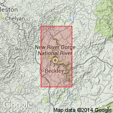
Use of the name New River is restricted to eastern Buchanan Co., northeastern Russell Co., and the coal-bearing portion of Tazewell Co., where the quartzarenite members of the Lee Formation are not recognized. Thickness reaches 1750 ft. The formation is a coal-bearing sequence of siltstone, shale, and sandstone with widespread and thick beds of quartz-pebble conglomerates and quartzarenites. The sandstones are transitional from the relatively pure quartz sandstones of the Lee to the argillaceous and micaceous sandstone of the younger Pennsylvanian formations. The coals, rarely more than 24 in. thick, include (ascending) the Pocahontas Nos. 8 and 9, Little Fire Creek, Lower Horsepen, Beckley, War Creek, Middle and Upper Horsepen, Lower and Middle Seaboard, Greasy Creek, Jawbone, Raven Marker, Raven Nos. 1, 2, and 3, and Aily coals. The New River also includes the Dismal Sandstone Member and the McClure Sandstone Member. Conformably overlies the Pocahontas Formation in the eastern outcrop areas. Northwestward the New River intertongues with the Lee Formation and the Lee-Pocahontas boundary is disconformable. Conformably underlies the Kanawha Formation.
Source: GNU records (USGS DDS-6; Reston GNULEX).

- Usage in publication:
-
- New River Formation*
- Modifications:
-
- Areal extent
- AAPG geologic province:
-
- Appalachian basin
Summary:
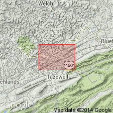
New River Formation occurs in WV and VA only. Includes strata from base of No. 8 Pocahontas coal to top of Upper Nuttall sandstone. Includes (no stratigraphic order implied): Pineville Sandstone Member, Raleigh Sandstone Member, and Quinnimont Shale Member in WV only; Middlesboro Sandstone Member and Council Sandstone Member in VA only; and Dismal Sandstone Member and McClure Sandstone Member in WV and VA only.
Source: GNU records (USGS DDS-6; Reston GNULEX).
For more information, please contact Nancy Stamm, Geologic Names Committee Secretary.
Asterisk (*) indicates published by U.S. Geological Survey authors.
"No current usage" (†) implies that a name has been abandoned or has fallen into disuse. Former usage and, if known, replacement name given in parentheses ( ).
Slash (/) indicates name conflicts with nomenclatural guidelines (CSN, 1933; ACSN, 1961, 1970; NACSN, 1983, 2005, 2021). May be explained within brackets ([ ]).