

- Usage in publication:
-
- Murray Bluff sandstone member
- Modifications:
-
- Original reference
- Dominant lithology:
-
- Sandstone
- AAPG geologic province:
-
- Illinois basin
Summary:
Pg. 39, 40. Murray Bluff sandstone member of Macedonia formation. A sandstone at base of Macedonia formation. Underlies a series of shaly strata including several coals and one persistent limestone. Age is Pennsylvanian.
Named from hill in southwestern part of Saline Co., southern IL.
Source: US geologic names lexicon (USGS Bull. 1200, p. 2662).

- Usage in publication:
-
- Murray Bluff sandstone [member]
- Modifications:
-
- Revised
- AAPG geologic province:
-
- Illinois basin
Summary:
Chart 6 (column 27). Shown on Pennsylvanian correlation chart as Murray Bluff sandstone in Tradewater formation.
Source: US geologic names lexicon (USGS Bull. 1200, p. 2662).

- Usage in publication:
-
- Murray Bluff sandstone member
- Modifications:
-
- Revised
- AAPG geologic province:
-
- Illinois basin
Summary:
Pg. 31, 45 (table 1), 62, pl. 1. Murray Bluff sandstone member of Abbott formation (new) of McCormick group (new). Rank reduced to member status in Abbott formation. Occurs above Delwood coal member. Thickness about 52 feet in type section of Abbott. Age is Pennsylvanian. Type locality stated. Presentation of new rock-stratigraphic classification of Pennsylvanian strata in Illinois.
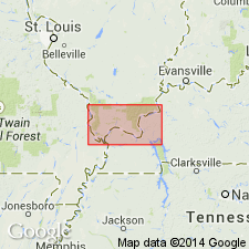
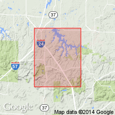
Type locality: in NE/4 sec. 35, T. 10 S., R. 5 E., Saline Co., southern IL. Named from hill in southwestern part of Saline Co.
Source: US geologic names lexicon (USGS Bull. 1200, p. 2662).

- Usage in publication:
-
- Murray Bluff Sandstone Member
- Modifications:
-
- Overview
- AAPG geologic province:
-
- Illinois basin
Summary:
Authors have elected to retain the names Abbott and Spoon Formations despite difficulties in mapping caused by definition of Kosanke and others (1960). Though Abbott Formation was defined as all strata from the top of the Caseyville Formation to the top of the Murray Bluff Sandstone Member, the member was incorrectly identified by Kosanke and others at the Abbott type section. Abbott and Spoon lithologies grade into one another and where the Bernadotte Sandstone Member of the basal Spoon and the Murray Bluff of the uppermost Abbott are absent or unidentifiable, there is no means of differentiating the two formations. Only the Reynoldsburg Coal Bed, at the base of the Abbott, and the Murray Bluff Sandstone Member, at the top, can be readily identified.
Source: GNU records (USGS DDS-6; Reston GNULEX).
- Usage in publication:
-
- Murray Bluff Sandstone Member
- Modifications:
-
- Revised
- AAPG geologic province:
-
- Illinois basin
Summary:
Tradewater Formation in the Goreville quad. is subdivided into two informal mapping units, the lower Tradewater and the upper. These two units were mapped originally as the Abbott and Spoon Formations, but this earlier nomenclature was abandoned midway through the COGEOMAP project. The term Tradewater was adopted from KY and applied to this interval of rocks in IL as part of an agreement with the IN and KY Surveys to standardize Pennsylvanian terminology in the Illinois basin. The top of the lower Tradewater is mapped as the top of the Murray Bluff Sandstone Member (a correlative of the Bernadotte Sandstone Member of Willman, 1975). The remainder of the lower Tradewater is subdivided into the ascending informal Ferne Clyffe member, Cedar Creek sandstone lentil, and Lake of Egypt member. The Reynoldsburg Coal Bed is near the base of the Ferne Clyffe. The Murray Bluff underlies the unnamed portion of the upper Tradewater below the informal Bethlehem sandstone lentil. Thickness in the study area ranges from 20 to 60 m. Age is Atokan.
Source: GNU records (USGS DDS-6; Reston GNULEX).
For more information, please contact Nancy Stamm, Geologic Names Committee Secretary.
Asterisk (*) indicates published by U.S. Geological Survey authors.
"No current usage" (†) implies that a name has been abandoned or has fallen into disuse. Former usage and, if known, replacement name given in parentheses ( ).
Slash (/) indicates name conflicts with nomenclatural guidelines (CSN, 1933; ACSN, 1961, 1970; NACSN, 1983, 2005, 2021). May be explained within brackets ([ ]).