- Usage in publication:
-
- Moss Back member*
- Modifications:
-
- Revised
- AAPG geologic province:
-
- Paradox basin
Summary:
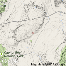
Revised in that basal member of Chinle formation in the San Rafael Swell, Emery Co, UT, Paradox basin, is named Temple Mountain member of Chinle. The new member unconformably underlies the massive cliff-forming Moss Back member of the Chinle. Temple Mountain member forms a purple ledge or slope, and was designated purple and white unit, mottled unit, and pinto bed in earlier reports. Underlies Church Rock member of Chinle. Geologic map. Of Late Triassic age.
Source: GNU records (USGS DDS-6; Denver GNULEX).
- Usage in publication:
-
- Moss Back member*
- Modifications:
-
- Named
- Dominant lithology:
-
- Sandstone
- Conglomerate
- AAPG geologic province:
-
- Paradox basin
Summary:
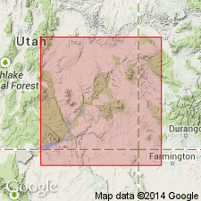
Named as a member (one of seven) of the Upper Triassic Chinle formation for Moss Back, eastern White Canyon, San Juan Co, UT in the Paradox basin. Type section measured at Long 110 deg 08' 51" W, Lat 37 deg 34' 36" N on southwest part of Moss Back ridge. Name applied to the upper sandstone and conglomerate unit formerly assigned to the Shinarump conglomerate. Extends as a lens about 50 mi wide and 155 mi long from the UT-CO line to central UT. Is discontinuous near junction of Green and Colorado Rivers. Consists of yellow gray, pale orange, fine- to medium-grained, well-sorted sandstone with conglomerate and conglomeratic sandstone lenses. Sandstone is subround clear quartz, mostly cross-stratified. Pebbles occur as suites of light brown and gray siltstone and limestone, and as quartz, quartzite, and chert. Carbonaceous material and silicified wood common. Forms vertical cliffs. Has a silty facies near Colorado and Green Rivers. Distinguished from the Shinarump member (revised) on basis of finer grain size and presence of limestone pebbles. Cross sections. Averages 60 ft thick. May be as much as 150 ft thick. Overlies Monitor Butte member, the basal contact marked by channels 10-20 ft deep and 100-1,000 ft wide. Overlain by Petrified Forest member of Chinle. Correlations discussed.
Source: GNU records (USGS DDS-6; Denver GNULEX).
- Usage in publication:
-
- Moss Back Member*
- Modifications:
-
- Overview
- AAPG geologic province:
-
- Paradox basin
Summary:
Used in Paradox basin as a member of Chinle Formation. Thought to be older than the Gartra Member (new assignment) of Chinle of northeast UT of Uinta uplift, and northwest CO in Greater Green River basin. Is of Late Triassic age.
Source: GNU records (USGS DDS-6; Denver GNULEX).
- Usage in publication:
-
- Moss Back Member*
- Modifications:
-
- Overview
- AAPG geologic province:
-
- Paradox basin
Summary:
Is one of several fairly homogeneous sandstone and conglomerate units in the Chinle Formation. Occurs as a northwest-trending lens extending from White Canyon, Elk Ridge, and Abajo Mountains on southeast to beyond the San Rafael Swell, east-central UT, Paradox basin. Is locally absent. Areal distribution map. Fence diagram. Cross section. Nomenclature chart. Lower contact placed at break between channel-filling, cross-stratified, cliff-forming sandstone of Moss Back with siltstone and claystone of lower Chinle, or with siltstone of the Moenkopi formation. Locally merges with Monitor Butte member of Chinle. Detailed lithologic description. Averages 60 ft thick. Is as much as 150 ft thick. Is discontinuous near its northeast limit. Measured sections. Pebble studies. Listing of fossils in chert pebbles. Fossils discussed--phytosaur teeth, cycadophytes, etc. Thought to be a stream deposit. Of Late Triassic age.
Source: GNU records (USGS DDS-6; Denver GNULEX).
- Usage in publication:
-
- Moss Back Member
- Modifications:
-
- Overview
- Revised
- AAPG geologic province:
-
- Paradox basin
Summary:
Member of Chinle Formation; divided into "type facies" and informal Kane Springs strata (new). Type facies occurs in Red and White Canyons, Orange Cliffs, Elk Ridge, and southeast Canyonlands National Park, San Juan Co, UT, Paradox basin. Type facies is within middle fluvial phase III and was deposited by braided streams in broad open northwest trending paleovalley. Phase III represents second major braided stream system in Chinle. Type facies overlies Monitor Butte Member of Chinle with erosional unconformity to the south and unconformably overlies Moenkopi Formation to the north and west; interfingers with overlying Petrified Forest Member of Chinle. Kane Springs strata occurs to north and east of type facies in Lisbon Valley, Kane Springs, Shafer Basin, Seven-mile Canyon, and Island in the Sky. Kane Springs strata are younger than type facies of Moss Back. [A unit cannot be both younger than and part of another unit.] Lower part of Kane Springs is within middle paludal phase IV (also includes Petrified Forest Member) which represents renewed regional subsidence with concurrent deposition of volcanic ash; grades laterally into Petrified Forest Member. Upper part of Kane Springs is within upper fluvial-lacustrine phase V (also includes Owl Rock Member of Chinle) and was deposited by widespread cyclic lacustrine systems; grades laterally into Owl Rock Member. Paleogeographic maps; log columns; cross sections.
Source: GNU records (USGS DDS-6; Denver GNULEX).
- Usage in publication:
-
- Moss Back Member*
- Modifications:
-
- Overview
- AAPG geologic province:
-
- Paradox basin
Summary:
Is the third member from base (of six) of Upper Triassic Chinle Formation studied in the White and Red Canyon areas of San Juan Co, UT in the Paradox basin. Has brown to gray medium-grained sandstone and conglomerate with abundant tabular planar and large-scale trough crossbeds that interfinger with red thin-bedded sandstone, siltstone, and mudstone that have carbonate paleosols and the trace fossil SCOYENIA. Fluvial deposition indicated. Lenticular units were deposited in channels. The red units are levee, crevasse splay, and overbank floodplain deposits. Overlies Monitor Butte Member of Chinle. Underlies Petrified Forest Member of Chinle.
Source: GNU records (USGS DDS-6; Denver GNULEX).
For more information, please contact Nancy Stamm, Geologic Names Committee Secretary.
Asterisk (*) indicates published by U.S. Geological Survey authors.
"No current usage" (†) implies that a name has been abandoned or has fallen into disuse. Former usage and, if known, replacement name given in parentheses ( ).
Slash (/) indicates name conflicts with nomenclatural guidelines (CSN, 1933; ACSN, 1961, 1970; NACSN, 1983, 2005, 2021). May be explained within brackets ([ ]).

