The National Geologic Map Database is migrating to a new infrastructure. We apologize for any service disruptions during this process.
|
|---|


- Usage in publication:
-
- Molus shale member
- Modifications:
-
- Informally named
- Dominant lithology:
-
- Shale
- AAPG geologic province:
-
- Appalachian basin
Summary:
Breathitt Formation is informally elevated to group rank and subdivided into the following eight informal formations: Pocahontas, Bottom Creek, Alvy Creek, Grundy, Pikeville, Hyden, Four Corners, and Princess formations. A shale sequence overlying the Hagy coal bed is herein informally called the Molus shale member and assigned to the Grundy formation. Underlies Mason coal bed. [Revisions made in this paper are strongly contested by C. Rice and other USGS scientists who work in this area (oral commun., 9/3/93).]
Source: GNU records (USGS DDS-6; Reston GNULEX).

- Usage in publication:
-
- Molus shale member
- Modifications:
-
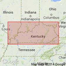
- Areal extent
- AAPG geologic province:
-
- Appalachian basin
Summary:
Corr. chart. Molus shale member (informal) of Grundy Formation of Breathitt Group. Shale and/or mudstone. Recognized in eastern and southeastern Kentucky in Grundy Formation, between the informal Partridge shale member above and Dave Branch shale member below. In eastern Kentucky [Big Sandy district] lies below the Millard (Glamorgan) coal bed and above the Hagy coal zone; in southeastern Kentucky [Upper Cumberland River district] lies below the Mason (Chemoa) coal bed and above the Splitseam coal bed. Correlative with the "Eagle shale (limestone)" in Norton Formation of Virginia. Age is Early Pennsylvanian (Westphalian; Morrowan). [Hagy coal zone approx. = the Lower War Eagle coal bed of West Virginia, which Peppers (1996, GSA Memoir 188, pl.) placed in uppermost Westphalian A, RADIIZONATES ALIGERENS (RA) miospore assemblage zone of western Europe.]
[See also Chesnut, 1997 (revised Oct. 12, 1999), Stratigraphy of the coal-bearing strata of the Eastern Kentucky coal field, available online through the Kentucky Geol. Survey (http://www.uky.edu/KGS/coal/coalcorrel.htm).]
Source: Publication.
For more information, please contact Nancy Stamm, Geologic Names Committee Secretary.
Asterisk (*) indicates published by U.S. Geological Survey authors.
"No current usage" (†) implies that a name has been abandoned or has fallen into disuse. Former usage and, if known, replacement name given in parentheses ( ).
Slash (/) indicates name conflicts with nomenclatural guidelines (CSN, 1933; ACSN, 1961, 1970; NACSN, 1983, 2005, 2021). May be explained within brackets ([ ]).