- Usage in publication:
-
- Millsap division
- Modifications:
-
- Original reference
- Dominant lithology:
-
- Clay
- Sandstone
- Limestone
- Shale
- AAPG geologic province:
-
- Fort Worth syncline
- Strawn basin
Summary:
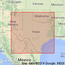
Pg. 361, 372-374. Millsap division, 2nd from base of 6 divisions of Carboniferous "Coal Measures." Mostly blue and black clays, with an occassional sandstone, hard limestone, and bed of sandy shale. In places, basal limestones contain FUSULINA foraminifers. Thickness at least 1,000 feet. Includes all Coal Measures strata below top of coal No. 1. Underlies Strawn division. Age is Carboniferous (Coal Measures). Found only in northern part of Carboniferous area. Carboniferous area of Texas stretches from below Colorado River northward to Red River, average width about 75 miles; comprises Brazos coal field (north) and Colorado coal field (south), separated by Cretaceous rocks. Report includes measured sections, fossils.
Named from town of Millsap, on Texas and Pacific RR, western part Parker Co., TX, where well developed.
Source: US geologic names lexicon (USGS Bull. 896, p. 1374); supplemental information from GNU records (USGS DDS-6; Denver GNULEX).
- Usage in publication:
-
- Millsap formation
- Modifications:
-
- Revised
- Reinstated
- AAPG geologic province:
-
- Strawn basin
- Fort Worth syncline
- Bend arch
Summary:
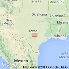
[See entry under Strawn formation; see also Millsap entry under Wilmarth (ca. 1930-1935).]
Source: US geologic names lexicon (USGS Bull. 896, p. 1374, 1375).

- Usage in publication:
-
- Millsap Lake formation*
- Modifications:
-
- Principal reference
- Dominant lithology:
-
- Shale
- Conglomerate
- Sandstone
- Limestone
- AAPG geologic province:
-
- Bend arch
- Fort Worth syncline
Summary:
Pg. 106-108. Millsap Lake formation. To obviate dual usage of Millsap (for this Pennsylvanian formation of Texas and for a Mississippian formation in Colorado) G. Scott and J.M. Armstrong (ms. of rept. on geol. of Parker Co., Texas) used Millsap Lake for the Texas formation, which usage is here adopted. The formation is largely shales with some conglomerates and thin sandstones; limestones are present but are thin and usually lenticular in character. Maximum thickness 3,000 feet or more. Divided by Scott and Armstrong (ms. of Parker Co. rept.) into following members (descending): Grindstone Creek beds, Brannon Iimestone, Steussy shales, Meek Bend limestone, Hill Creek beds, Dennis Bridge limestone, Kickapoo Falls limestone, Lazy Bend beds, and Dickerson beds. Present in Brazos River Valley. Age is Pennsylvanian (Alleghany).
Type locality: Millsap Lake, Parker Co., north-central TX.
Source: US geologic names lexicon (USGS Bull. 896, p. 1375); supplemental information from GNU records (USGS DDS-6; Denver GNULEX).

- Usage in publication:
-
- Millsap division†
- Millsap formation†
- Millsap Lake formation*
- Modifications:
-
- Overview
Summary:
[Post-1891] Texas reports (1893, etc.) dropped Millsap, because of conflict with name of a well-established formation of Mississippian age in Colorado, and included the beds thus designated in Strawn formation. This definition of Strawn was adopted by the USGS in 1912. F.B. Plummer and R.C. Moore, however, in 1922 (Univ. Tex. Bull., no. 2132) divided the Strawn deposits into Mineral Wells formation above and Millsap formation below. (See under Strawn formation.) In 1933 (Univ. Tex. Bull., no. 3232, p. 105, 109) E.H. Sellards divided Strawn group into (descending) Mineral Wells formation restricted, Garner formation, and Millsap Lake formation, the latter name being introduced to replace Millsap formation.
Source: US geologic names lexicon (USGS Bull. 896, p. 1374).
- Usage in publication:
-
- Millsap Lake formation*
- Modifications:
-
- Revised
- AAPG geologic province:
-
- Bend arch
Summary:
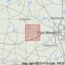
Pg. 15-24. Millsap Lake formation in Parker County, north-central Texas, has been divided by G. Scott and J.M. Armstrong (unpublished mss.) into 3 members (descending), Grindstone Creek member, Lazy Bend member, and Dickerson member, and the Grindstone Creek and Lazy Bend members are divided into several beds [listed under those members]. Is basal formation of Strawn group. Underlies Garner formation and unconformably overlies Bend group, which is divided into Smithwick and Marble Falls formations.
Source: US geologic names lexicon (USGS Bull. 896, p. 1375).
- Usage in publication:
-
- Millsap Lake group
- Modifications:
-
- Revised
- AAPG geologic province:
-
- Bend arch
Summary:
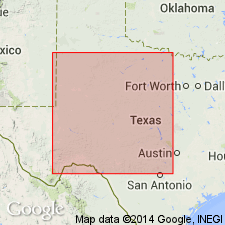
Pg. 66 (flg. 1), 88. Millsap Lake group. Rank raised to group in Strawn series, north-central Texas. Includes (ascending) unnamed subsurface formations, Dickerson, Lazy Bend, and Grindstone Creek formations. Underlies Garner formation of Lone Camp group (new); unconformably overlies Smithwick group of Lampasas series (new). Age is Middle Pennsylvanian (Strawn).
Source: US geologic names lexicon (USGS Bull. 1200, p. 2509); supplemental information from GNU records (USGS DDS-6; Denver GNULEX).
- Usage in publication:
-
- Millsap Lake group
- Modifications:
-
- Revised
Summary:
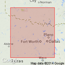
Pg. 163. Millsap Lake group. Stratigraphically restricted below as Lampasas-Strawn boundary in Brazos River outcrop section is placed at base of conglomerate which rests on Dennis Bridge limestone member of Lazy Bend formation at Dennis Highway bridge in Parker County, north-central Texas. As thus restricted, overlies Parks group (herein rank raised).
Source: US geologic names lexicon (USGS Bull. 1200, p. 2509).
- Usage in publication:
-
- Millsap Lake group
- Modifications:
-
- Revised
Summary:
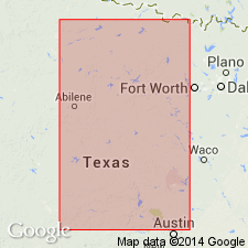
Pg. 209. Thickness of Millsap Lake group (restricted) 1,400 feet. Overlies Kickapoo Creek group (new) of Lampasas series. Age is Pennsylvanian (Strawn). [Some reports place Kickapoo Creek group in Strawn Series.]
Source: US geologic names lexicon (USGS Bull. 1200, p. 2509).
For more information, please contact Nancy Stamm, Geologic Names Committee Secretary.
Asterisk (*) indicates published by U.S. Geological Survey authors.
"No current usage" (†) implies that a name has been abandoned or has fallen into disuse. Former usage and, if known, replacement name given in parentheses ( ).
Slash (/) indicates name conflicts with nomenclatural guidelines (CSN, 1933; ACSN, 1961, 1970; NACSN, 1983, 2005, 2021). May be explained within brackets ([ ]).

