The National Geologic Map Database is migrating to a new infrastructure. We apologize for any service disruptions during this process.
|
|---|


- Usage in publication:
-
- Middle Run Formation
- Modifications:
-
- Named
- Dominant lithology:
-
- Sandstone
- Siltstone
- Conglomerate
- AAPG geologic province:
-
- Cincinnati arch
Summary:
A sedimentary unit encountered below the Mount Simon Sandstone in the subsurface of southwestern OH is here named the Middle Run Formation for a nearby stream. Lower contact of the unit was not reached in coring, but base is believed to be approximately 7,000 ft below the surface based on seismic profile. Therefore, total thickness estimated at 1100 m. Described from core as mostly grayish-red to moderate-red, fine- to medium-grained sandstone with abundant lithic clasts and dark-reddish-brown siltstone. Age assumed to be late Precambrian based on its sharp contact with the overlying Upper Cambrian Mount Simon.
Source: GNU records (USGS DDS-6; Reston GNULEX).

- Usage in publication:
-
- Middle Run Formation
- Modifications:
-
- Overview
- AAPG geologic province:
-
- Cincinnati arch
Summary:
Middle Run Formation is here described as a primarily fine- to medium-grained, subangular- to subrounded-grained, siliceously and hematitically cemented, tightly compacted, grayish-red, lithic arenite. Contains rare intervals of calcite-cemented granule to pebble-sized lithic-fragment conglomerates. Horizontal and ripple laminations and cross-bedding common. Fluvial origin indicated. Basin containing the Middle Run may extend north-south for 160 km and east-west for 48 km. Unit originally thought to be previously unrecognized facies of the overlying Mount Simon Sandstone. May be a rift-related sedimentary sequence and is tentatively correlated with the Jacobsville Sandstone of northern MI. Copper Harbor conglomerate or Freda Sandstone of the Oronto Group are also possible correlatives. Age of late Precambrian (Keweenawan) is based on its similarity to other red clastic sequences, its possible relationship to the Grenville Orogeny, and its position below the Late Cambrian Mount Simon.
Source: GNU records (USGS DDS-6; Reston GNULEX).
- Usage in publication:
-
- Middle Run Formation
- Modifications:
-
- Areal extent
- Overview
- AAPG geologic province:
-
- Cincinnati arch
Summary:
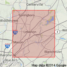
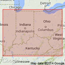
Middle Run Formation has been identified in 15 wells in southwest OH, southeast IN, and central KY. In most wells it unconformably underlies the Mount Simon Sandstone, but in one well in KY it underlies basalt. Seismic data from Warren Co., OH, suggest that a basalt-dominated sequence may underlie the Middle Run, though nowhere have the underlying rocks been penetrated. Unit extends from Putnam Co., OH, southward to Jessamine Co., KY, and westward to Fayette and Switzerland Cos., IN. Consists of thick- to massively bedded, red to gray, fine- to medium-grained sandstones with minor red siltstones and shales. Contains hematite and abundant lithic grains of rhyolite. Cross-bedding is large-scale or, less frequently, ripple. Abundance of monocrystalline quartz, feldspar, and volcanic rock fragments suggests that granitic, gneissic, or volcanic terranes could have been sources for the Middle Run according to Dickinson (1985). The Grenville Orogeny probably postdated the basin fill. Rocks have been dated isotopically at 1.0 Ga by Rudman and others (1965) who thought they were crystalline basement, but this date is questionable.
Source: GNU records (USGS DDS-6; Reston GNULEX).
For more information, please contact Nancy Stamm, Geologic Names Committee Secretary.
Asterisk (*) indicates published by U.S. Geological Survey authors.
"No current usage" (†) implies that a name has been abandoned or has fallen into disuse. Former usage and, if known, replacement name given in parentheses ( ).
Slash (/) indicates name conflicts with nomenclatural guidelines (CSN, 1933; ACSN, 1961, 1970; NACSN, 1983, 2005, 2021). May be explained within brackets ([ ]).