

- Usage in publication:
-
- Marlbrook-Columbus chalk marls
- GRYPHAEA VESICULARIS chalk marls
- Modifications:
-
- Original reference
- Dominant lithology:
-
- Marl
Summary:
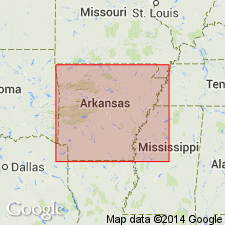
Pg. 72, 84-86, 188. Marlbrook-Columbus or GRYPHAEA VESICULARIS chalk marls. White chalky marl containing large percentage of yellow and pale-blue clays, and decomposing readily under influence of oisture. Whenb freshly exposed an dmoist the marls have delicate blue tint, but when dry they are pure white. Thickness probably 200 feet. Underlie Big Deciper beds and overlie Brownstown or yellow EXOGYRA PONDEROSA marls. [According to C.H. Dane and L.W. Stephenson, R.T. Hill's Big Deciper beds are in upper part of Saratoga chalk. See C.H. Dane, 1929, Arkansas Geol. Survey Bull., no. 1, p. 103.]
Source: US geologic names lexicon (USGS Bull. 896, p. 1304).
- Usage in publication:
-
- Marlbrook marl
- Modifications:
-
- Revised
- Dominant lithology:
-
- Marl
- AAPG geologic province:
-
- Arkla basin
Summary:
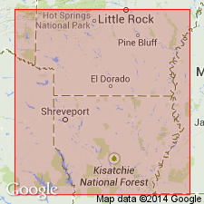
Pg. 26. Marlbrook Marl. Series of blue chalky, somewhat glauconitic marls in places impure chalk. Thickiness 50 to 750 feet. About 200 to 300 feet above base is very chalky layer which has been called Saratoga chalk marl or Saratoga formation. Overlies Annona chalk and underlies Nacatoch sand. Probably Marlbrook formation as here used contains in upper part beds which Hill classed with Washington (Nacatoch) sand.
Source: US geologic names lexicon (USGS Bull. 896, p. 1304).
- Usage in publication:
-
- Marlbrook marl
- Modifications:
-
- Revised
- Dominant lithology:
-
- Marl
Summary:
Also, 1929, Arkansas Geol. Survey Bull., no. 1. Restricted Marlbrook marl to beds in southwest, Arkansas, that unconformably underlie Saratoga chalk and conformably overlie Annona chalk. This is present approved definition.
Source: US geologic names lexicon (USGS Bull. 896, p. 1304).

- Usage in publication:
-
- Marlbrook Marl
- Modifications:
-
- Mapped 1:250k
- Dominant lithology:
-
- Marl
- AAPG geologic province:
-
- Arkla basin
- East Texas basin
- Ouachita folded belt
Summary:
Marlbrook Marl. Marl, slightly glauconitic in upper part, highly plastic when wet, strikingly uniform throughout, medium bluish-gray to yellowish-gray; weathers light-gray to white, forms smooth, rolling topography; marine megafossils scarce. Thickness 150 to 450 feet, thins eastward. [Overlies Annona and Pecan Gap Chalks. Underlies Navarro Group, undivided; in Middle Sulphur River area, Delta and Hunt Cos., northeastern TX, underlies Neylandville Formation.] Age is Late Cretaceous.
[Mapped in mostly continuous belt in western and central parts of map sheet, in Bowie, Delta, Fannin, Franklin Hopkins, Hunt, Lamar, and Red River Cos., northeastern TX; in Forceman-Wallace area, Little River Co., southwestern AR.]
Source: Publication.

- Usage in publication:
-
- Marlbrook Marl ("upper Taylor marl")
- Modifications:
-
- Areal extent
- AAPG geologic province:
-
- East Texas basin
- Gulf Coast basin
- Ouachita folded belt
Summary:
Marlbrook Marl ("upper Taylor marl"). Lies above Pecan Gap Chalk and below Neylandville Formation. Age is Late Cretaceous.
Not separately mapped. (Neylandville and Marlbrook [undifferentiated] mapped in Falls, Hill, Limestone, McLennan, Milam, and Navarro Cos., eastern TX.)
Source: Publication.

- Usage in publication:
-
- Marlbrook Marl
- Modifications:
-
- Areal extent
- AAPG geologic province:
-
- Gulf Coast basin
- Ouachita folded belt
Summary:
Marlbrook Marl ("upper Taylor marl"). Clay, strikingly uniform throughout, dominantly montmorillonitic, silt-size quartz becomes more abundant upward, calcite fragments common, glauconitic, disseminated pyrite, blocky with conchoidal fracture, light medium gray; weathers light brown to light gray and becomes slightly fissile. [Thickness not stated.] Overlies Pecan Gap Chalk (Upper Cretaceous); underlies Navarro Group (Upper Cretaceous). Age is Late Cretaceous.
Not separately mapped. (Mapped with Navarro Group in Guadalupe, Caldwell, and Hays Cos., southeastern TX.)
Source: Modified from GNU records (USGS DDS-6; Denver GNULEX).
- Usage in publication:
-
- Marlbrook Marl*
- Modifications:
-
- Paleomagnetics
- AAPG geologic province:
-
- Arkla basin
Summary:
Paleomagnetic (a.f. demagnetized) data indicates the Upper Cretaceous Marlbrook Marl in the Arkla basin in southwest AR possesses a weak remanent magnetization of normal magnetic polarity. The normal polarity is assumed to be primary magnetization, and is interpreted to represent deposition during the Gubbio (Italy) normal polarity zone B+ (Campanian to early Maestrichtian).
Source: GNU records (USGS DDS-6; Denver GNULEX).

- Usage in publication:
-
- Marlbrook Marl ("upper Taylor marl")
- Modifications:
-
- Areal extent
- AAPG geologic province:
-
- Gulf Coast basin
- Ouachita folded belt
Summary:
Pamphlet [p. 4]. Marlbrook Marl ("upper Taylor marl"). Not separately mapped. Mapped with [overlying] Navarro Group, undivided, in Bexar and Guadalupe Counties, southern Texas.
Lower part [interpreted to be Marlbrook Marl ("upper Taylor marl")]: clay, dominantly montmorillonitic, unctuous, greenish gray to brownish gray; weathers to a very thick, black, clayey soil; thickness 400+/- feet. Correlative with [lower part of] Escondido Formation (mapped west of Bexar County). Age is Late Cretaceous.
Source: Publication.

- Usage in publication:
-
- Marlbrook Marl
- Modifications:
-
- Mapped 1:250k
- Dominant lithology:
-
- Clay
- AAPG geologic province:
-
- East Texas basin
- Ouachita folded belt
Summary:
Marlbrook Marl ("upper Taylor marl"). Clay, calcareous, variable amount of silt and glauconite, silt content increases upward, disseminated pyrite, locally phosphate nodules and phosphatized marine megafossils, blocky, conchoidal fracture, light to dark gray; weathers light gray with poor fissility. Thickness 350+/- feet. Lies above Wolfe City Formation and below Neylandville Formation. Marine megafossils. Age is Late Cretaceous.
[Mapped in Collin and Rockwall Cos., eastern TX.]
Source: Publication.

- Usage in publication:
-
- Marlbrook Marl
- Modifications:
-
- Mapped 1:250k
- Dominant lithology:
-
- Clay
- Limestone
- AAPG geologic province:
-
- East Texas basin
- Ouachita folded belt
Summary:
Pamphlet [p. 2]. Marlbrook Marl. Clay, light-yellowish-gray, weathers light-gray with poor fissility, variable amount of silt and glauconite, marine megafossils scarce; limestone bed in southern Collin County 10 to 13 inches thick, light-gray, aphanitic, forms persistent scarp 180 feet above base. Thickness approximately 300 feet. Lies above Pecan Gap Chalk and below Neylandville Marl. Age is Late Cretaceous.
[Mapped in southeastern corner of map sheet, in Hunt and Collins Cos., northeastern TX.]
Source: Publication.
For more information, please contact Nancy Stamm, Geologic Names Committee Secretary.
Asterisk (*) indicates published by U.S. Geological Survey authors.
"No current usage" (†) implies that a name has been abandoned or has fallen into disuse. Former usage and, if known, replacement name given in parentheses ( ).
Slash (/) indicates name conflicts with nomenclatural guidelines (CSN, 1933; ACSN, 1961, 1970; NACSN, 1983, 2005, 2021). May be explained within brackets ([ ]).