The National Geologic Map Database is migrating to a new infrastructure. We apologize for any service disruptions during this process.
|
|---|


- Usage in publication:
-
- Marias River shale*
- Modifications:
-
- Original reference
- Dominant lithology:
-
- Shale
- Sandstone
- AAPG geologic province:
-
- Sweetgrass arch
Summary:
Pg. 2792 (fig. 3), 2793; 1959, Billings Geol. Soc. [Gdbk.] 10th Ann. Field Conf., p. 89 (fig. 1), 90-91. Marias River shale. Consists of 900 to 1,200 feet of dark gray shale, with lesser amounts of sandstone, siltstone, bentonite, and limestone. Comprises (ascending) Floweree, Cone calcareous, Ferdig shale, and Kevin shale members (all new). Underlies Telegraph Creek formation; disconformably overlies Bootlegger member (new) of Blackleaf formation. Age is Late Cretaceous (Cenomanian, Turonian, Coniacian, and Santonian).
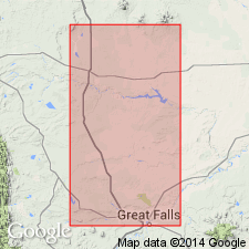
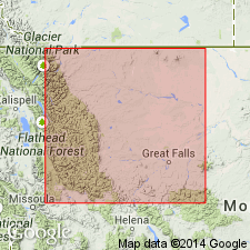
Named from excellent exposures along the Marias River, which flows eastward across Sweetgrass arch between South arch and Kevin-Sunburst dome, between T. 30 and 31 N., R. 4 E. to 5 W., Liberty and Toole Cos., MT. Here, most of formation is exposed in Marias River saddle, along boundary between Liberty and Toole Cos. Forms bedrock on most of Sweetgrass arch and extends westward into Rocky Mountains.
Source: US geologic names lexicon (USGS Bull. 1200, p. 2379); supplemental information from GNU records (USGS DDS-6; Denver GNULEX).
- Usage in publication:
-
- Marias River Shale*
- Modifications:
-
- Overview
- AAPG geologic province:
-
- Montana folded belt
Summary:
Is shown undivided on cross sections. Is mapped as four units in eastern Lewis and Clark Co, MT in Montana folded belt province. Mapped units are (descending) the Kevin Shale Member, sandstone member and Ferdig Shale Member, Ferdig Shale Member, and Cone Calcareous and Floweree Shale Members. Is uppermost formation of Colorado Group. Unconformably overlies Blackleaf Formation of Colorado Group. Age is Late Cretaceous. [See remarks under specific map unit names for details.]
Source: GNU records (USGS DDS-6; Denver GNULEX).
- Usage in publication:
-
- Marias River Shale*
- Modifications:
-
- Biostratigraphic dating
- Geochronologic dating
- AAPG geologic province:
-
- Sweetgrass arch
Summary:
Marias River Shale. Samples collected from:
(1) a 5-cm-thick bentonite within the DESMOSCAPHITES ERDMANNI ammonite zone, near top of Marias River Shale, in NW/4 sec. 32, T. 32 N., R. 3 W., Toole Co., MT. K-Ar age on biotite 78.0 +/-0.8 Ma; isotopic age is 6 percent too low, fails to fit stratigraphic sequence. Age is Late Cretaceous (Santonian) following Cobban's ammonite zonation.
(2) bottom 10 cm of a 1-m-thick bentonite bed in Marias River Shale, within lower part of INOCERAMUS LABIATUS bivalve molluscan zone, in sec. 13, T. 22 N., R. 1 W., Cascade Co., MT. K-Ar age on biotite 88.9 +/-0.9 Ma. Age is Late Cretaceous (Turonian).
Source: Modified from GNU records (USGS DDS-6; Denver GNULEX).
- Usage in publication:
-
- Marias River Shale*
- Modifications:
-
- Revised
- AAPG geologic province:
-
- Sweetgrass arch
Summary:
Is the upper formation of the Colorado Group in report area. Divided into Floweree (base), Cone (name changed from Cone Calcareous), Ferdig (name changed from Ferdig Shale), and Kevin (name changed from Kevin Shale) Members. Type sections of all four members and of MacGowan Concretionary Bed of Kevin measured and described in detail. Report area covers parts of Toole, Pondera, Chouteau, Teton, Lewis and Clark, and Cascade Cos, MT on the Sweetgrass arch. Of Late Cretaceous, Cenomanian, Turonian, Coniacian, and Santonian age.
Source: GNU records (USGS DDS-6; Denver GNULEX).
- Usage in publication:
-
- Marias River Shale*
- Modifications:
-
- Biostratigraphic dating
- AAPG geologic province:
-
- Sweetgrass arch
Summary:
Lower part of Cone Member of Marias River Shale is assigned a late Cenomanian (Late Cretaceous) age based on presence of the ammonite NEOCARDIOCERAS JUDDII from USGS Mesozoic localities 24615, Cascade Co, MT and D556, Teton Co, MT on the Sweetgrass arch. Is thus assignable to N. JUDDII zone.
Source: GNU records (USGS DDS-6; Denver GNULEX).
- Usage in publication:
-
- Marias River Shale*
- Modifications:
-
- Biostratigraphic dating
- AAPG geologic province:
-
- Sweetgrass arch
- Montana folded belt
Summary:
Age (in part) is early Turonian (Late Cretaceous) on basis of ammonites identified from Cone Member in Glacier and Teton Cos, MT, Sweetgrass arch, and Lewis and Clark Co, MT, Montana folded belt province. WATINOCERAS REESIDEI identified from USGS Mesozoic localities D558 and D1481, and W. HATTINI n. sp. identified from USGS Mesozoic localities D521 and D3171. Fauna places Cone Member in upper zone of tripartite ammonite zonation of the early Turonian.
Source: GNU records (USGS DDS-6; Denver GNULEX).
For more information, please contact Nancy Stamm, Geologic Names Committee Secretary.
Asterisk (*) indicates published by U.S. Geological Survey authors.
"No current usage" (†) implies that a name has been abandoned or has fallen into disuse. Former usage and, if known, replacement name given in parentheses ( ).
Slash (/) indicates name conflicts with nomenclatural guidelines (CSN, 1933; ACSN, 1961, 1970; NACSN, 1983, 2005, 2021). May be explained within brackets ([ ]).