The National Geologic Map Database is migrating to a new infrastructure. We apologize for any service disruptions during this process.
|
|---|


- Usage in publication:
-
- Lynchburg formation
- Modifications:
-
- Overview
- Areal extent
- Dominant lithology:
-
- Gneiss
- Schist
- AAPG geologic province:
-
- Piedmont-Blue Ridge province
Summary:
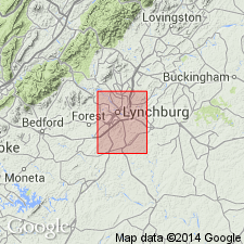
In Lynchburg 15-min quad, Lynchburg formation occurs in two outcrop belts, one 5 mi wide and other 2.5 mi wide, both trending northeast to southwest. Lithologies include biotite-quartz gneiss, mica schist, graphitic schist, and conglomeratic gneiss. Rocks previously mapped as Loudoun formation in many areas are now identified as Lynchburg. Rocks mapped as Lynchburg southwest of James River by other workers are probably not Lynchburg, but reconnaissance mapping by author and H.C. Sunderman shows Lynchburg to be continuous from city of Lynchburg to at least east-central Franklin Co., VA. In addition, Lynchburg probably occurs northwest of main outcrop belt, infolded with other rocks (Diggs, 1957). Lynchburg unconformably overlies Reusens migmatite facies of Moneta gneiss and conformably underlies Candler formation or Catoctin greenstone. Where Catoctin is absent, change from Lynchburg to Candler varies from abrupt to gradational over a few hundred feet.
Source: GNU records (USGS DDS-6; Reston GNULEX).
- Usage in publication:
-
- Lynchburg formation
- Modifications:
-
- Revised
- AAPG geologic province:
-
- Piedmont-Blue Ridge province
Summary:
Lynchburg formation contacts revised by introduction of Mechum River metasedimentary rocks which lie about halfway between Swift Run Formation in Blue Ridge to the west and Lynchburg Formation in the Piedmont to the east. All three of the formations were derived from and unconformably overlie basement complex rocks. Mechum River rocks are equivalent in part to Swift Run and Lynchburg, as suggested by the east-to-west overlap of Swift Run and Lynchburg rocks over basement with the Mechum River rocks in between. Catoctin Formation overlies Swift Run and Lynchburg Formations in central VA, Mechum River rocks probably also were overlain by Catoctin, but it was probably removed by erosion. In addition, basement rocks, Lynchburg, Swift Run, and Mechum River rocks are all intruded by basic dikes and possibly metagabbro sills, but none occur in formations above Catoctin Formation. Age is Precambrian. Report includes geologic map and cross section.
Source: GNU records (USGS DDS-6; Reston GNULEX).
- Usage in publication:
-
- Lynchburg gneiss
- Modifications:
-
- Revised
- AAPG geologic province:
-
- Piedmont-Blue Ridge province
Summary:
Mechum River formation includes rocks of Swift Run formation and thinned down western edge of Charlottesville, Lynchburg, and Rockfish formations mapped as a unit. [Author is probably implying that Mechum River consists of rocks previously assigned to parts of other formations.] There is no distinct boundary between rocks of Lynchburg gneiss and Rockfish conglomerate. In this report, the term Lynchburg gneiss is used for rocks lying above Rockfish conglomerate and below a 300-ft bed of graphitic slate [Johnson Mill graphite slate formation], which is well developed in Albemarle Co.
Source: GNU records (USGS DDS-6; Reston GNULEX).
- Usage in publication:
-
- Lynchburg Group
- Modifications:
-
- Revised
- AAPG geologic province:
-
- Piedmont-Blue Ridge province
Summary:
Lynchburg raised to group rank with two formations. Consists of Bunker Hill Formation (new), and overlying Fauquier Formation.
Source: GNU records (USGS DDS-6; Reston GNULEX).
- Usage in publication:
-
- Lynchburg Formation
- Modifications:
-
- Overview
- AAPG geologic province:
-
- Piedmont-Blue Ridge province
Summary:
Lynchburg Formation occurs along southeast flank of Blue Ridge anticlinorium from northern VA to boundary with NC. In central VA, contact between base of Lynchburg and underlying Virginia Blue Ridge complex is a thin biotite schist zone. From Lynchburg southward, Marshall and Lovingston gneisses (in core of Blue Ridge anticlinorium) are separated from Lynchburg by Moneta gneiss; an amphibolite layer separates the layered biotite gneiss of the Moneta from metasedimentary rocks of the Lynchburg. Rankin and others (1973) consider the Moneta to be equivalent to Ashe Formation which they correlate with Lynchburg. Directly overlain by Swift Run Formation where present; otherwise overlain by Catoctin Formation. In fault contact with Candler Formation from an area between Charlottesville and Lynchburg to a point just south of Smith Mountain Lake. Also in contact, but not intruded by, igneous rocks of Robertson River Formation (dated at between 750 and 730 Ma by Lukert and Banks, 1969). Earliest Cambrian fossils occur much farther up in section, in upper part of Chilhowee Group. Therefore, age is designated as late Precambrian.
Source: GNU records (USGS DDS-6; Reston GNULEX).

- Usage in publication:
-
- Lynchburg Group
- Modifications:
-
- Revised
- AAPG geologic province:
-
- Piedmont-Blue Ridge province
Summary:
Lynchburg is raised to group rank in Culpeper and Rockfish areas of central VA based on mapping, following usage of Furcron (1969), but with revised nomenclature. Mapping by Wehr (1983, unpub. Ph.D thesis and this report) indicates that Lynchburg includes lithostratigraphic units mappable at scale of 1:24,000 and that Lynchburg Formation of Allen (1963) and Fauquier Formation of Espenshade and Clarke (1976) are laterally equivalent and related through a sedimentary facies transition. In Culpeper area, includes (ascending) Bunker Hill Formation, Monumental Mills Formation, Thorofare Mountain Formation, Ball Mountain Formation, and Charlottesville Formation. In Rockfish River area, includes (ascending) Rockfish Conglomerate, Thorofare Mountain Formation, Ball Mountain Formation and its Johnson Mill Member (rank reduced), and Charlottesville Formation. The name Fauquier Formation is not included in Lynchburg Group because of conflict with work by Espenshade and Clarke (1976). Overlying Swift Run Formation not included in Lynchburg Group because of uncertain correlation with Swift Run at its type locality (Bartholomew, 1971, and written commun., 1983).
Source: GNU records (USGS DDS-6; Reston GNULEX).

- Usage in publication:
-
- Lynchburg Group
- Modifications:
-
- Overview
- AAPG geologic province:
-
- Piedmont-Blue Ridge province
Summary:
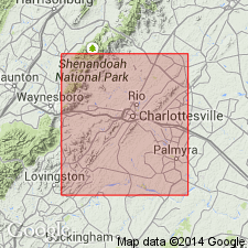
Lynchburg Group, on the southeastern limb of the Blue Ridge anticlinorium, is subdivided in this report into (ascending) Fauquier Formation, unnamed metagraywacke turbidite deposits (which combines Rockfish conglomerate formation and Lynchburg gneiss formation of Nelson, 1962), Johnson Mill Formation, and the Charlottesville Formation. Lynchburg rocks also occur in several outliers, the largest and most westerly of which is the belt containing the Mechums River Formation, which has been previously correlated with the Lynchburg. [Field trip is based on reconnaissance geologic mapping in the Charlottesville 1 deg X 2 deg quad. as part of a new edition of the Geologic Map of VA to be completed by 1993.]
Source: GNU records (USGS DDS-6; Reston GNULEX).
- Usage in publication:
-
- Lynchburg Group*
- Modifications:
-
- Revised
- AAPG geologic province:
-
- Piedmont-Blue Ridge province
Kasselas, G.D., 1993, Stratigraphic framework, structural evolution and tectonic implications of the eastern Blue Ridge sequence in the central Appalachians near Warrenton, Virginia: Virginia Polytechnic Institute and State University, Department of Geological Sciences M.S. thesis, __ p.
Summary:
The usage of Lynchburg Group is extended from Culpeper, VA, where it was mapped and revised by Wehr (1985) north to the southern part of the Warrenton, VA, study area. South of Carter Run fault, it is divided into the basal Bunker Hill Formation, Monumental Mills Formation, and Ball Mountain Formation. Ball Mountain Formation includes rocks previously mapped by Wehr (1985) as Swift Run(?) Formation because rocks do not lithologically match those at Swift Run type locality. North of Carter Run fault, correlative rocks are assigned to Fauquier Group (rank raised) which includes basal Bunker Hill Formation, Monumental Mills Formation, Swains Mountain Formation (new), and Carter Run Formation (new).
Source: GNU records (USGS DDS-6; Reston GNULEX).

- Usage in publication:
-
- Lynchburg Group
- Modifications:
-
- Revised
- AAPG geologic province:
-
- Piedmont-Blue Ridge province
Summary:
Lynchburg Group, as used on the State map, includes the Monumental Mills Formation, Charlottesville Formation, Alligator Back Formation, Ashe Formation, Moneta Gneiss, and unnamed metasandstone, quartzite, graphitic phyllite and metasiltstone, metagraywacke, conglomerate and metagraywacke, and fanglomerate. Because the Alligator Back Formation is considered here to be Late Proterozoic and Cambrian, the age of the Lynchburg is then modified to Late Proterozoic and Cambrian.
Source: GNU records (USGS DDS-6; Reston GNULEX).
- Usage in publication:
-
- Lynchburg Group*
- Modifications:
-
- Revised
- AAPG geologic province:
-
- Piedmont-Blue Ridge province
Summary:
Lynchburg Group as used by Wehr (1985) is revised to include only his Ball Mountain and Charlottesville Formations. In type area near Lynchburg, Lynchburg Group is 3000 to 4000 m thick and contains numerous ultramafic bodies, one of which is adjacent to a thrust fault about 170 m above Grenvillian basement. In the interpretation here, all of the type Lynchburg Formation of former usage down to the ultramafic lens in here included in Lynchburg Group and is within Jefferson terrane. Report includes geologic maps, correlation chart, and isotopic data.
Source: GNU records (USGS DDS-6; Reston GNULEX).
- Usage in publication:
-
- Lynchburg Group
- Modifications:
-
- Revised
- AAPG geologic province:
-
- Appalachian basin
Summary:
Lynchburg Group in central VA is herein divided into three numbered formations based on their lithostratigraphy. Lynchburg I disconformably overlies the Moneta Formation and is composed of metaconglomerates and coarse-grained feldspathic meta-arenites with many mafic-ultramafic sills and dikes. Interpreted as slope apron deposits. Lynchburg II is characterized by graphite-bearing medium to fine-grained metasandstone and graphite schist with intercalated non-graphitic coarser-grained metasandstones and metaconglomerates, again with many mafic-ultramafic sills and dikes. Interpreted as anoxic submarine fan channel-fill deposits and overbank-interchannel deposits. Lynchburg III is composed of fine-grained meta-sandstone/siltstone and mica schist with lens-shaped coarse grained metasandstones and metaconglomerates also interpreted as channel-fill deposits, but more open than Lynchburg II. Both the Lynchburg and underlying Moneta appear to have formed in a rifting environment during the Late Proterozoic.
Source: GNU records (USGS DDS-6; Reston GNULEX).
For more information, please contact Nancy Stamm, Geologic Names Committee Secretary.
Asterisk (*) indicates published by U.S. Geological Survey authors.
"No current usage" (†) implies that a name has been abandoned or has fallen into disuse. Former usage and, if known, replacement name given in parentheses ( ).
Slash (/) indicates name conflicts with nomenclatural guidelines (CSN, 1933; ACSN, 1961, 1970; NACSN, 1983, 2005, 2021). May be explained within brackets ([ ]).