

- Usage in publication:
-
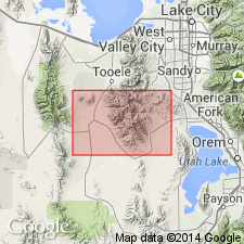
- Lynch dolomite*
- Modifications:
-
- Named
- Dominant lithology:
-
- Limestone
- Dolomite
- AAPG geologic province:
-
- Great Basin province
Summary:
Named for exposures on Lynch Ridge, T5S, R4W, Tooele Co, UT in the Great Basin province. Also exposed in Ophir Canyon, southeast of Ophir, and on the divide between Dry and Ophir Canyons. No type locality designated. Conformably overlies Middle Cambrian Bowman limestone; contact is gradational over 80 ft stratigraphically. Unconformably underlies Middle? Devonian Jefferson? formation. Upper contact placed at base of a thin limy sandstone that separates Lynch dolomite from limestones that have a Devonian fauna. An unusual steel-gray crystalline dolomite that weathers black, except for a spangling of white rods and vermicular tube-like markings one-sixteenth of an inch in diameter and one-quarter to one-half inch long, occurs a few ft above the base. Basal part of Lynch is dark-gray dolomite. Upper part of Lynch is blue-gray dolomite and limestone. Section 827+ ft thick measured east of Cliff mine [T5S, R4W?] where: basal unit is 6 ft thick; middle spangled unit, which includes some gray limestone and siliceous shale, is 275 ft thick; and upper dolomite and limestone is 546+ ft thick. Middle unit identical to Bluebird dolomite of Tintic district. Fossils (HYOLITHES) collected about 280 ft above base. Of Middle? and Late Cambrian age. Geologic map; cross section; stratigraphic table.
Source: GNU records (USGS DDS-6; Denver GNULEX).
- Usage in publication:
-
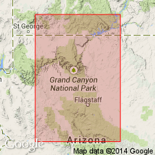
- Lynch dolomite
- Modifications:
-
- Not used
- AAPG geologic province:
-
- Plateau sedimentary province
- Paradox basin
Summary:
Lynch dolomite in the Kaiparowits region should be considered a dolomite phase of the Muav Formation. Age is Cambrian.
Source: GNU records (USGS DDS-6; Menlo GNULEX).
For more information, please contact Nancy Stamm, Geologic Names Committee Secretary.
Asterisk (*) indicates published by U.S. Geological Survey authors.
"No current usage" (†) implies that a name has been abandoned or has fallen into disuse. Former usage and, if known, replacement name given in parentheses ( ).
Slash (/) indicates name conflicts with nomenclatural guidelines (CSN, 1933; ACSN, 1961, 1970; NACSN, 1983, 2005, 2021). May be explained within brackets ([ ]).