

- Usage in publication:
-
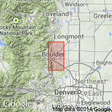
- Lykins formation*
- Modifications:
-
- Named
- Dominant lithology:
-
- Sandstone
- AAPG geologic province:
-
- Denver basin
Summary:
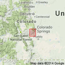
Named for Lykins Gulch, T2N, R71W, Boulder Co, CO in the Denver basin. Mapped along east side of Front Range from north of Lykins Gulch to south side of South Boulder Creek. Conformable on Lyons sandstone (named). Underlies Morrison formation. Rocks assigned to Lykins in this report were called "Upper Wyoming" by Eldridge (1896). Nowhere exposed in a single section. No type locality designated. Distinguished from underlying Lyons by its soft showy color. Is easily weathered. Is about 800 ft thick at Fourmile Canyon. Thickness varies. Four parts distinguished at Fourmile Canyon; basal 230 ft of red sandstone, 35 ft of crinkled sandstone, 467 ft covered with dark red soil, and 100+ ft brown-red sandstone (top). Crinkled sandstone unit is hard, calcareous, persistent, and has minutely laminated, deformed or crumpled beds. Has a dense limestone bed at base and additional limestone beds at other horizons in unit. Crinkling probably due to north-south stress. Shown as Triassic age, but reason for age not discussed. Geologic map.
Source: GNU records (USGS DDS-6; Denver GNULEX).
- Usage in publication:
-
- Lykins formation
- Modifications:
-
- Revised
- AAPG geologic province:
-
- Denver basin
Summary:
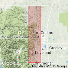
Overlies the newly named Ingleside formation in Owl Canyon, Larimer Co, CO in the Denver basin. Section 791 ft thick measured at Heygood Canyon when Lykins overlies Ingleside and underlies Sundance formation. Is recognized by its brick-red color. Composed of almost equal parts of pink, soft, friable, thick-bedded to massive sandstone and soft, red sandy shale. A few thin bands of limestone in upper part. Fossiliferous horizon about 200 ft from base (74). Local measured sections. Considered to have a hard basal sandstone of "the Lyons." Age not clearly stated except as Upper Carboniferous. Local sections described.
Source: GNU records (USGS DDS-6; Denver GNULEX).
- Usage in publication:
-
- Lykins formation
- Modifications:
-
- Mapped 1:250k
- Dominant lithology:
-
- Sandstone
- Shale
- AAPG geologic province:
-
- Las Animas arch
- Las Vegas-Raton basin
Summary:
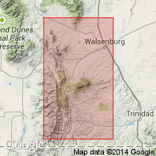
Is Permian formation mapped (pl. I, scale 1:250,000) primarily along the drainage of the Purgatoire River in southeastern Colorado in northeast Las Animas Co (Las Vegas-Raton basin) and southern Otero and Bent Cos, CO (Las Animas arch). Is oldest bedrock unit in the map area. Is overlain by the Jurassic Morrison formation. The great series of formations which succeeded the Mississippian and underlies the Morrison in eastern Colorado is familiarly known as the "Red Beds." The term "Red Beds" as used in this paper does not imply any stratigraphic unit, but the series of red strata which vary in age from Pennsylvanian to Triassic. The "Red Beds" exposed in this area may be divided into two parts: the lower, a series of brick red sandy shales and crinkled purplish limy sandstones, 122 ft thick; and the upper, a massive, cross-bedded, oolitic, maroon sandstone, 240 ft thick succeeded by gypsum, which may possibly belong to the overlying Morrison. Author tentatively correlates the two divisions of the "Red Beds" with the Lykins of the Colorado Springs and Denver areas, giving to the upper division the name Red Canyon member and to the lower, the name Chaquaqua member.
Source: GNU records (USGS DDS-6; Denver GNULEX).
- Usage in publication:
-
- Lykins formation
- Modifications:
-
- Revised
- AAPG geologic province:
-
- Denver basin
Summary:
Pg. 14 (fig. 3), 15 (table 1), 30-47. Lykins formation. In Golden-Morrison area, north-central Colorado, subdivided into five members (ascending): Harriman shale, Falcon limestone, Bergen shale, Glennon limestone, and Strain shale. Thickness 410 to 463 feet. Underlies Ralston formation; disconformably(?) overlies Lyons formation. Age is Permian to Triassic.
Source: US geologic names lexicon (USGS Bull. 1200, p. 2280).

- Usage in publication:
-
- Lykins formation*
- Modifications:
-
- Areal extent
- AAPG geologic province:
-
- Las Animas arch
Summary:
Extended into the subsurface of Otero County, Colorado, on the Las Animas arch. Correlates with Blaine formation, Whitehorse sandstone, Day Creek dolomite, and Taloga formation. Overlies Lyons sandstone. Age is Permian and Triassic(?). Report includes correlation chart.
Source: Modified from GNU records (USGS DDS-6; Denver GNULEX).
- Usage in publication:
-
- Lykins formation
- Modifications:
-
- Overview
- AAPG geologic province:
-
- Denver basin
Summary:
Lykins formation in the Canon City embayment area, southwest Denver basin in Fremont and El Paso Cos, CO is composed of red-orange siltstone and shale, has some gypsum beds near base, and two persistent though not continuous crinkled limestone beds near top. Ranges from 0-190 ft thick. Overlies Permian Lyons formation east and north of Beaver Creek (T17S, R68W), and west of Beaver Creek it unconformably overlies Permian and Pennsylvanian Fountain formation. Underlies Jurassic Ralston formation throughout the mapped area (Ts14 to 18S, Rs67-70W). Its Permian age assigned on basis of correlation with Forelle limestone of WY, San Andres limestone of NM, South Canyon Creek dolomite of northwest CO, and Day Creek dolomite and Blaine formation of western KS. Geologic map. Measured sections. Stratigraphic chart.
Source: GNU records (USGS DDS-6; Denver GNULEX).
- Usage in publication:
-
- Lykins formation*
- Modifications:
-
- Mapped 1:24k (Golden quad, Jefferson Co, CO)
- Dominant lithology:
-
- Mudstone
- Sandstone
- Limestone
- AAPG geologic province:
-
- Denver basin
Summary:
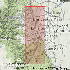
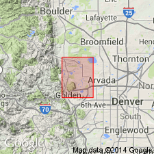
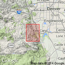
Is a Permian? and Triassic? formation mapped in northern Jefferson, Co, CO (Denver basin). Unconformably? overlies Lyons sandstone (Permian); unconformably? underlies Ralston Creek formation (Upper Jurassic). Outcrops along northwesterly strike in southwestern part of quad. North of Tucker Gulch occurs in western half of valley between low hogback formed by Lyons and high hogback formed by Dakota Group (Lower Cretaceous). South of Tucker Gulch Lykins is cut out by Golden fault except at small knoll along west side of sec 21, T3S, R70W. Described as principally a grayish-red mudstone but includes some limestone and a few thin very fine grained sandstone beds. Consists of five formal members (not separately mapped) (ascending): Harriman shale, 55 ft thick; Falcon limestone, 3 ft thick; Bergen shale, 30 ft thick; Glennon limestone, 14 ft thick; and Strain shale, 350 ft thick. The two limestone members occur in lower fourth of formation an a third unnamed limestone, about 1 ft thick, is generally present very close to the base. Several dissociated segments of dasycladacean alga MIZZIA MINUTA found near top of Glennon; fossil suggests middle and late Permian age. Numerous concentric dome-like structures in Glennon resemble blue-green algae. Thickness is about 450 ft.
Source: GNU records (USGS DDS-6; Denver GNULEX).
- Usage in publication:
-
- Lykins formation*
- Modifications:
-
- Areal extent
- Overview
- AAPG geologic province:
-
- Las Vegas-Raton basin
Summary:
Beds in Huerfano Park, and locally along the eastern foothills of the Sangre de Cristo Mountains that have previously been assigned to the Sangre de Cristo formation are thought to be the Lykins? formation of Permian? and Triassic? age. Section of Lykins? measured in sec 18, T27S, R70E, in Huerfano Co, CO of Las Vegas-Raton basin. Overlies Sangre de Cristo formation; unconformably underlies Entrada sandstone.
Source: GNU records (USGS DDS-6; Denver GNULEX).

- Usage in publication:
-
- Lykins formation*
- Modifications:
-
- Mapped 1:24k (Littleton quad, Arapahoe, Douglas, and Jefferson Cos, CO)
- Dominant lithology:
-
- Siltstone
- AAPG geologic province:
-
- Denver basin
Summary:
Is Permian? and Triassic? formation mapped in east-central Jefferson Co, CO (Denver basin). Crops out in valley between hogbacks of Lyons sandstone and Lytle and South Platte formations in southwestern portion of map area. Divided into three separately mapped units: Harriman shale (70 ft thick) and Bergen shale (40 ft thick) members (mapped undifferentiated), Glennon limestone member (15 ft thick), and Strain shale member (250 ft thick). (The Falcon limestone member (2.5 ft thick) occurs above Harriman though is not included with any of the map units on the explanation.) At top of Lykins there is about 6 ft of light-brown massive fine-grained soft sandstone that may be correlative with Entrada sandstone. Lykins is predominantly reddish thinly stratified siltstone. Measured section (part). Conformably overlies Lyons sandstone (Permian); unconformably underlies Ralston Creek formation.
Source: GNU records (USGS DDS-6; Denver GNULEX).
- Usage in publication:
-
- Lykins formation*
- Modifications:
-
- Mapped 1:24k (Kassler quad, Douglas and Jefferson Cos, CO)
- Dominant lithology:
-
- Shale
- Limestone
- AAPG geologic province:
-
- Denver basin
Summary:
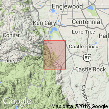
Is Permian? and Triassic? formation mapped in northwestern Douglas and southeastern Jefferson Cos, CO (Denver basin). Outcrops as northwesterly striking, northeast dipping (60 deg) band along Hogback in central part of map. Occupies valley between Lyons sandstone hogback on west and hogback on east composed of Lytle and South Platte formations. Consists of five members (ascending): Harriman shale, Falcon limestone, Bergen shale, Glennon limestone, and Strain shale members. Three units are mapped: Bergen and Harriman, undivided [Falcon shown in measured sections to be included in Bergen and Harriman unit]; Glennon; and Strain. Harriman described as moderate reddish-brown thin-bedded silty shale about 70 ft thick; Falcon is yellowish-gray massive or thinly laminated, porous limestone 2 ft thick; Bergen is moderate reddish-brown thin-bedded silty shale about 40 ft thick; Glennon is 15-17 ft of grayish orange-pink, moderate yellowish-brown limestone with yellowish-gray thin-bedded sandy layers; Strain is moderate reddish-brown silty shale about 250 ft thick interbedded with some thin layers of light-green shale and some layers of grayish-orange massive, loosely cemented, cross-bedded sandstone. Measured sections. Conformably overlies Lyons sandstone (Permian); unconformably underlies Ralston Creek formation (Jurassic). Age based on correlation with Satanka, Forelle, and Chugwater formations of WY.
Source: GNU records (USGS DDS-6; Denver GNULEX).

- Usage in publication:
-
- Lykins Formation*
- Modifications:
-
- Mapped 1:24k (Morrison quad, Jefferson Co, CO)
- Dominant lithology:
-
- Sandstone
- Siltstone
- Limestone
- AAPG geologic province:
-
- Denver basin
Summary:
Is Triassic? and Permian formation which has individual members mapped in north-central Jefferson Co, CO (Denver basin). Conformably overlies Lyons Sandstone (Permian); unconformably underlies Ralston Creek Formation (Upper Jurassic). Outcrops along west side of Hogback. Divided into separately mapped (descending): Strain Shale Member of LeRoy (1946) (Triassic? and Permian), Forelle Limestone Member (Permian), and undivided Bergen Shale, Falcon Limestone, and Harriman Shale Members of LeRoy (1946) (Permian). Strain described as maroon stratified micaceous fine-grained silty sandstone and siltstone containing some green siltstone layers; thickness is about 300 ft. Forelle described as pink wavy-laminated sandy marine limestone 130 ft above base of formation; contains algal stromatolites; thickness is about 17 ft. Undivided Bergen, Falcon, and Harriman described as maroon and green siltstone containing laminated red-weathering gray crystalline sandy limestone (Falcon) 75 ft above base and yellow crystalline limestone 2 ft above base; thickness about 133 ft. Thickness of formation is about 450 ft.
Source: GNU records (USGS DDS-6; Denver GNULEX).
- Usage in publication:
-
- Lykins Formation*
- Modifications:
-
- Mapped 1:24k (Indian Hills quad, Jefferson Co, CO)
- Dominant lithology:
-
- Shale
- Limestone
- Sandstone
- AAPG geologic province:
-
- Denver basin
Summary:
Is Permian and Triassic? formation consisting of five members separately mapped in central Jefferson Co, CO (Denver basin). Members outcrop in northeast part of quad along Hogback. Conformably overlies Lyons Sandstone (Permian); unconformably underlies Ralston Creek Formation (Upper Jurassic) [unconformable contact not shown on Correlation of Map Units]. Divided into (ascending), Harriman Shale, Falcon Limestone, Bergen Shale, Forelle Limestone, and Strain Shale Members. [Mapped units described under unit name.] Thickness is about 380 ft.
Source: GNU records (USGS DDS-6; Denver GNULEX).
- Usage in publication:
-
- Lykins Formation*
- Modifications:
-
- Areal extent
- AAPG geologic province:
-
- Denver basin
Summary:
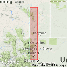
Is a CO name of Permian and Triassic? age used in Denver basin south of the CO-WY State boundary to Ralston Reservoir, Larimer to Jefferson Cos, CO along this line of section. Lies beneath Jelm Formation unconformably. Is equivalent, in part, to Red Peak Formation of Chugwater Group which is used across State line north in WY in the northern Denver basin north to Douglas, Converse Co, WY in the southern Powder River basin.
Source: GNU records (USGS DDS-6; Denver GNULEX).
- Usage in publication:
-
- Lykins Formation*
- Modifications:
-
- Age modified
- AAPG geologic province:
-
- Denver basin
Summary:
Age modified to Late Permian and Early Triassic. Age designation given on map explanation; basis for age change not specified. Unit occurs along Front Range within Denver basin.
Source: GNU records (USGS DDS-6; Denver GNULEX).
For more information, please contact Nancy Stamm, Geologic Names Committee Secretary.
Asterisk (*) indicates published by U.S. Geological Survey authors.
"No current usage" (†) implies that a name has been abandoned or has fallen into disuse. Former usage and, if known, replacement name given in parentheses ( ).
Slash (/) indicates name conflicts with nomenclatural guidelines (CSN, 1933; ACSN, 1961, 1970; NACSN, 1983, 2005, 2021). May be explained within brackets ([ ]).