The National Geologic Map Database is migrating to a new infrastructure. We apologize for any service disruptions during this process.
|
|---|


- Usage in publication:
-
- Louviers alluvium*
- Modifications:
-
- Named
- Dominant lithology:
-
- Alluvium
- AAPG geologic province:
-
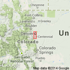
- Denver basin
Summary:
Named for town of Louviers, Kassler quad, Douglas Co, CO in the Denver basin. Type locality is a gravel pit on northeast edge of town in SW1/4 SE1/4 sec 33, T6S, R68W. Consists of a reddish-brown pebbly facies along major streams and yellowish-brown silty along minor streams. At type lies 60 ft above the modern stream and 40 ft below Slocum alluvium (new). Is older than Broadway alluvium (new). Interpreted to be of early Wisconsin, Pleistocene age on basis of fossil mammals and mollusks.
Source: GNU records (USGS DDS-6; Denver GNULEX).

- Usage in publication:
-
- Louviers alluvium*
- Modifications:
-
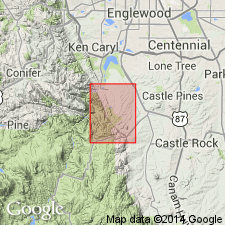
- Mapped 1:24k (Littleton quad, Arapahoe, Douglas, and Jefferson Cos, CO)
- Dominant lithology:
-
- Silt
- Clay
- Sand
- Gravel
- AAPG geologic province:
-
- Denver basin
Summary:
Is Pleistocene (lower Wisconsin) formation mapped in east-central Jefferson, west Arapahoe, and northwest Douglas Cos, CO (Denver basin). Is older than "younger loess" map unit (lower Wisconsin); younger than "older loess" map unit (Illinoian or Sangamon). Coarse-grained alluvium present along South Platte River; fine-grained alluvium present as small deposits along Dad Clark Gulch, Lee Gulch, and a gulch in sec 36, T5S, R69W. Map unit described as dark- or moderate-yellowish-brown pebbly silt in upper 5 ft, alternating beds of light-grayish-brown fine-grained micaceous pebbly sand and cobbles in middle 10 ft, and a thick bed of cobbles, pebbles, sand, and some clay in lower part which is probably several times thicker than the exposed 15 ft. Stones consist mainly of granite, quartz, mica, feldspar, ironstone, and welded tuff. Diagnostic features of Louviers are a well-developed terrace, graded bedding, contorted silt and clay layers, and iron and manganese oxide stains. Terrace of Louviers is 50 ft above Plum Creek and South Platte River in south part of quad and 40-45 ft above South Platte in north part. Contains abundant vertebrate fossils including MAMMUTHUS (PARELEPHAS) COLUMBI, CAMELOPS sp., BISON ANTIQUUS, EQUUS sp., and several species of rodents as well fossil mollusks. Total thickness of unit could be as much as 70 ft.
Source: GNU records (USGS DDS-6; Denver GNULEX).
- Usage in publication:
-
- Louviers alluvium*
- Modifications:
-
- Mapped 1:24k (Kassler quad, Douglas and Jefferson Cos, CO)
- Dominant lithology:
-
- Cobble
- Sand
- Silt
- Clay
- AAPG geologic province:
-
- Denver basin
Summary:
Is Pleistocene (Wisconsin) formation mapped in northwestern Douglas and southeastern Jefferson Cos, CO (Denver basin). Shown on Explanation to be younger than older loess unit (Sangamon) and older than younger loess unit (Wisconsin); lies unconformably on Slocum alluvium (Illinoian or Sangamon). Unit described as consisting of two facies: reddish-brown pebbly facies and yellowish-brown silty facies. Graded bedding is distinctive feature of unit. Small patches of unit occur along most streams in northeastern part of quad; largest exposure is in prominent terrace along Plum Creek. Type section is proposed within type locality (sec 33, T6S, R68W); thickness here is 48 ft; additional measured sections. Thickness is variable; fine-grained facies ranges from about 6 ft along mountain front to about 25 ft in small streams that flow into Plum Creek. Thickness of coarse-grained facies may be as much as 120 ft. Vertebrate fossils are abundant and diverse in Louviers (fossil list) and suggest Wisconsin age.
Source: GNU records (USGS DDS-6; Denver GNULEX).
- Usage in publication:
-
- Louviers Alluvium*
- Modifications:
-
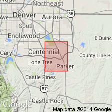
- Mapped 1:24k (Parker quad, Arapahoe and Douglas Cos, CO)
- Dominant lithology:
-
- Sand
- Clay
- Gravel
- AAPG geologic province:
-
- Denver basin
Summary:
Is Pleistocene formation mapped in southwestern Arapahoe and northern Douglas Cos, CO (Denver basin). Conformably overlies lower part (younger part) of Slocum Alluvium (Pleistocene); conformably underlies Broadway Alluvium (Pleistocene). Correlates with lower part of loess unit (Pleistocene). Divided into separately mapped lower (younger) and upper (older) parts; gravel at base of upper part used as basis for subdivision. Unit described as moderate-reddish-brown pebbly feldspar-and-quartz sand and silty clay; bouldery gravels at base of both upper and lower parts. Deposits commonly grade upward from gravel into sand, then into silt and clay; poorly sorted. Covers and fills irregularities on bedrock surfaces. Terrace surfaces are 30-80 ft above principal streams. Up to 100 ft thick.
Source: GNU records (USGS DDS-6; Denver GNULEX).

- Usage in publication:
-
- Louviers Alluvium*
- Modifications:
-
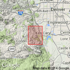
- Mapped 1:24k (Morrison quad, Jefferson Co, CO)
- Dominant lithology:
-
- Alluvium
- AAPG geologic province:
-
- Denver basin
Summary:
Is Pleistocene (Bull Lake Glaciation) alluvium mapped in Jefferson Co, CO (Denver basin). Largest exposures in northeast part of quad and southeast part of quad, in area of Soda Lakes. Shown on Correlation of Map Units to unconformably overlie Slocum Alluvium (Pleistocene--Sangamon Interglaciation) and to unconformably underlie Broadway Alluvium (Pleistocene--Pinedale Glaciation); correlates with lowermost part of upper Holocene to Pleistocene landslide and colluvium units. Map unit described as reddish-brown pebbly to bouldery alluvium along permanent streams and sandy to clayey alluvium along intermittent streams. Coarse alluvium is stained by manganese and iron. Thickness probably more than 25 ft. Terrace is about 65 ft above modern streams. Strong Brown soil of post-Bull Lake pre-Pinedale age in upper part. Alluvium contains fossil mollusks. Six-foot boulders in torrential flood deposits between Bear Creek and Turkey Creek resulted from flash flood during capture of Turkey Creek by small tributary of Bear Creek. Turkey Creek in pre-Louviers time flowed southeast from gap in Dakota hogback.
Source: GNU records (USGS DDS-6; Denver GNULEX).
- Usage in publication:
-
- Louviers Alluvium*
- Modifications:
-
- Mapped 1:24k (Indian Hills quad, Jefferson Co, CO)
- Dominant lithology:
-
- Clay
- Sand
- Gravel
- AAPG geologic province:
-
- Denver basin
Summary:
Is Pleistocene (Bull Lake) formation mapped in central Jefferson Co, CO (Denver basin). Older than older alluvium and colluvium (Pleistocene); younger than Slocum Alluvium (Pleistocene). Well exposed beneath Piney Creek Alluvium along an arroyo east of the Hogback near West Bowles Avenue. Probably underlies Piney Creek in many places, but is not exposed. Map unit described as light-reddish-grown silty clay and sand containing layers of sand and fine gravel. Exposed thickness is 3-8 ft.
Source: GNU records (USGS DDS-6; Denver GNULEX).
- Usage in publication:
-
- Louviers Alluvium*
- Modifications:
-
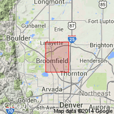
- Mapped 1:24k (Lafayette quad, Adams Boulder, and Jefferson Cos, CO)
- Dominant lithology:
-
- Sand
- Gravel
- AAPG geologic province:
-
- Denver basin
Summary:
Is Pleistocene (Pinedale-Bull Lake interglaciation and Bull Lake glaciation age) formation mapped in northeastern Jefferson and northwestern Adams Cos, CO (Denver basin). Unconformably overlies Slocum Alluvium (Pleistocene); unconformably underlies Broadway Alluvium (Pleistocene, Pinedale age). Unit described as light-reddish-brown to light-brown gravelly to pebbly sand; lenses and channels filled by sandy gravel along major streams. Gravel derived from Slocum, Verdos, and Rocky Flats Alluviums. Alluvium is markedly finer grained downstream along Big Dry Creek. Terrace is 11-13 m above modern flood plain of Big Dry Creek in south-central part of quad. Moderately well developed zonal soil in upper part of alluvium is post-Bull Lake in age. Soil has a B (clay-enriched) horizon and Cca (calcium carbonate-enriched) horizon. Stones in lower part of soil have thin continuous crusts of calcium carbonate on their bases. Soil profile shown. Thickness about 10 m. Radiocarbon date of charcoal from Broadway Alluvium indicates Louviers was deposited before 38,440 yrs.
Source: GNU records (USGS DDS-6; Denver GNULEX).
- Usage in publication:
-
- Louviers Alluvium*
- Modifications:
-
- Mapped 1:24k (Fort Logan quad, Arapahoe, Denver, and Jefferson Cos, CO)
- Dominant lithology:
-
- Clay
- Silt
- Sand
- Gravel
- AAPG geologic province:
-
- Denver basin
Summary:
Is Pleistocene formation mapped in western Arapahoe, western Denver, and eastern Jefferson Cos, CO (Denver basin). On Correlation of Map Units, Louviers is shown to unconformably overlie Slocum Alluvium (Pleistocene) and to unconformably underlie Broadway Alluvium (Pleistocene). Correlates with lowermost part of colluvium unit (Pleistocene and Holocene). Unit described as reddish- to yellowish-brown, pebbly, arkosic sand, coarse sand, cobble-sized gravel, and occasional boulders. Includes lenticular masses of silt and clay, commonly having contorted bedding. Coarse granular materials are stained and cemented in places by manganese and iron oxides; contain abundant amounts of mica, and generally are cross-bedded. Engineering properties discussed. Outcrops mainly in southern part of quad. Commonly 15-20 ft thick in terrace deposits along South Platte River and Bear Creek; up to 45 feet thick in South Platte River valley.
Source: GNU records (USGS DDS-6; Denver GNULEX).
- Usage in publication:
-
- Louviers Alluvium*
- Modifications:
-
- Age modified
- AAPG geologic province:
-
- Denver basin
Summary:
Assigned Bull Lake (Pleistocene) age. Exposed in only a few places probably due to subsequent erosion and burial beneath younger alluvium; inferred to underlie younger alluvium for entire length of South Platte River within quad. Study area is within Denver basin. Thickness is possibly as much as 150 ft. Overlies Loveland? Loess; underlies Peoria Loess.
Source: GNU records (USGS DDS-6; Denver GNULEX).
- Usage in publication:
-
- Louviers Alluvium*
- Modifications:
-
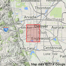
- Mapped 1:24k (Arvada quad, Adams, Denver, and Jefferson Cos, CO)
- Dominant lithology:
-
- Sand
- Gravel
- Silt
- Clay
- AAPG geologic province:
-
- Denver basin
Summary:
Is Pleistocene formation mapped in southwestern Adams, northwestern Denver, and northeastern Jefferson Cos, CO (Denver basin). On Correlation of Map Units, Louviers is shown to unconformably overlie Slocum Alluvium (Pleistocene) and to unconformably underlie Broadway Alluvium (Pleistocene); correlates with lowermost part of Pleistocene and Holocene colluvium unit. Unit is described as reddish- to yellowish-brown pebbly arkosic sand, coarse sand, cobble-sized gravel, and occasional boulders. Includes lenticular masses of silt and clay, commonly having contorted bedding. Coarse granular materials are stained and cemented in places by manganese and iron oxides, contain abundant amounts of mica, and generally are cross-bedded. Engineering properties discussed. Commonly 15-20 ft thick in terrace deposits along Clear Creek and South Platte River; as much as 25 ft thick in Clear Creek valley.
Source: GNU records (USGS DDS-6; Denver GNULEX).
- Usage in publication:
-
- Louviers Alluvium*
- Modifications:
-
- Mapped 1:24k (Commerce City quad, Adams and Denver Cos, CO)
- Dominant lithology:
-
- Gravel
- Sand
- Silt
- Clay
- AAPG geologic province:
-
- Denver basin
Summary:
Is Pleistocene formation mapped in northern Denver and western Adams Cos, CO (Denver basin). On Correlation of Map Units, Louviers is shown to unconformably overlie Slocum Alluvium (Pleistocene); unconformably underlies Broadway Alluvium (Pleistocene). Correlates with lower part of colluvium unit (Pleistocene and Holocene). Unit described as reddish- to yellowish-brown pebbly arkosic sand, coarse sand, cobble gravel, and a few boulders. Includes lenticular masses of silt and clay, commonly having contorted bedding. Coarse granular materials are stained and cemented locally by manganese and iron oxides, contain abundant mica, and generally are cross-bedded. Many exposures are in pits excavated through younger alluvial deposits. Engineering properties discussed. Thickness is commonly 15-20 ft in terrace deposits along South Platte River and is as much as 25-35 ft in Clear Creek and South Platte River valleys.
Source: GNU records (USGS DDS-6; Denver GNULEX).
- Usage in publication:
-
- Louviers Alluvium*
- Modifications:
-
- Mapped 1:24k (Englewood quad, Adams, Arapahoe, and Denver Cos, CO)
- Dominant lithology:
-
- Sand
- Silt
- Gravel
- AAPG geologic province:
-
- Denver basin
Summary:
Is Pleistocene formation mapped in eastern Denver Co, CO (Denver basin). Shown on Correlation of Map Units to unconformably overlie Slocum Alluvium (Pleistocene), to unconformably underlie Broadway Alluvium (Pleistocene), and to correlate in part with loess unit (Pleistocene). Unit described as light-brown, clean pebbly sand interbedded with clayey silt to silty sand and pebble to cobble gravel along South Platte River and clean pebbly sand interbedded with sandy silt to silty sand along Cherry Creek. Forms terraces about 11-14 ft above Cherry Creek. Buried beneath younger alluvium and eolian deposits. Only mapped exposure is along Leetsdale Drive between South Monaco and South Quebec Streets. Table of physical properties. Thickness (from subsurface logs) about 4.5 m in terraces along Cherry Creek, and 15 m in valleys of South Platte River and Cherry Creek.
Source: GNU records (USGS DDS-6; Denver GNULEX).
For more information, please contact Nancy Stamm, Geologic Names Committee Secretary.
Asterisk (*) indicates published by U.S. Geological Survey authors.
"No current usage" (†) implies that a name has been abandoned or has fallen into disuse. Former usage and, if known, replacement name given in parentheses ( ).
Slash (/) indicates name conflicts with nomenclatural guidelines (CSN, 1933; ACSN, 1961, 1970; NACSN, 1983, 2005, 2021). May be explained within brackets ([ ]).