

- Usage in publication:
-
- Little Copper Formation
- Modifications:
-
- Named
- Reference
- Dominant lithology:
-
- Argillite
- Quartzite
- Conglomerate
- AAPG geologic province:
-
- Snake River basin
Summary:
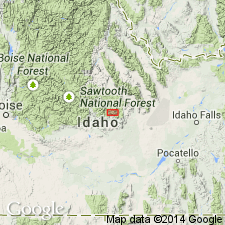
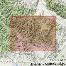
Named as the basal formation (of six formations) of Copper Basin Group. Replaces name Milligen Formation, name previously given to basal formation of Copper Basin. Milligen restricted to Devonian rocks in the Wood River valley south in Blaine and Lincoln Cos. A section assigned as reference section of Milligen on ridge above Little Copper Creek redesignated the type section of the Little Copper. This section is in SW1/4 NE1/4 SE1/4 sec 22 to center of NE1/4 NW1/4 sec 23, T4N, R21E, Blaine Co, ID in the Snake River basin. Stratigraphic base not known; is in contact with Devonian and Silurian rocks at Fish Creek Reservoir, and with Carey Dolomite at Garfield Canyon. Gradationally underlies Drummond Mine Limestone of Copper Basin Group. Restricted to area where Drummond Mine is present. Consists of 1,120+ m of dark-gray, thin- to medium-bedded, blocky-weathering argillite with some interbeds of medium-gray quartzite and granule conglomerate. Some limestone lenses. Reference section designated at SW1/4 sec 12, T3N, R21E. Age of Early Mississippian, Kinderhookian assigned. Formation represents fast marine deposition of turbidites derived from Antler orogenic belt. Stratigraphic chart.
Source: GNU records (USGS DDS-6; Denver GNULEX).
- Usage in publication:
-
- Little Copper Member*
- Modifications:
-
- Revised
- AAPG geologic province:
-
- Idaho Mountains province
- Snake River basin
Summary:
Revised in stratigraphic rank from basal formation of Copper Basin Group to basal member of the Copper Basin Formation. Mapped (geologic map) in the Copper Basin plate along Star Hope and Iron Bog Creeks, Custer Co, Idaho Mountains province, and along Muldoon Creek, Custer and Blaine Cos, Idaho Mountains province and Snake River basin. In thrust contact with older rocks. Gradationally underlies Drummond Mine Member (revised) of Copper Basin. Composed of 3,200 ft of brown, olive-green, medium- to thick-bedded, blocky argillite and subordinate gray quartzite and granule conglomerate. No fossils found, but Early Mississippian, early? Kinderhookian age probable because of age of overlying Drummond Mine.
Source: GNU records (USGS DDS-6; Denver GNULEX).
For more information, please contact Nancy Stamm, Geologic Names Committee Secretary.
Asterisk (*) indicates published by U.S. Geological Survey authors.
"No current usage" (†) implies that a name has been abandoned or has fallen into disuse. Former usage and, if known, replacement name given in parentheses ( ).
Slash (/) indicates name conflicts with nomenclatural guidelines (CSN, 1933; ACSN, 1961, 1970; NACSN, 1983, 2005, 2021). May be explained within brackets ([ ]).