

- Usage in publication:
-
- Libby formation*
- Modifications:
-
- Named
- Dominant lithology:
-
- Argillite
- Sandstone
- Limestone
- AAPG geologic province:
-
- Northern Rocky Mountain region
Summary:
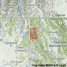
Named the upper formation of the Belt series for the town of Libby, Lincoln Co, MT in the Northern Rocky Mountain region. No type locality designated, but a typical section designated as the measured section southeast of Flagstaff Mountain, south side of the Kootenai River. Is 2,250 ft thick at the measured section where the base is not exposed and the top has been eroded. Thickness estimated as at least 6,000 ft. Is predominately gray argillite, somewhat sandy, sericitic, calcareous, in beds 1 to 3 ft thick. Some beds alternate from very thin light colored to dark colored. Also has thin-bedded, gray sandstone and thin-bedded, dark gray, oolitic, ferruginous magnesian limestone. At one locality a few beds of white ferruginous dolomite and algal dolomite present. Some of the calcareous layers have spherical and pod-like nodules on the weathered surface. Mapped in northern part of quad. Geologic map. Overlies Striped Peak formation. Of pre-Cambrian age.
Source: GNU records (USGS DDS-6; Denver GNULEX).

- Usage in publication:
-
- Libby Formation*
- Modifications:
-
- Overview
- AAPG geologic province:
-
- Northern Rocky Mountain region
Summary:
Recognized in WA, ID and MT in the Northern Rocky Mountain region as a formation in the Missoula Group of the Belt Supergroup of Precambrian age. See figs 4, 5, 7, and 13 for correlation with other formations of the Belt in the U.S. and with formations of the Purcell Supergroup of Alberta and British Columbia, Canada.
Source: GNU records (USGS DDS-6; Denver GNULEX).
For more information, please contact Nancy Stamm, Geologic Names Committee Secretary.
Asterisk (*) indicates published by U.S. Geological Survey authors.
"No current usage" (†) implies that a name has been abandoned or has fallen into disuse. Former usage and, if known, replacement name given in parentheses ( ).
Slash (/) indicates name conflicts with nomenclatural guidelines (CSN, 1933; ACSN, 1961, 1970; NACSN, 1983, 2005, 2021). May be explained within brackets ([ ]).