

- Usage in publication:
-
- Lewisville beds*
- Modifications:
-
- Original reference
- Dominant lithology:
-
- Clay
- Sand
- AAPG geologic province:
-
- Ouachita folded belt
- South Oklahoma folded belt
- Strawn basin
Summary:
Pg. 114-115, 297. Lewisville beds. Lignitic sandy clays and sands, frequently accompanied by sulphate of iron, magnesian salts, etc. Thickness not determined. Middle part of Woodbine sand. Replaces "Timber Creek bed." Overlies Dexter sands and underlies less ferruginous sands and clays composing upper part of Woodbine. [The latter ferruginous sands and claya are now known to belong to the Eagle Ford.]
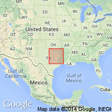
Named from exposures at Lewisville, Denton Co., northeastern TX.
[GNC remark (ca. 1938, US geologic names lexicon, USGS Bull. 896, p. 1177-1178): USGS adopted Lewisville as upper member of Woodbine sand (Lewisville marine member of Woodbine sand). Age is Late Cretaceous (Gulf).]
Source: US geologic names lexicon (USGS Bull. 896, p. 1177-1178).
- Usage in publication:
-
- Lewisville formation
- Modifications:
-
- Revised
- AAPG geologic province:
-
- Strawn basin
Summary:
Pg. 475, 476, 477, 480-481 (correlation chart). Lewisville formation of Woodbine group. Rank raised to formation in Woodbine group. Includes Pine Bluff tuffaceous gravelly member at base. Unconformable above Euless formation; unconformably underlies Eagle Ford formation. [Age is Late Cretaceous (Gulf).]
Source: US geologic names lexicon (USGS Bull. 1200, p. 2161-2162).
- Usage in publication:
-
- Lewisville formation
- Modifications:
-
- Areal extent
Summary:
Correlation chart of outcropping Upper Cretaceous formations in Texas shows Lewisville formation (undifferentiated) in upper part of Woodbine group above Dexter sand.
Source: US geologic names lexicon (USGS Bull. 1200, p. 2161-2162).
- Usage in publication:
-
- Lewisville member*
- Modifications:
-
- Mapped
- Dominant lithology:
-
- Sandstone
- Shale
- Clay
- AAPG geologic province:
-
- Fort Worth syncline
- Ouachita folded belt
- South Oklahoma folded belt
Summary:
Lewisville member of Woodbine formation. Includes beds from top of tuffaceous sandstone and carbonaceous shale of Red Branch member (new) to uppermost glauconitic reef sandstone with abundant OSTREA SOLENISCUS shells; underlies Templeton member (new). Thickness 75 to 95 feet. [Age is Late Cretaceous (Gulf).]
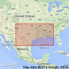
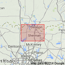
Recognized (surface and subsurface) in Cooke, Grayson, Fannin, and Denton Cos., northeastern TX.
Source: Publication; US geologic names lexicon (USGS Bull. 1200, p. 2161-2162).
- Usage in publication:
-
- Lewisville member*
- Modifications:
-
- Biostratigraphic dating
- AAPG geologic province:
-
- Fort Worth syncline
- Ouachita folded belt
- South Oklahoma folded belt
- Strawn basin
Summary:
Pg. 4, 5 (table), 7 (fig. 2), 11-15, pls. Lewisville member of Woodbine formation. Lewisville has greatest geographic extent of any of members of Woodbine. As used in this report member includes so-called Pine Bluff member of Hazzard, Blanpied, and Spooner. In Tarrant and Denton Counties, overlies Euless member; in Grayson and Fannin Counties, overlies Red Branch member; in other areas, lower part of Woodbine is either absent or undifferentiated. In Denton, Grayson, Fannin, and Lamar Counties, underlies Templeton member. Fauna described. Notes on type area. [Age is Late Cretaceous (Gulf).]
Type area: Timber Creek from point about 2 mi south of center of Lewisville, Denton Co., upstream to point about 3 mi southwest of center of Lewisville and about 1 mi above crossing of road to Shiloh Church.
Source: US geologic names lexicon (USGS Bull. 1200, p. 2161-2162).
- Usage in publication:
-
- Lewisville Member
- Modifications:
-
- Reference
- AAPG geologic province:
-
- Strawn basin
Summary:
Pg. 332-333 (credited to C.F. Dodge, Univ. Texas-Arlington, May 1970). Lewisville Member of Woodbine Formation. Sandy clay, siltstone, sandstone, shale, and ironstone. Thickness 106.2 feet. Fossils. Age is Late Cretaceous (Gulfian). Recognized in north and northeastern Texas. Reference locality suggested by C.F. Dodge, 1969, Texas Jour. Sci., v. 21, no. 1, p. 54. (For reference section, see R.T. Hill, 1901, USGS 21st Ann. Rpt.) Taff (1892, Texas Geol. Survey 3rd Ann. Rpt., p. 271) included these rocks in his Timber Creek Beds.
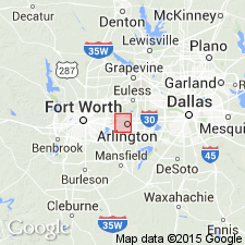
Reference locality: stream valley just east of Farm Road 157, south of bridge across Trinity River; [east of N. Collins Ave. (Farm Road 157) near intersection with Brown Blvd., in vicinity of Lat. 32 deg. 46 min. 30 sec. N., Long. 97 deg. 05 min. 48 sec. W., Euless 7.5-min quadrangle (ca. 2000 ed.), eastern Tarrant Co., north-central TX].
[Additional locality information from USGS historical topographic map collection TopoView, ACME Mapper 2.0, and Montana State Univ. Graphical Locator, accessed February 16, 2012.]
Source: Publication.

- Usage in publication:
-
- Lewisville Member
- Modifications:
-
- Mapped 1:250k
- Dominant lithology:
-
- Sandstone
- Shale
- Clay
- AAPG geologic province:
-
- Ouachita folded belt
- South Oklahoma folded belt
Summary:
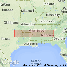
Pamphlet [p. 4]. Lewisville Member of Woodbine Formation. In Texas, sandstone, gray to brown and yellowish-brown, glauconitic, minor shale beds, some lenses of tuffaceous clay and sandstone, marine megafossils, oyster concentrations locally; thickness 75 to 95 feet. In Oklahoma, sandstone, yellow to reddish-brown, ferruginous, glauconitic, thin- to thick-bedded, cross-bedded, interbedded with tan to brown shale; thickness approximately 120 feet. Lies above Red Branch Member and below Templeton Member; both of Woodbine Formation. Age is Late Cretaceous.
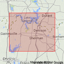
[Mapped on either side of Red River and southward to Lake Ray Roberts (Tioga area); in Cooke, Fannin, and Grayson Cos., northeastern TX, and Bryan Co., southeastern OK; northeastern and central part of map sheet.]
Source: Publication.
For more information, please contact Nancy Stamm, Geologic Names Committee Secretary.
Asterisk (*) indicates published by U.S. Geological Survey authors.
"No current usage" (†) implies that a name has been abandoned or has fallen into disuse. Former usage and, if known, replacement name given in parentheses ( ).
Slash (/) indicates name conflicts with nomenclatural guidelines (CSN, 1933; ACSN, 1961, 1970; NACSN, 1983, 2005, 2021). May be explained within brackets ([ ]).