

- Usage in publication:
-
- Lebanon limestone
- Modifications:
-
- Named
- Dominant lithology:
-
- Limestone
- AAPG geologic province:
-
- Appalachian basin
Summary:
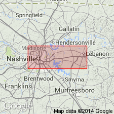
Named a Lower Lebanon and Upper Lebanon limestone in the Stones River group in TN. The Lower Lebanon limestone is 50 to 60 feet thick, highly fossiliferous, thin-bedded, sky-blue limestones, coarsely crystalline and abounding in calcareous remains, sometimes separated by seams of argillaceous matter. The Lower Lebanon grades into the Upper Lebanon limestone, which consists of 110 to 130 feet of grayish, sometimes brownish, and blue thick-bedded limestones, becoming thin-bedded and interstratified with occasional seams of clay in upper 15 or 20 feet. The Lebanon limestones underlie the Nashville group and are the oldest rocks in Middle Tennessee. Age is Lower Ordovician (Chazyan).
Source: GNU records (USGS DDS-6; Reston GNULEX).

- Usage in publication:
-
- Lebanon Limestone*
- Modifications:
-
- Areal extent
- AAPG geologic province:
-
- Appalachian basin
Summary:
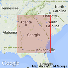
The Lebanon Limestone of the Stones River Group, as used by Milici and Smith (1969), is here used in the Chickamauga terrane in GA.
Source: GNU records (USGS DDS-6; Reston GNULEX).
- Usage in publication:
-
- Lebanon Member
- Modifications:
-
- Revised
- AAPG geologic province:
-
- Appalachian basin
Summary:
Lebanon regarded as member of the Stones River Formation of the Chickamauga Group in the Foreland thrust area of northwest Georgia following the nomenclature of Carter and Chowns (1986: AL Geol. Soc. Guidebook, 23rd Ann. Field Trip) and Carter and Chowns (in press: Amer. Assoc Pet. Geol. Studies in Geology). Lowest exposed unit at RR cut near Davis Crossroads, Walker Co.; underlies Carters Member of the Stones River.
Source: GNU records (USGS DDS-6; Reston GNULEX).

- Usage in publication:
-
- Lebanon Limestone*
- Modifications:
-
- Overview
- AAPG geologic province:
-
- Cincinnati arch
Summary:
The Lebanon Limestone of the Stones River Group in central Tennessee consists of gray to bluish gray and tan, dense, fine grained limestone interbedded with coarse grained limestone and thin calcareous shale partings. Contains dolomitic and clayey burrows that weather differentially. Thickness is 74 to 118 feet. Conformably overlies the Ridley Limestone and unconformably underlies the Carters Limestone, both of the Stones River Group. The Lebanon was deposited in a quiet subtidal and normal marine environment.
Source: GNU records (USGS DDS-6; Reston GNULEX).
For more information, please contact Nancy Stamm, Geologic Names Committee Secretary.
Asterisk (*) indicates published by U.S. Geological Survey authors.
"No current usage" (†) implies that a name has been abandoned or has fallen into disuse. Former usage and, if known, replacement name given in parentheses ( ).
Slash (/) indicates name conflicts with nomenclatural guidelines (CSN, 1933; ACSN, 1961, 1970; NACSN, 1983, 2005, 2021). May be explained within brackets ([ ]).