- Usage in publication:
-
- Lava Creek Tuff*
- Modifications:
-
- Named
- Geochronologic dating
- Dominant lithology:
-
- Tuff
- AAPG geologic province:
-
- Yellowstone province
Summary:
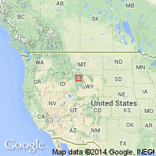
Named as upper ash-flow sheet of Yellowstone Group (raised in stratigraphic rank from formation) for Lava Creek, which enters the Gardner River about 3 km southeast of Mammoth, Yellowstone National Park, WY in Yellowstone province. Type area designated in upper canyon of Lava Creek and its tributary, Arrow Canyon. Is 210 m thick at type. Is more than 300 m thick in several areas. Occurs in Yellowstone Park, south to Jackson Lake, west to Island Park area and southern Centennial Mountains, and west along margin of Snake River Plain, ID. Divisible into two informal members. Principal reference section of lower member is south-facing cliff of Purple Mountain above an old gravel pit about 1 km east of Madison Junction where member has a basal 300 m thick, less densely welded, and an upper 180 m thick, densely welded tuff. Principal reference section for upper member is east wall, Sheepeater Canyon, Gardner River, 1 km northeast of Osprey Falls where member is 140 m thick, consisting of air-fall pumice, ash, phenocryst-rich glassy welded tuff, nonwelded and gray tuff, and black vitrophyre. Yellowstone caldera formed by collapse of magma-chamber roof that resulted from eruption of Lava Creek. Sanidine dated by K-Ar as 600,000 years old. Is part of the third volcanic cycle (of three) of Quaternary Yellowstone Plateau.
Source: GNU records (USGS DDS-6; Denver GNULEX).
- Usage in publication:
-
- Lava Creek Tuff*
- Modifications:
-
- Geochronologic dating
- Areal extent
- AAPG geologic province:
-
- Yellowstone province
Summary:
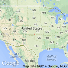
Pearlette was formerly thought to represent one ash-fall over a wide area. Recent petrographic and chemical studies of ash samples called Pearlette have shown that there are at least three different ash beds on the Great Plains and Rocky Mountain area of closely related petrographic and properties that are related to the Yellowstone Tuff. Pearlette type O identified at Onion Creek, SE1/4 NE1/4 sec 26, T24S, R24E, Grand Co, UT, Paradox basin, has 0.7 +/-0.2 m.y. and at three localities in Meade Co, KS, Anadarko basin, has 0.6 +/-0.07 to 0.9 +/-0.25 m.y. age. Type O correlates with Lava Creek Tuff of Yellowstone area WY. Pearlette type S is correlated with the Mesa Falls Tuff of Yellowstone area of 1.2 m.y. age. Zircons from type S not dated because of small size and paucity. Pearlette type B identified at Cudahy ash Mine, Meade Co, KS in the Anadarko basin has an age of 2.0 m.y. and is correlated with Huckleberry Ridge Tuff of Yellowstone National Park, WY in the Yellowstone province.
Source: GNU records (USGS DDS-6; Denver GNULEX).
- Usage in publication:
-
- Lava Creek ash bed (informal)*
- Modifications:
-
- Areal extent
- AAPG geologic province:
-
- Anadarko basin
- Big Horn basin
- Central Kansas uplift
- Central Western Overthrust
- Chadron arch
- Denver basin
- Eagle basin
- Estancia basin
- Great Basin province
- Green River basin
- Gulf Coast basin
- Iowa shelf
- Las Vegas-Raton basin
- Los Angeles basin
- Mojave basin
- Orogrande basin
- Palo Duro basin
- Paradox basin
- Permian basin
- Piceance basin
- Plateau sedimentary province
- Powder River basin
- Salina basin
- San Juan basin
- San Juan Mountains province
- Sedgwick basin
- Sierra Grande uplift
- Sioux uplift
- Snake River basin
- South Western Overthrust
- Ventura basin
- Wasatch uplift
- Wind River basin
- Yellowstone province
Summary:
Lava Creek A ash bed; Lava Creek B ash bed. Lava Creek A ash bed is the informal designation for ash that is the downwind equivalent of member A of Lava Creek Tuff of Yellowstone Group of the Yellowstone National Park area, Wyoming and Idaho. Lava Creek B ash bed (previously called Pearlette type B ash) is the informal designation for ash that is the downwind equivalent of member B of Lava Creek Tuff. Age is Pleistocene, based on K-Ar age (sanidine) of 0.62 Ma for members A and B of Lava Creek Tuff (J.D. Obradovich, written commun., 1979; calculated using current decay constants of Steiger and Jager, 1977); Pliocene-Pleistocene boundary placed at 1.8 Ma.
Lava Creek A ash bed identified w/certainty in Big Horn Co., WY.
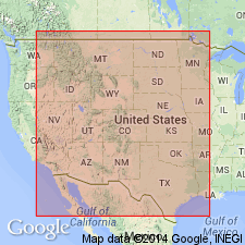
Lava Creek B ash bed identified w/certainty in: Inyo, San Bernadino, and Ventura Cos., CA; Adams, Chaffee, Custer, Garfield, Gunnison, Huerfano, Jefferson, Lake, La Plata, Logan, Montrose, Ouray, Rio Blanco, and Routt Cos., CO; Bannock, Bingham, Caribou, and Franklin Cos., ID; Audubon, Cherokee, Guthrie, and Harrison Cos., IA; Clark, Grant, Lincoln, McPherson, Meade, Republic, Russell, Seward, and Sheridan Cos. KS; Big Horn and Custer Cos., MT; Frontier, Lincoln, Seward, Valley, and Webster Cos., NE; Eureka and Pershing Cos., NV; Bernalillo, Curry, Dona Ana, Eddy, Harding, and Quay Cos., NM; Beaver and Custer Cos., OK; Bennett, Minnehaha, and Shannon Cos., SD; Bastrop, Briscoe, Dickens, El Paso, Howard, Kent, Knox, Presidio, Randall, and Swisher Cos., TX; Box Elder, Grand, Kane, Salt Lake, Sevier, Tooele, and Utah Cos., UT; Big Horn, Carbon, Fremont, Park, Platte, Sublette, Sweetwater, and Washakie Cos., WY; and Sasketchewan Province, Canada.
Source: Publication.
- Usage in publication:
-
- Lava Creek B tephra layer
- Modifications:
-
- Areal extent
- AAPG geologic province:
-
- San Juan basin
Summary:
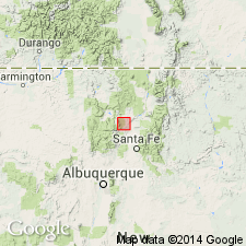
A tephra layer about 80 cm thick is exposed in fluvial deposits of the ancestral Rio Chama in the Espanola basin [a subbasin of the San Juan basin] in north-central NM. The tephra is a gray-white vitric ash of bubble walls and bubble-wall junction shards as much as 350 mm in diameter. This tephra came from an eruption 620,000 yrs. ago at Yellowstone, WY. Contaminants in the ash suggest reworking and redeposition within a 10-30 m thick piedmont alluvium in arroyos draining the Jemez Mountains. Measured section. Cross section. Ash is identified along a 25 km stretch of the Rio Chama about 100 m above the river.
Source: GNU records (USGS DDS-6; Denver GNULEX).
- Usage in publication:
-
- Lava Creek B ash bed (informal)*
- Modifications:
-
- Geochronologic dating
- Mapped 1:24k
- AAPG geologic province:
-
- Anadarko basin
Summary:
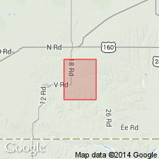
Lava Creek B ash bed (informal). Lenticular silver-gray volcanic ash. Thickness 0 to 5 m. Lies within upper unnamed member of Crooked Creek Formation, about 20 m above Huckleberry Ridge ash bed. Previously called Pearlette type O ash bed. Source in Yellowstone National Park. Age is Pleistocene, 0.66 to 0.67 Ma (citing Izett and others, 1970). [Pliocene-Pleistocene boundary placed at 1.8 Ma.]
Lies above Cudahy fauna (Hibbard, 1944) at Sunbrite Hatlanta Mine, in center E/2 sec. 26, T. 32 S., R. 28 W.
Source: Publication.
- Usage in publication:
-
- Lava Creek B ash
- Modifications:
-
- Geochronologic dating
- AAPG geologic province:
-
- Anadarko basin
- Permian basin
- Yellowstone province
Summary:
Pg. 234 (table 7.1), 237, p. 240+ (fig. 7.1). Lava Creek B ash (Pearlette type O). Age is: 0.602 +/-0.004 Ma, citing Ganseck and others, 1998 (Geol., v. 26, p. 343-346, Yellowstone area); between 0.66 +/-0.01 and 0.67 +/-0.01 Ma, citing Izett and Honey, 1995 (USGS Misc. Inv. Ser. Map I-2498, Meade County, Kansas), and Izett and others, 1992 (GSA Abs. with Prog., v. 24, no. 7, p. A102, Wind River area, Wyoming). Occurs within Irvingtonian NALMA, Brunhes chron zone (normal polarity zone 1n). Lies within Tule Formation in Texas (above the Mayfield Ranch fauna); lies immediately above Cudahy fauna in Kansas and Oklahoma.
Source: Publication.
For more information, please contact Nancy Stamm, Geologic Names Committee Secretary.
Asterisk (*) indicates published by U.S. Geological Survey authors.
"No current usage" (†) implies that a name has been abandoned or has fallen into disuse. Former usage and, if known, replacement name given in parentheses ( ).
Slash (/) indicates name conflicts with nomenclatural guidelines (CSN, 1933; ACSN, 1961, 1970; NACSN, 1983, 2005, 2021). May be explained within brackets ([ ]).

