

- Usage in publication:
-
- Laketown dolomite*
- Modifications:
-
- Original reference
- Dominant lithology:
-
- Dolomite
- AAPG geologic province:
-
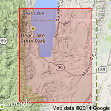
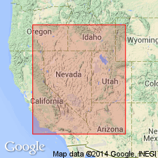
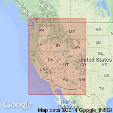
- Wasatch uplift
Summary:
Pg. 407, 410. Laketown dolomite. Massive light-gray dolomite, 1,000 feet thick in northern Utah. Underlies Jefferson dolomite and overlies Fish Haven dolomite. Age is Silurian (Niagaran).
[Named from exposures in Laketown Canyon, Rich Co., northeastern UT. Extends into western UT (Gold Hill district, see Nolan's USGS Prof. Paper. 177, 1935) and southern ID.]
Source: US geologic names lexicon (USGS Bull. 896, p. 1137).
- Usage in publication:
-
- Laketown dolomite*
- Modifications:
-
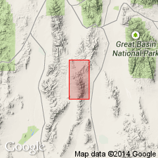
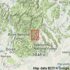
- Areal extent
- AAPG geologic province:
-
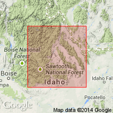
- Idaho Mountains province
Summary:
Introduced into south-central ID. Mapped in the Bayhorse quad, Custer Co, ID in the Idaho Mountains province. None of the exposures includes the total thickness of the formation. Consists of moderately thick bedded gray dolomitic limestone that weathers rusty. Chert nodules present. Some of the dolomite is sandy; some is shaly. Intercalated gray shale at several horizons and white quartzite in lenticular bodies of small areal extent and irregular distribution. At Lone Pine Peak in the Bayhorse quad, newly 1,000 ft of quartzite is overlain by 2,500 ft of dolomite and intercalated quartzite. Correlation chart. Is younger than Silurian Trail Creek formation and older than Middle Devonian Jefferson formation. Has a few fossils: corals, crinoids, brachiopods. Fossils listed. Assigned to the Silurian.
Source: GNU records (USGS DDS-6; Denver GNULEX).
- Usage in publication:
-
- Laketown formation
- Modifications:
-
- Revised
- AAPG geologic province:
-
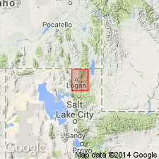
- Wasatch uplift
Summary:
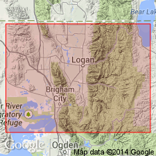
Revised in that Laketown disconformably underlies a newly named formation, the Water Canyon formation in Cache Co, UT on the Wasatch uplift. A section 1,510 ft thick measured on north side of Green Canyon in sec 20, T12N, R2E where the Laketown disconformably overlies Fish Haven dolomite. Divisible into a lower member of light-gray dolomite 224 ft thick; middle member of dark-gray, fine- to coarse-grained, thin-bedded to massive dolomite 619 ft thick; and an upper member of gray dolomite 667 ft thick. The lower part of the upper member is thick-bedded, porous crystalline. The upper part of the upper member is medium grained, thin to thick-bedded and crystalline. Several coral species identified. Of Silurian, Niagaran age. Geologic map.
Source: GNU records (USGS DDS-6; Denver GNULEX).
- Usage in publication:
-
- Laketown dolomite*
- Modifications:
-
- Areal extent
- AAPG geologic province:
-
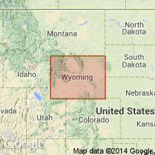
- Green River basin
Summary:
Laketown dolomite. Extended geographically into southwestern Wyoming. Mapped at 5 localities in Uinta County, Wyoming (Greater Green River basin). Age is Silurian.
Source: US geologic names lexicon (USGS Bull. 1200, p. 2086-2087); supplemental information from GNU records (USGS DDS-6; Denver GNULEX).
- Usage in publication:
-
- Laketown dolostone
- Modifications:
-
- Revised
- AAPG geologic province:
-
- Wasatch uplift
Summary:
Revised in that Laketown underlies a newly named member, the Card member, of the Water Canyon formation in the Logan Canyon area, Cache Co, UT in the Wasatch uplift. Upper contact placed at top of massive, granular and dark colored dolostone beds of Laketown with more compact lighter weathering dolostone of Card. Is of Niagaran or Silurian age.
Source: GNU records (USGS DDS-6; Denver GNULEX).
- Usage in publication:
-
- Laketown Dolomite*
- Modifications:
-
- Areal extent
- AAPG geologic province:
-
- Great Basin province
Summary:
Red Warrior Limestone abandoned. Its rocks reassigned, in the Star Range, Beaver Co, UT in the Great Basin province, to the lower part of the Upper Devonian Pinyon Peak Limestone, the Devonian Sevy Dolomite, Simonson Dolomite, and Guilmette Formation, and to the Silurian Laketown Dolomite. [Of Silurian age.]
Source: GNU records (USGS DDS-6; Denver GNULEX).

- Usage in publication:
-
- Laketown Dolostone
- Modifications:
-
- Redescribed
- Revised
- AAPG geologic province:
-
- Wasatch uplift
- Great Basin province
Summary:
Divided into six members which include (ascending): Tony Grove Lake (new), High Lake (new), Gettel (new), Portage Canyon (new), Jack Valley (revised), and Decathon (revised) Members. Redescribed from dolomite, a mineral term, to dolostone, a rock term. Outcrops at several mountain ranges in northern and western UT and eastern NV in Wasatch uplift and Great Basin province. Disconformably overlies Fish Haven Dolostone in northeastern part of region, or Ely Springs Dolostone in southern and western part of region (both redescribed); disconformably underlies Water Canyon Formation in northeastern part of region or Sevy Dolostone in southern and western part. Measured sections. Age ranges from middle Early through Middle Silurian; locally uppermost member (Decathon) extends into Late Silurian [basis of age determination not discussed].
Source: GNU records (USGS DDS-6; Denver GNULEX).
- Usage in publication:
-
- Laketown Dolomite*
- Modifications:
-
- Revised
- Age modified
- AAPG geologic province:
-
- Great Basin province
Summary:
Formations defined by Staatz and Osterwald (1959) and Staatz and Carr (1964) are reduced to member rank and assigned to Laketown in Fish Springs Range, Juab Co, UT, Great Basin province. Units are (ascending): Bell Hill, Harrisite, Lost Sheep, and Thursday Members. Laketown [unconformably] underlies Sevy Dolomite; overlies [unconformably] Ely Springs Dolomite. Assigned Middle Silurian age in this area. Age based on a report by Berry and Boucot (1970).
Source: GNU records (USGS DDS-6; Denver GNULEX).
- Usage in publication:
-
- Laketown Dolomite*
- Modifications:
-
- Areal extent
- AAPG geologic province:
-
- Great Basin province
Summary:
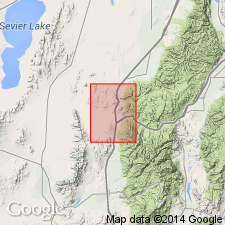
Areally extended into the Dog Valley area, west-central UT in Great Basin province, where it overlies the Late Ordovician Fish Haven Dolomite, and underlies the Early and Middle Devonian Sevy Dolomite. Assigned a Middle and Late Silurian age.
Source: GNU records (USGS DDS-6; Denver GNULEX).
- Usage in publication:
-
- Laketown Dolomite
- Modifications:
-
- Revised
- AAPG geologic province:
-
- Great Basin province
Summary:
Reexamination of Lakeside Mountains section of Budge and Sheehan (1980) resulted in revision of contact between Laketown and underlying Fish Haven Dolomites. Lakeside Mountains section is located near Delle, UT, in NE1/4 SE1/4 sec 32, T2N, R8W, Tooele Co, Great Basin province. Contact between Fish Haven and Laketown raised from between units 15 and 16 to between units 18 and 19 of Budge and Sheehan. Basis of boundary change is 1) lithology of upper part of unit 18 is similar to upper part of Bloomington Lake Member of Fish Haven at type section in Bear River Range, ID, and 2) unit 19 contains Silurian brachiopod VIRGIANA UTAHENSIS which is common in Tony Grove Lake Member of Laketown. Total thickness of Laketown revised from 311.3 m of Budge and Sheehan to 237.9 m. Disconformably overlies Fish Haven and Ely Springs Dolomites. Underlies Roberts Mountain Formation in Silver Island Range, northern Tooele Co, UT. Early Silurian (Llandoverian) age.
Source: GNU records (USGS DDS-6; Denver GNULEX).

- Usage in publication:
-
- Laketown Dolomite*
- Modifications:
-
- Mapped 1:24k
- Dominant lithology:
-
- Dolomite
- Chert
- AAPG geologic province:
-
- Great Basin province
Summary:
Is Middle Silurian formation mapped in limited areas in the vicinity of The Needles in southeast corner of map area in Beaver Co, southwest UT (Great Basin province). Is shown in subsurface in cross section of southern Mountain Home Range in western Millard and Beaver Cos, southwest UT. Unconformably overlies Ely Springs Dolomite (Upper Ordovician). Is shown below Sevy Dolomite (Lower Devonian) on correlation of map units, but Sevy is only indicated to be in the subsurface. Is described as banded dark-gray and light-brownish-gray cliff-forming dolomite. Some chert, particularly in upper 100 m. Incompletely exposed; thickness in nearby area [Tunnel Spring quad., USGS MF-1334] (Hintze, 1981) is 474 m.
Source: GNU records (USGS DDS-6; Denver GNULEX).
- Usage in publication:
-
- Laketown Dolostone*
- Modifications:
-
- Mapped 1:50k
- Redescribed
- Dominant lithology:
-
- Dolostone
- Chert
- AAPG geologic province:
-
- Great Basin province
Summary:
Redescribed--change in lithic designation from dolomite to dolostone (more appropriate term). Is mapped undivided with underlying Ely Springs Dolostone (Late Ordovician) in northeastern part of study area, Lincoln and White Pine Cos, NV in east-central part of Great Basin province. Complex structure, poor exposures, and similarities between the Laketown and Ely Springs Dolostones preclude any separation. Map unit consists mainly of upper part of Laketown. Is saccharoidal, fine- to medium-grained, light-gray dolostone. Chert is especially abundant. Lower part is brownish-gray, fine-grained dolostone. Thickness not determined. Thickness in Egan Range (to west) is 1,030 ft (Kellogg, 1963, p. 685). Underlies Sevy Dolostone (Early and Middle Devonian). Age is Middle and Late Silurian.
Source: GNU records (USGS DDS-6; Denver GNULEX).
- Usage in publication:
-
- Laketown Dolomite*
- Modifications:
-
- Areal extent
- AAPG geologic province:
-
- Idaho Mountains province
- Snake River basin
Summary:
Overlies unconformably the Silurian upper part of the Saturday Mountain Formation. Thins south and east of central and northern parts of Lost River Range, Custer Co, ID in the Idaho Mountains province into Butte Co, ID in the Snake River basin. Is not present in southern Lemhi Range, Lemhi Co and in Beaverhead Mountains, ID, Idaho Mountains province. Regional thinning probably resulted from shoaling against Lemhi arch and from pre-Devonian erosion. Thickness ranges from 0-60 m in Lemhi Range and is 400 m in Lost River Range. Of Silurian age.
Source: GNU records (USGS DDS-6; Denver GNULEX).
- Usage in publication:
-
- Laketown Dolostone*
- Modifications:
-
- Redescribed
- Dominant lithology:
-
- Dolostone
- AAPG geologic province:
-
- Great Basin province
- Snake River basin
Summary:
Is redescribed as dolostone. The name "dolostone" is used for rocks composed predominantly of the mineral "dolomite" on Figure 2 and throughout this chapter, although in the literature it has been common practice to use dolomite rather than dolostone in formal names of dolomitic formations and members. Occurs in stratigraphic column for north-central UT (Great Basin province); unconformably above Fish Haven Dolostone (redescribed) (Upper Ordovician); unconformably below Water Canyon Formation (Lower Devonian). In stratigraphic column for west-central UT and east-central NV (Great Basin province); unconformably above Ely Springs Dolostone (redescribed) (Upper Ordovician and locally Lower Silurian); conformably below unnamed dolostone (Upper Silurian). Assigned to Llandoverian (part) and Wenlockian (Lower Silurian). In stratigraphic column for central ID (Snake River basin); wedging out between Silurian part of Roberts Mountains Formation below and unnamed Lower Devonian dolostone and quartzite above; assigned to Wenlockian (Lower Silurian) and Ludlovian and Pridolian (Upper Silurian).
Source: GNU records (USGS DDS-6; Denver GNULEX).
For more information, please contact Nancy Stamm, Geologic Names Committee Secretary.
Asterisk (*) indicates published by U.S. Geological Survey authors.
"No current usage" (†) implies that a name has been abandoned or has fallen into disuse. Former usage and, if known, replacement name given in parentheses ( ).
Slash (/) indicates name conflicts with nomenclatural guidelines (CSN, 1933; ACSN, 1961, 1970; NACSN, 1983, 2005, 2021). May be explained within brackets ([ ]).