

- Usage in publication:
-
- Lake Point Limestone*
- Modifications:
-
- Biostratigraphic dating
- AAPG geologic province:
-
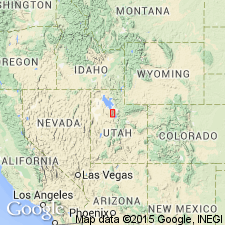
- Great Basin province
Summary:
Pg. A42-A46. Lake Point Formation in the Rogers Canyon sequence. Present in northern Oquirrh Mountains, Tooele County, Utah. Two faunal zones are recognized. The RHIPIDOMELLA NEVADENSIS Zone in lower part of formation is Late Mississippian (late Chester). The informal RUGOCLOSTUS zone in the upper two-thirds of formation is Early Pennsylvanian (Morrow) in age. Mississippian-Pennsylvanian boundary probably lies within unit 3.
Source: Publication.
- Usage in publication:
-
- Lake Point Limestone*
- Modifications:
-
- Named
- Dominant lithology:
-
- Limestone
- Shale
- Sandstone
- Chert
- AAPG geologic province:
-
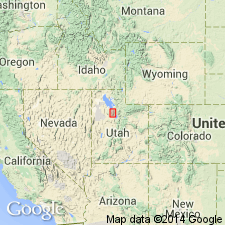
- Great Basin province
Summary:
Named as basal formation of Oquirrh Group (rank raised) for town of Lake Point south of Great Salt Lake, Tooele Co, UT, Great Basin province, and as part of Rogers Canyon sequence. Type section measured in NE1/4 sec 6, T2S, R3W and SW1/4 sec 31, T1S, R3W where formation is 1,737 ft thick and it overlies Green Ravine Formation (new) conformably and underlies Erda Formation (new) of Oquirrh conformably. Lower contact placed at base of cross-bedded limestone that contains quartz sand which overlies argillaceous and fragmented fossil limestones (Green Ravine). Upper contact placed at base of lowest red-brown weathering quartzite (Erda). Composed of interbedded arenaceous and argillaceous, medium- to dark-gray, thin- to thick-bedded, locally cross bedded to massive limestone that has nodular black cherty layers. Some shale, medium-gray, medium-bedded, cross-bedded, calcareous sandstone that has some light tan chert nodules, and bedded chert. Cyclic deposition recognized of shaly limestone, calcareous sandstone, arenaceous limestone, cross-bedded arenaceous limestone, and cherty limestone. Has an abundant, well preserved brachiopod, coral, and bryozoan assemblage (listed). Of Late Mississippian, late Chester (lower third) and Early Pennsylvanian, Morrow, age. Columnar sections. Correlation chart.
Source: GNU records (USGS DDS-6; Denver GNULEX).
- Usage in publication:
-
- Lake Point Limestone*
- Modifications:
-
- Areal extent
- Age modified
- Biostratigraphic dating
- AAPG geologic province:
-
- Great Basin province
Summary:
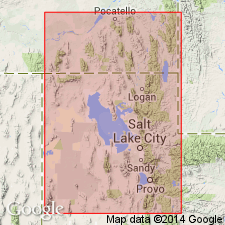
Identified only in the northern Oquirrh Mountains, UT in the Great Basin province where it is the basal formation of the Oquirrh Group. Is 466 m thick at its type section (measured section shown on plate). Overlies Green Ravine Formation. Underlies Erda Formation of Oquirrh Group. Age modified from Chesterian and Morrowan to: late Chesterian, Morrowan, and Atokan. Atokan conodonts identified in the upper 78 m of the Lake Point. Conodont biozones of the Lake Point are: ADETOGNATHUS UNICORNUS, RHACHISTOGNATHUS MURICATUS (Chesterian), R. PRIMUS to NEOGNATHODUS SYMMETRICUS (Morrowan), IDOGNATHOIDES SINATUS (Morrowan), and DIPLOGNATHODUS COLORADOENSIS (Atokan). Correlation charts. Graphic section of type. Two conodont zones are missing --N. BASSLERI and I. PARVUS. Correlates with West Canyon Limestone, basal formation of Oquirrh Group in the southern Oquirrh Mountains, UT, and with Bannock Peak Limestone (new), basal formation of Oquirrh Group of southeast ID.
Source: GNU records (USGS DDS-6; Denver GNULEX).
For more information, please contact Nancy Stamm, Geologic Names Committee Secretary.
Asterisk (*) indicates published by U.S. Geological Survey authors.
"No current usage" (†) implies that a name has been abandoned or has fallen into disuse. Former usage and, if known, replacement name given in parentheses ( ).
Slash (/) indicates name conflicts with nomenclatural guidelines (CSN, 1933; ACSN, 1961, 1970; NACSN, 1983, 2005, 2021). May be explained within brackets ([ ]).