- Usage in publication:
-
- Lake Pinto sandstone member*
- Modifications:
-
- Original reference
- Dominant lithology:
-
- Sandstone
- Conglomerate
- AAPG geologic province:
-
- Bend arch
Summary:
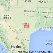
Pg. 77, and charts; Jour. Geol., v. 30, p. 25, 31, 1922. Lake Pinto sandstone member of Mineral Wells formation. Massive sandstone which caps the escarpments about Mineral Wells. Named for Lake Pinto, 0.5 mile west of Mineral Wells, which lies in a valley almost surrounded by an outcrop of the bed. The exposures in hills east and west of Mineral Wells locally contain lenses of fine to moderately coarse conglomerate. Thickness 22 feet. Underlies Salesville shale member and overlies East Mountain shale member of Mineral Wells formation. Age is Pennsyvlanian.
[GNC remark (ca. 1936, US geologic names lexicon, USGS Bull. 896, p. 1136): Above definition still in use. See F.B. Plummer and J. Hornberger, Jr., Univ. Texas Bull., no. 3534. Lake Pinto sandstone member of Mineral Wells formation adopted by the USGS. Recognized in Palo Pinto Co., central northern TX.]
Source: US geologic names lexicon (USGS Bull. 896, p. 1136).

- Usage in publication:
-
- Lake Pinto sandstone member
- Modifications:
-
- Revised
- AAPG geologic province:
-
- Fort Worth syncline
Summary:
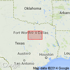
Pg. 23-24, fig. 3, pl. 1. Lake Pinto sandstone member of Salesville formation. In this report [Parker County, north-central Texas], Lake Pinto considered basal member of Salesville, although author does not wholly agree with Cheney's reclassification. Sandstone and associated beds show facies changes across country. Thickness as much as 50 feet. Underlies unnamed shale member that includes Dog Bend limestone bed in lower part; overlies shale in East Mountain formation. Age is Middle Pennsylvanian.
Source: US geologic names lexicon (USGS Bull. 1200, p. 2085).

- Usage in publication:
-
- Lake Pinto Sandstone [unranked]
- Modifications:
-
- Mapped 1:250k
- Dominant lithology:
-
- Sandstone
- AAPG geologic province:
-
- Bend arch
- Fort Worth syncline
Summary:
Lake Pinto Sandstone [unranked] in Mineral Wells Formation of Strawn Group. Medium- to fine-grained, locally conglomeratic, thick-bedded, brown. Thickness 20 to 50 feet. Prominent near Mineral Wells (Palo Pinto County), less prominent southward. Lies above Village Bend Limestone and below Dog Bend Limestone, [both unranked] in Mineral Wells Formation. Age is Middle Pennsylvanian (Desmoinesian).
Mapped in Palo Pinto and Parker Cos., central northern TX.
Source: Publication.

- Usage in publication:
-
- Lake Pinto Sandstone [unranked]
- Modifications:
-
- Mapped 1:250k
- Dominant lithology:
-
- Sandstone
- AAPG geologic province:
-
- Fort Worth syncline
Summary:
Lake Pinto Sandstone [unranked] in Mineral Wells Formation of Strawn Group. Medium- to fine-grained, locally conglomeratic, thick-bedded, brown. Thickness 20 to 40 feet. Lies in middle part of Mineral Wells Formation, above Village Bend Limestone [unranked] and below Dog Bend Limestone [unranked], which is exposed on the Abilene sheet immediately to the west. [Age is considered earliest Late Pennsylvanian (earliest Missourian). Early-Middle Pennsylvanian boundary tentatively placed between Village Bend and Lake Pinto. Boardman and others, 1994, Kansas Geol. Survey Bull., no. 232, p. 8, 14 (fig. 8) state boundary is 15 to 25 feet above Village Bend, based on fusulinids, conodonts, and ammonoids.]
[Small, isolated outcrop along western edge of map sheet, west of Weatherford, in Parker Co., eastern TX. See also adjacent Geol. Atlas Texas, Abilene sheet, 1972.]
Source: Publication.
For more information, please contact Nancy Stamm, Geologic Names Committee Secretary.
Asterisk (*) indicates published by U.S. Geological Survey authors.
"No current usage" (†) implies that a name has been abandoned or has fallen into disuse. Former usage and, if known, replacement name given in parentheses ( ).
Slash (/) indicates name conflicts with nomenclatural guidelines (CSN, 1933; ACSN, 1961, 1970; NACSN, 1983, 2005, 2021). May be explained within brackets ([ ]).

