- Usage in publication:
-
- La Jolla formation
- Modifications:
-
- Named
- Dominant lithology:
-
- Sandstone
- Shale
- AAPG geologic province:
-
- Peninsular Ranges province
Summary:
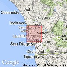
Three lowermost divisions of the Tejon Eocene are recognized as a distinct formation and so designated under name La Jolla formation. [Members] consist of (ascending): "Delmar sand", "Torrey sand", and "Rose Canon shale". Composed of shales, sandstones, and conglomerates. Torrey sand and Delmar sand [members] mapped undivided, and Rose Canon shale [members] separately mapped on geologic map of La Jolla quad, San Diego Co, CA. Thickness of Delmar is about 200 feet; thickness of Torrey approximately 25 to 200 feet and Rose Canon about 300 feet. La Jolla formation unconformably overlies rocks of Cretaceous age; underlies Poway conglomerate tentatively correlated with Tejon formation. Age is Eocene based on molluscan fauna.
Source: GNU records (USGS DDS-6; Menlo GNULEX).

- Usage in publication:
-
- La Jolla Group*
- Modifications:
-
- Adopted
- Revised
- AAPG geologic province:
-
- Peninsular Ranges province
Summary:
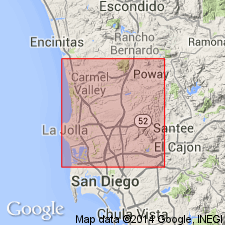
La Jolla Formation of Clark (1926) [and Hanna (1926)] named for exposures in La Jolla 15' quad is raised in rank to La Jolla Group and includes Mount Soledad Formation (new), Delmar Formation, Torrey Sandstone, Ardath Shale (new), Scripps Formation (new), and Friars Formation (new). Within former La Jolla Formation, Hanna (1926) named Rose Canyon Shale Member which included what is now Mount Soledad Formation, Ardath Shale, Scripps Formation, and Friars Formation. Name Rose Canyon is abandoned. Formations of La Jolla Group form intertonguing relationships. Group unconformably overlies Cabrillo Formation of Late Cretaceous age and basement rocks; underlies Stadium Conglomerate (new) of Poway Group. Age is early(?), middle, and late Eocene based on stratigraphic relations and included fossils.
Source: GNU records (USGS DDS-6; Menlo GNULEX).

- Usage in publication:
-
- La Jolla Group
- Modifications:
-
- Biostratigraphic dating
- AAPG geologic province:
-
- Peninsular Ranges province
Summary:
Lists of mollusks from formations in La Jolla Group are given with localities of samples. Stages range from "Capay(?)", "Domengine" to "Transition". Correlation chart shows intertonguing relationships of formations in group and indicates early(?) and middle Miocene age.
Source: GNU records (USGS DDS-6; Menlo GNULEX).

- Usage in publication:
-
- La Jolla Group*
- Modifications:
-
- Age modified
- AAPG geologic province:
-
- Peninsular Ranges province
Summary:
Age revised from early(?) to late Eocene to: early(?) and middle Eocene based on revised ages for several of its formations.
Source: GNU records (USGS DDS-6; Menlo GNULEX).
For more information, please contact Nancy Stamm, Geologic Names Committee Secretary.
Asterisk (*) indicates published by U.S. Geological Survey authors.
"No current usage" (†) implies that a name has been abandoned or has fallen into disuse. Former usage and, if known, replacement name given in parentheses ( ).
Slash (/) indicates name conflicts with nomenclatural guidelines (CSN, 1933; ACSN, 1961, 1970; NACSN, 1983, 2005, 2021). May be explained within brackets ([ ]).

