

- Usage in publication:
-
- LaHood formation
- Modifications:
-
- Named
- Dominant lithology:
-
- Sandstone
- Conglomerate
- AAPG geologic province:
-
- Northern Rocky Mountain region
Summary:
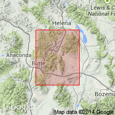
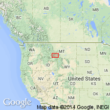
Named as a formation of pre-Cambrian Belt series for exposures near LaHood Park, Jefferson Co, MT in the Northern Rocky Mountain region. Type section designated along creek which crosses U.S. Hwy 105 from northeast approximately 0.6 mi southeast of LaHood Park upstream in sec 12, T1N, R3W, and sec 7, T1N, R2W. A lower contact not selectable at type; upper contact is with Flathead sandstone. Divided into 5 units at type: No. 5 (base)--542 ft of subarkosic sandstone and conglomerate, dark-green-gray, medium- to thick-bedded, medium- to coarse-grained, weathers into rectangular blocks; No. 4--398 ft of subarkosic sandstone and conglomerate, fine-grained to conglomeratic, thin- to thick-bedded, weathers into slabs; No. 3--181 ft of subarkosic sandstone, light-olive-gray, thin- to very thick bedded, coarse-grained, salt-and-pepper, conglomeratic lenses in middle third; No. 2--775 ft of subarkosic sandstone, light-olive-gray, thin- to medium-bedded, medium- to coarse-grained; No. 1--820 ft of arkosic sandstone, gray to brown, thin- to medium-bedded, medium- to coarse-grained. Interpreted to be a nearshore deposit along south shore of the Belt sea. Its source area was probably the Tobacco Root highlands. Some boulders were derived from Pony gneiss, and some from Cherry Creek series. Interfingers with Spokane and Greyson shales east of Three Forks, MT.
Source: GNU records (USGS DDS-6; Denver GNULEX).
- Usage in publication:
-
- LaHood Formation
- Modifications:
-
- Principal reference
- AAPG geologic province:
-
- Northern Rocky Mountain region
Summary:
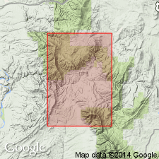
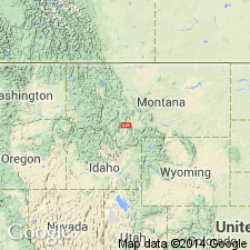
Coarse-grained arkose and conglomerate of the LaHood Formation crop out in a narrow zone from the northern half of the Bridger Range to and across the Highland Mountains, in Jefferson Co, MT, Northern Rocky Mountain region. Replaces use of East Gallatin and North Boulder Groups (both terms abandoned). Grades northward into fine-grained carbonate, argillite, siltite, and quartzite of Belt Series of the U.S. (Neihart Quartzite, Chamberlain Shale, Prichard Formation, Newland Limestone, and lower part of Greyson Shale). A principal reference section designated 6 mi east of type along ridge in W1/2 sec 13, T1N, R2W, Jefferson Island 15-minute quad, MT, where it unconformably overlies metamorphic rocks and unconformably underlies Flathead Quartzite. Is 4,170 ft thick at the principal reference section. Was deposited by torrential streams that flowed into the south margin of the Belt sea from a rugged source area to the south. Slumping and turbidity currents redistributed some of the LaHood to more stable bottom areas. Is of Precambrian age.
Source: GNU records (USGS DDS-6; Denver GNULEX).
- Usage in publication:
-
- LaHood Formation*
- Modifications:
-
- Overview
- AAPG geologic province:
-
- Northern Rocky Mountain region
Summary:
Adopted as redefined by McMannis (1963), that is to say, as a name applied to all dominantly coarse strata of the Precambrian Belt Supergroup from the Bridger Range on the east to the Highland Mountains on the west. Maudlow quad is in Northern Rocky Mountain region, Gallatin Co, MT.
Source: GNU records (USGS DDS-6; Denver GNULEX).

- Usage in publication:
-
- LaHood Formation*
- Modifications:
-
- Overview
- AAPG geologic province:
-
- Northern Rocky Mountain region
Summary:
Used in the southern part of the Belt basin in the Northern Rocky Mountain region. Stratigraphic position and correlation with other Precambrian formations of the Belt Supergroup of the U.S. and of the Purcell Supergroup of Alberta and British Columbia, Canada shown on figures 4, 5, and 8.
Source: GNU records (USGS DDS-6; Denver GNULEX).
- Usage in publication:
-
- LaHood Formation*
- Modifications:
-
- Contact revised
- AAPG geologic province:
-
- Northern Rocky Mountain region
Summary:
Upper contact revised; within study area LaHood is everywhere overlain by newly named Moose Formation of lower Belt of Belt Supergroup except in central part of Table Mountain fault block where LaHood is overlain by newly named Table Mountain Quartzite of lower Belt. At type Moose, LaHood-Moose contact is by a small fault. Study area is in Highland Mountains, Silver Bow Co, MT, Northern Rocky Mountain region. LaHood overlies Early Proterozoic basement rocks. Schematic cross section (fig. 2); correlation diagram (fig. 3). Middle Proterozoic age.
Source: GNU records (USGS DDS-6; Denver GNULEX).
For more information, please contact Nancy Stamm, Geologic Names Committee Secretary.
Asterisk (*) indicates published by U.S. Geological Survey authors.
"No current usage" (†) implies that a name has been abandoned or has fallen into disuse. Former usage and, if known, replacement name given in parentheses ( ).
Slash (/) indicates name conflicts with nomenclatural guidelines (CSN, 1933; ACSN, 1961, 1970; NACSN, 1983, 2005, 2021). May be explained within brackets ([ ]).