


- Usage in publication:
-
- Knox dolomite
- Modifications:
-
- Named
- Dominant lithology:
-
- Dolomite
- Limestone
- AAPG geologic province:
-
- Appalachian basin
Safford, J.M., 1869, Geology of Tennessee: Nashville, TN, 550 p.
Summary:
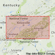
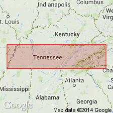
Named for development in Knox Co., TN. Heavy-bedded ridge-making dolomites and limestones, chiefly dolomite, 4000 ft thick. Lowest strata blue, oolitic, and often fossiliferous; strata next above dark gray and granular; upper strata, light gray with chert layers. Top formation Knox or Knoxville group. Overlies Knox (Conasauga) shale. Underlies Trenton or Lebanon (Stones River) Group.
Source: GNU records (USGS DDS-6; Reston GNULEX).
- Usage in publication:
-
- Knox dolomite*
- Modifications:
-
- Areal extent
- AAPG geologic province:
-
- Appalachian basin
Summary:
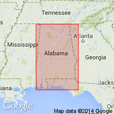
Geographically extended to AL. Uses Knox dolomite in table of geologic formations of AL. Part of Ordovician. The Knox dolomite is prominent formation in Appalachian Valley. It is a massive calcareous rock that generally occupies the central portion of valley. Overlies Cambrian Coosa shale; underlies Ordovician Pelham limestone (Trenton).
Source: GNU records (USGS DDS-6; Reston GNULEX).
- Usage in publication:
-
- Knox dolomite*
- Modifications:
-
- Areal extent
- AAPG geologic province:
-
- Appalachian basin
Summary:
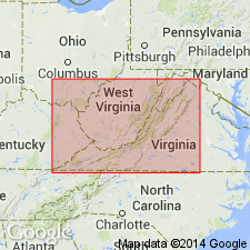
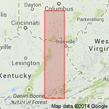
Geographically extended to VA. Generally, a heavy-bedded gray magnesian limestone or dolomite with some residual chert. 2000-3000 ft thick. Late Cambrian and earliest Ordovician age. Overlies Nolichucky shale.
Source: GNU records (USGS DDS-6; Reston GNULEX).
- Usage in publication:
-
- Knox group*
- Modifications:
-
- Revised
- AAPG geologic province:
-
- Appalachian basin
Summary:
Referred to as Knox group in Lee Valley, Hawkins Co., TN. Comprises (ascending) Copper Ridge dolomite, Chepultepec dolomite, Longview dolomite, Kingsport limestone, and Mascot dolomite.
Source: GNU records (USGS DDS-6; Reston GNULEX).
- Usage in publication:
-
- Knox dolomite
- Modifications:
-
- Areal extent
- AAPG geologic province:
-
- Appalachian basin
Summary:
Geographically extended to subsurface of KY. Knox can be correlated to TN. Contacts are not well constrained and close correlation is difficult.
Source: GNU records (USGS DDS-6; Reston GNULEX).
- Usage in publication:
-
- Knox dolomite*/group*
- Modifications:
-
- Overview
- AAPG geologic province:
-
- Appalachian basin
Summary:
The Knox extends from the top of the Maynardville limestone to marked disconformity, observable everywhere in east TN between Lower and Middle Ordovician rocks. Where Knox is divided into formations, it is referred to as group; where not subdivided, it is considered a formation, Knox dolomite. Where fully subdivided, consists of (ascending) Copper Ridge dolomite, Chepultepec dolomite, Longview dolomite, Kingsport formation, and Mascot dolomite.
Source: GNU records (USGS DDS-6; Reston GNULEX).
- Usage in publication:
-
- Knox dolomite*
- Modifications:
-
- Revised
- AAPG geologic province:
-
- Appalachian basin
Summary:
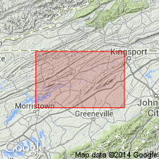
Described the Knox group in Lee County, VA, where it is 2300 ft thick and comprises (ascending) Copper Ridge, Chepultepec, Longview, Kingsport, and Mascot dolomites. Overlies Chances Branch member of Maynardville limestone; underlies Murfreesboro limestone.
Source: GNU records (USGS DDS-6; Reston GNULEX).

- Usage in publication:
-
- Knox dolomite
- Modifications:
-
- Areal extent
- AAPG geologic province:
-
- Appalachian basin
Summary:
Geographically extended to subsurface of IN. Consists of tan saccharoidal dolomite containing widely ranging percentages of sand or silty dolomite, chert, and sandstone. Approximately 500 ft thick in northern part of State and thickens southward to more than 1500 ft. Overlies Galesville sandstone in northwestern IN and Eau Claire formation in rest of State; underlies St. Peter sandstone.
Source: GNU records (USGS DDS-6; Reston GNULEX).
- Usage in publication:
-
- Knox Group*
- Modifications:
-
- Overview
- AAPG geologic province:
-
- Appalachian basin
Summary:
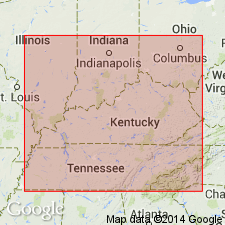
Adopted by the USGS for subsurface of KY. Consists of (ascending) Copper Ridge Dolomite, Chepultepec Dolomite, Longview Dolomite, and Newala Dolomite. Approximately 2100 ft thick. Overlies Maynardville limestone; underlies Dot formation.
Source: GNU records (USGS DDS-6; Reston GNULEX).
- Usage in publication:
-
- Knox dolomite megagroup
- Modifications:
-
- Areal extent
- Revised
- AAPG geologic province:
-
- Appalachian basin
Summary:
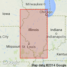
Geographically extended into subsurface of Illinois. Revised to megagroup. The Knox had already been introduced into the Illinois basin in Kentucky and Indiana and therefore should be recognized in the subsurface of Illinois. It is more than 4000 feet thick in southern Illinois. Term "megagroup" is proposed as formal designation for rock-stratigraphic unit larger than group. Although comparable in size with series and systems, megagroups are defined in terms of lithology and transect boundaries of units that are based on time of deposition. ["Megagroup" not recognized as a formal stratigraphic rank term (ACSN, 1961, 1970; NACSN, 1983, 2005, 2021). Considered informal. The rank or lithologic term should not be capitalized.]
Source: Modified from GNU records (USGS DDS-6; Reston GNULEX).
- Usage in publication:
-
- Knox Supergroup
- Modifications:
-
- Areal extent
- Revised
- AAPG geologic province:
-
- Appalachian basin
Summary:
Geographically extended to subsurface of OH. Revised to Knox Supergroup because it can be subdivided into lesser recognizable units including groups, formations, and members. In OH, Knox Supergroup consists of Lee Valley and Beekmantown Groups (Lee Valley Group --Maynardville Dolomite, Copper Ridge Dolomite; Beekmantown Group --Chepultepec Dolomite, Lambs Chapel Dolomite).
Source: GNU records (USGS DDS-6; Reston GNULEX).
- Usage in publication:
-
- "Knox" Group
- Modifications:
-
- Areal extent
- AAPG geologic province:
-
- Appalachian basin
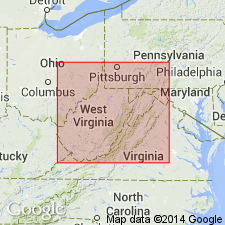
Summary:
Geographically extended to WV. "Knox" Group used for Cambrian and Ordovician units, undivided for State map, mainly in subsurface of cross section.
Source: GNU records (USGS DDS-6; Reston GNULEX).
- Usage in publication:
-
- Knox Group
- Modifications:
-
- Revised
- AAPG geologic province:
-
- Appalachian basin
Summary:
Abandoned Longview Dolomite in TN and redefined the Kingsport Formation and Mascot Dolomite. Included the Longview in the Kingsport and lowered the upper contact of the Kingsport with the overlying Mascot. The Kingsport contains limestone and medium to coarse-crystalline dolomite; Mascot contains very finely crystalline dolomite (part of which used to be referred to Kingsport). The reason for this revision is that the original formations in the upper part of the Knox were divided by fossil content and were not readily mappable.
Source: GNU records (USGS DDS-6; Reston GNULEX).
- Usage in publication:
-
- Knox Group
- Modifications:
-
- Areal extent
- AAPG geologic province:
-
- Appalachian basin
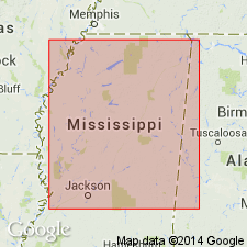
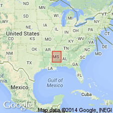
Summary:
Geographically extended to subsurface of MS. Oldest rocks penetrated in Black Warrior basin. Consists of two subdivisions: 1) a lower medium-gray, fine- to medium-crystalline, saccharoidal dolomite with chert, and 2) an upper 500 ft of light- and medium-gray, finely crystalline to microcrystalline dolomite that is partly sandy. Total thickness is approximately 1200 ft. Underlies Chickamauga Group.
Source: GNU records (USGS DDS-6; Reston GNULEX).
- Usage in publication:
-
- Knox Megagroup
- Modifications:
-
- Overview
- AAPG geologic province:
-
- Appalachian basin
Summary:
Uses Knox Megagroup in stratigraphic column of KY subsurface. Consists of Franconian, Potosi, Eminence, and Gunter Sandstone Formations, and Knox Group.
Source: GNU records (USGS DDS-6; Reston GNULEX).
- Usage in publication:
-
- Knox Supergroup
- Modifications:
-
- Overview
- AAPG geologic province:
-
- Appalachian basin
Summary:
Uses Knox Supergroup for subsurface of KY. Supergroup consists of the Upper Cambrian Copper Ridge Group and Lower Ordovician Beekmantown Group.
Source: GNU records (USGS DDS-6; Reston GNULEX).
- Usage in publication:
-
- Knox Supergroup
- Modifications:
-
- Overview
- AAPG geologic province:
-
- Appalachian basin
Summary:
Adopts use of Knox Supergroup in Indiana. Comprises rocks dominated by dolostone and dolomitic limestone. Overlies Potsdam Supergroup; underlies Ancell Group. Knox Supergroup composed of (ascending) Potosi, Oneota, and Shakopee Dolomites in northwestern IN and of Potosi, Oneota, Shakopee, and Everton Dolomites in southwestern IN. Thickness ranges from less than 500 ft in northern part of State to approximately 4500 ft in extreme southern IN. Age is Late Cambrian and Early Ordovician.
Source: GNU records (USGS DDS-6; Reston GNULEX).
- Usage in publication:
-
- Knox Group
- Modifications:
-
- Revised
- AAPG geologic province:
-
- Appalachian basin
Summary:
Although Butts (1926) suggested that the Knox Group in this area [Talladega and Calhoun Cos, AL] included Copper Ridge and Chepultepec Dolomites, criteria used to define these units in adjacent areas cannot be applied. Therefore, this nomenclature should not be used in report area.
Source: GNU records (USGS DDS-6; Reston GNULEX).
- Usage in publication:
-
- Knox Group/Dolostone/Limestone
- Modifications:
-
- Overview
- AAPG geologic province:
-
- Warrior basin
Summary:
The Knox Group in the subsurface of the Warrior basin in MS is divided into (ascending) the Copper Ridge Dolostone, Knox Dolostone, and Knox Limestone [use of Knox Dolostone and Knox Limestone is in violation of the North American Stratigraphic Code]. Thickness is 1935 to 7763 ft. The Knox Group is of Late Cambrian and Early Ordovician age.
Source: GNU records (USGS DDS-6; Reston GNULEX).
- Usage in publication:
-
- Knox Group
- Modifications:
-
- Revised
- Age modified
- AAPG geologic province:
-
- Appalachian basin
Summary:
Author formally proposes to reinstate Odenville Limestone as a formal stratigraphic unit and to assign it to the top of the Knox Group as the youngest unit. Reference sections are designated. According to Roberson (1988), the Odenville contains a distinctive stenohaline fauna that is more diverse and abundant than the fauna of the underlying units of the Knox Group. The stenohaline fauna is dominated by lithistid sponges, brachiopods, cephalopods, and gastropods. Available biostratigraphic data indicate a very latest Canadian (latest Early Ordovician) age for the bulk of the Odenville. The uppermost beds may be as young as earliest Whiterockian (earliest Middle Ordovician).
Source: GNU records (USGS DDS-6; Reston GNULEX).
- Usage in publication:
-
- Knox Group
- Modifications:
-
- Revised
- AAPG geologic province:
-
- Appalachian basin
Summary:
The Early Ordovician Odenville Limestone is assigned to the top of the Knox Group in the Helena thrust sheet of AL. These rocks have most recently been included in the underlying Newala Limestone, but recent work (see Osborne, in press: AL G.S. Bull. 144) has indicated that unit is distinct and mappable. In this area, the Knox is subdivided into ascending Copper Ridge Dolomite, Chepultepec Dolomite, Longview Limestone, Newala Limestone, and Odenville Limestone. Odenville reaches a maximum thickness of 366 ft. Unconformably underlies undifferentiated Middle Ordovician rocks.
Source: GNU records (USGS DDS-6; Reston GNULEX).

- Usage in publication:
-
- Knox Group
- Modifications:
-
- Overview
- AAPG geologic province:
-
- Appalachian basin
Summary:
Knox Group (undivided) mapped in Roane Co., eastern TN. Consists of siliceous, light- to dark-gray and olive-gray, very fine to medium-grained, and generally medium-bedded dolomite. Contains a few limestone layers in upper part and scattered thin quartz sandstone beds and lenses. Commonly weathered to thick residuum of reddish-orange soil containing chert fragments. Approximately 2600 ft thick in study area. Overlies Maynardville Limestone and unconformably underlies Chickamauga Limestone. Age is Late Cambrian and Early Ordovician.
Source: GNU records (USGS DDS-6; Reston GNULEX).
- Usage in publication:
-
- Knox Group
- Modifications:
-
- Areal extent
- Revised
- AAPG geologic province:
-
- Illinois basin
Summary:
Knox Megagroup, as defined by Swann and Willman (1961), is replaced by Knox Group in southern part of Illinois basin. Although Droste and Patton (1985) recognized that the term "megagroup" violated the North American Stratigraphic Code (1983) and changed the term to Knox Supergroup in Indiana, the only group recognized within the supergroup is the Prairie du Chien, the type area of which is in WI. Prairie du Chien and its constituent formations have been described in northern IN and IL, but they are not traceable into Paducah quad. No control wells in southwestern IN were available to Droste and Patton (1985). In IL, Willman and others (1975) stated that the base of the Prairie du Chien could not be picked with confidence south of a line between Edgar and Monroe Cos., IL, north of Paducah quad. Even if boundaries of Prairie du Chien Group could be traced into southern IL, usage of the name is inadvisable as groups are customarily named to distinguish assemblages of similar formations from adjacent units of contrasting lithology. Prairie du Chien Group in WI is a logical group there because it comprises carbonate formations between top of Jordan Sandstone and base of St. Peter Sandstone. Jordan grades southward into dolomite of Eminence Formation in northern IL; thus Prairie du Chien loses its identity and merely becomes upper part of thick succession of carbonate rocks properly combined as the Knox. Knox is thus reclassified as Knox Group, replacing Knox Megagroup or Knox Supergroup. Prairie du Chien Group should be restricted to areas where Jordan Sandstone or equivalent clastic units are present.
Source: GNU records (USGS DDS-6; Reston GNULEX).
- Usage in publication:
-
- Knox Group
- Modifications:
-
- Revised
- Areal extent
- AAPG geologic province:
-
- Illinois basin
- Ozark uplift
Summary:
Knox Group is applied to thick succession of Upper Cambrian and Lower Ordovician (Canadian) carbonate rocks overlying Mt. Simon Sandstone in southern part of Illinois basin. Equivalent formations outcropping on Ozark dome are difficult to trace into subsurface because of lithologic similarity and downdip facies changes. Formation names are the same as those used for strata outcropping on Ozark dome in MO (from Martin, IN Howe and Koenig, 1961; and Thompson, 1991). In Humble Oil Co. No. 1 Pickel well, NW1/4SE1/4NW1/4 sec. 21, T13S, R2W, Mill Creek 7.5-min quad, IL, the following formations of the Knox are present (M.L. Sargent, written commun., 1992): Cambrian Bonneterre Formation, Davis Formation, Derby and Doe Run Formations (undivided), Potosi Dolomite, and Eminence Dolomite; and Ordovician (Canadian) Gasconade Formation, Roubidoux Formation, Jefferson City Formation, Cotter Dolomite, Powell Dolomite, Smithville Dolomite, and an unnamed unit, for a total of 6,576 ft.
Source: GNU records (USGS DDS-6; Reston GNULEX).
- Usage in publication:
-
- Knox Dolomite*
- Modifications:
-
- Revised
- AAPG geologic province:
-
- Appalachian basin
Summary:
The Rose Run is revised to the Rose Run Sandstone Member of the Knox Dolomite in the subsurface of OH. The rank of the Rose Run is reduced to member status because dolomite of the Knox Dolomite occurs both above and below the sandstone attributed to the Rose Run. Unit correlates with the upper sandy member of the Gatesburg Formation and is considered of Late Cambrian age.
Source: GNU records (USGS DDS-6; Reston GNULEX).
- Usage in publication:
-
- Knox Group*
- Modifications:
-
- Revised
- AAPG geologic province:
-
- Appalachian basin
Summary:
Revised the Rose Run Sandstone in KY as part of the Knox Group in the Waverly arch and OH-WV hinge zone as shown in section G-G'. Overlies the Copper Ridge Dolomite of the Knox Group and underlies undifferentiated dolomite of the Knox Group. Unit correlates with the upper sandstone member of the Copper Ridge Dolomite in the Rome trough and in the Valley and Ridge province of WV and VA. The Rose Run is of earliest Ordovician age.
Source: GNU records (USGS DDS-6; Reston GNULEX).

- Usage in publication:
-
- Knox Group*
- Modifications:
-
- Areal extent
- AAPG geologic province:
-
- Illinois basin
Summary:
The Knox Group is extended into the Illinois basin in subsurface of IL. IN, and KY. Includes (ascending) Cambrian (Croixan) Franconia Formation (including its Davis Member), Potosi Dolomite and Eminence Dolomite; Ordovician (Canadian) Oneota Dolomite (with its Gunter Sandstone Member) and Shakopee Dolomite; and Ordovician (Whiterockian) unnamed unit and Everton Formation. Equivalent rocks in MO have no group assignment; they include (ascending) Davis, Doe Run, and Derby Formations; Potosi, Eminence, and Gasconade Dolomites; Roubidoux Formation; Jefferson City, Cotter, Powell, and Smithville Dolomites; and Everton Formation. Knox Group is equivalent temporally and lithologically to Arbuckle Group in OK, and is partially equivalent to Ellenburger Group in TX.
Source: GNU records (USGS DDS-6; Reston GNULEX).
For more information, please contact Nancy Stamm, Geologic Names Committee Secretary.
Asterisk (*) indicates published by U.S. Geological Survey authors.
"No current usage" (†) implies that a name has been abandoned or has fallen into disuse. Former usage and, if known, replacement name given in parentheses ( ).
Slash (/) indicates name conflicts with nomenclatural guidelines (CSN, 1933; ACSN, 1961, 1970; NACSN, 1983, 2005, 2021). May be explained within brackets ([ ]).