

- Usage in publication:
-
- Kishenehn formation
- Modifications:
-
- Original reference
- Dominant lithology:
-
- Clay
- Sandstone
Summary:
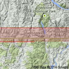
Kishenehn formation. Fresh-water deposit (lake beds) of Tertiary age, not known to have an exact stratigraphic equivalent anywhere else in area covered by Commission. Thickness of 250 feet is exposed in Flathead trough at Boundary line; total thickness in wells probably 700 feet. Tertiary fossils (Eocene or later). Named from Kishenehn Creek. Dawson discovered same formation near mouth of the Kishenehn in 1855, and Willis encountered it in 1901 on North Fork of the Flathead. He regarded it probably Miocene or Pliocene. [According to Daly, 1912 (Canada Geol. Survey Dept. Mines Mem. 38, sh. 1, 2) this formation does not extend into Montana but stops at International Boundary. Mackenzie, 1916 (Canada Geol. Survey Mem. 87, p. 31), spelled this name Kishinena, and Rose, 1918 (Canada Geol. Survey Summ. Rpt., 1917, pt. C, p. 31), spelled it Kishenena.]
Source: US geologic names lexicon (USGS Bull. 896, p. 1105-1106).
- Usage in publication:
-
- Kishenehn Formation
- Modifications:
-
- Geochronologic dating
- Areal extent
- AAPG geologic province:
-
- North Western Overthrust
Summary:
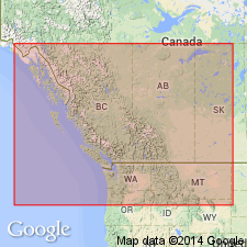
Kishenehn Formation mapped in Kishenehn basin, a half-graben 95 mi long and 1-8 mi wide extending from Flathead, BC, CN south to north end Flathead Lake, Flathead Co, MT, Montana folded belt province. Consists of 3,000 ft (basin edges) to 11,000+ ft (basin center) of synorogenic deposits. Divided into informal members (ascending): 1) basal member recognized primarily on limonitic-staining, pressure-marked conglomerate clasts (of well-rounded Proterozoic and Paleozoic quartzites), and stratigraphic position, only in North Fork region, dominantly sandy conglomerate interbedded with pebbly sandstone, carbonaceous mudstone and coal 460 to 3,900 ft thick; 2) Coal Creek member (first used), a heterogeneous assemblage of sandstone, siltstone, mudstone, lignite, oil shale, marlstone, conglomerate 3,770-11,500+ ft thick known in Middle and North Fork areas; 3) Pinchot member (first used), red-brown, fine- and coarse-grained conglomerate with interbeds of red-brown and gray calcareous claystone and gray sandy conglomerate in Middle Fork area 660-4,900 ft thick. Coal Creek-Pinchot contact not exposed. A 33.2 +/-1.5 Ma fission track date obtained from fine-grained gray tephra as much as 8 in thick in middle of Coal Creek member. Fossils: leaves, gastropods, bivalves, insects, fish (listed) suggest age range of late Eocene to early Miocene, and sub-tropical to warm temperate climate. Shown as Oligocene age on geologic map.
Source: GNU records (USGS DDS-6; Denver GNULEX).
- Usage in publication:
-
- Kishenehn Formation*
- Modifications:
-
- Age modified
- Geochronologic dating
- Mapped
- AAPG geologic province:
-
- North Western Overthrust
Summary:
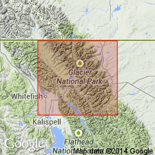
Kishenehn Formation. A thick sequence, as much as 5,000 m, of Oligocene and Eocene nonmarine deposits in Middle and North Fork Flathead River drainages, along western border of Glacier National Park, Flathead County, northwestern Montana. Fossiliferous. Locally subdivided (after usage of Constenius and Dyni, 1983, Min. Energy Resources, v. 26, no. 4, p. 1-16), descending: (1) conglomerate member of Pinchot Creek (Eocene), as much as 700 m thick; and (2) lacustrine member of Coal Creek (Eocene), about 1,150 m thick. Fission-track dating on zircon from a tuff bed in middle part of lacustrine member of Coal Creek suggests an Eocene age of 43+/- 4.9 Ma (Charles Naeser, USGS, written commun., 1990).
Source: Publication.
For more information, please contact Nancy Stamm, Geologic Names Committee Secretary.
Asterisk (*) indicates published by U.S. Geological Survey authors.
"No current usage" (†) implies that a name has been abandoned or has fallen into disuse. Former usage and, if known, replacement name given in parentheses ( ).
Slash (/) indicates name conflicts with nomenclatural guidelines (CSN, 1933; ACSN, 1961, 1970; NACSN, 1983, 2005, 2021). May be explained within brackets ([ ]).