

- Usage in publication:
-
- Kiowa shales
- Modifications:
-
- Named
- Dominant lithology:
-
- Shale
- AAPG geologic province:
-
- Anadarko basin
Summary:
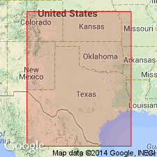
Named for Kiowa Co, KS in the Anadarko basin. Composed of inferior dark-colored, and superior light-colored shales that outcrop in several of the counties of southwestern KS. Rests on the Cheyenne sandstone in their eastern exposures, and on the "Red-Beds" in their middle and western exposures. Thickness not stated. Is overlain by brown sandstones of middle Cretaceous age, or by Tertiary or Pleistocene deposits, according to locality. The fossils are chiefly those which, in TX, are most common in the Fredericksburg division. A few are most characteristic of the Bosque division. Few others culminate in, or are peculiar to rocks of the Denison beds. Are part of the Comanche series.
Source: GNU records (USGS DDS-6; Denver GNULEX).
- Usage in publication:
-
- Kiowa shale member*
- Modifications:
-
- Areal extent
- AAPG geologic province:
-
- Anadarko basin
Summary:
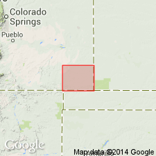
Extended geographically to Baca Co, CO in the Anadarko basin as the upper member of the Purgatoire formation. Overlies Cheyenne sandstone member of Purgatoire. Underlies Dakota sandstone. Crops out in narrow, irregular areas in major valleys and canyons in southwest and northwest part of county. Forms grassy slopes between steep cliffs of Cheyenne and Dakota. Averages 50 ft thick. Is 90 ft thick in northwest part. Geologic map. Cross section. Early Cretaceous age.
Source: GNU records (USGS DDS-6; Denver GNULEX).
- Usage in publication:
-
- Kiowa Shale Member*
- Modifications:
-
- Not used
Summary:
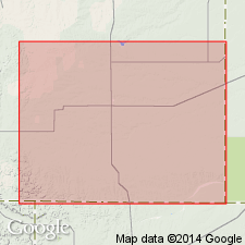
Not used as uppermost member of Purgatoire Formation in Baca Co, CO in Anadarko basin. Follows recommendation by Scott (1970) that Glencairn nomenclature replace Kiowa in southeastern CO inasmuch as Kiowa of McLaughlin (1954) is sandy like the Glencairn Shale Member farther west and lacks many characteristics of the Kiowa Shale of KS.
Source: GNU records (USGS DDS-6; Denver GNULEX).
For more information, please contact Nancy Stamm, Geologic Names Committee Secretary.
Asterisk (*) indicates published by U.S. Geological Survey authors.
"No current usage" (†) implies that a name has been abandoned or has fallen into disuse. Former usage and, if known, replacement name given in parentheses ( ).
Slash (/) indicates name conflicts with nomenclatural guidelines (CSN, 1933; ACSN, 1961, 1970; NACSN, 1983, 2005, 2021). May be explained within brackets ([ ]).