

- Usage in publication:
-
- Killian Springs Formation*
- Modifications:
-
- Named
- Biostratigraphic dating
- Dominant lithology:
-
- Phyllite
- Sandstone
- Siltstone
- AAPG geologic province:
-
- Great Basin province
Summary:
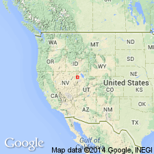
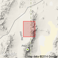
Name derived from Killian Springs. Type section designated as 300-m-thick sequence of clastic and carbonate rocks exposed between Killian Springs and Cottonwood Springs on west side of Pilot Range sec.21 T5N R19W, Patterson Pass 7.5' quad, Box Elder Co, UT. Rocks were in part formerly called "phyllite of Killian Springs", Pioche Shale, Pioche Formation by various authors. Present in Pilot Range, Toano Range, and southern Silver Island Mountains (Leppy Range). Consists mainly of interbedded phyllite and phyllitic siltstone and subordinate carbonate rocks. Thickness ranges to 300 m. Underlain by Prospect Mountain Quartzite; overlain by Toano Limestone (new). Age is provisionally regarded as Early and Middle Cambrian (based on sponge spicules suggestive of Middle Cambrian forms in upper half of unit and regional stratigraphic relations).
Source: GNU records (USGS DDS-6; Menlo GNULEX).
- Usage in publication:
-
- Killian Springs Formation*
- Modifications:
-
- Areal extent
- AAPG geologic province:
-
- Great Basin province
Summary:
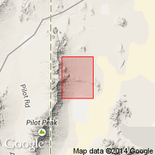
Killian Springs Formation geographically extended into report area [Pilot Range, Patterson Pass 7.5' quad, Box Elder Co, UT and Elko Co, NV]. Age given as Cambrian.
Source: GNU records (USGS DDS-6; Menlo GNULEX).
- Usage in publication:
-
- Killian Springs Formation*
- Modifications:
-
- Areal extent
- AAPG geologic province:
-
- Great Basin province
Summary:
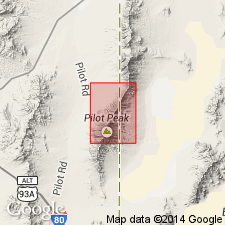
Killian Springs Formation geographically extended into report area [northern Pilot Range, Crater Island NW 7.5' quad, Box Elder Co, UT]. Age given as Cambrian.
Source: GNU records (USGS DDS-6; Menlo GNULEX).
- Usage in publication:
-
- Killian Springs Formation*
- Modifications:
-
- Areal extent
- AAPG geologic province:
-
- Great Basin province
Summary:
Killian Springs Formation geographically extended into report area [south Pilot Range]. Age given as Cambrian.
Source: GNU records (USGS DDS-6; Menlo GNULEX).
For more information, please contact Nancy Stamm, Geologic Names Committee Secretary.
Asterisk (*) indicates published by U.S. Geological Survey authors.
"No current usage" (†) implies that a name has been abandoned or has fallen into disuse. Former usage and, if known, replacement name given in parentheses ( ).
Slash (/) indicates name conflicts with nomenclatural guidelines (CSN, 1933; ACSN, 1961, 1970; NACSN, 1983, 2005, 2021). May be explained within brackets ([ ]).