

- Usage in publication:
-
- Kenai group*
- Modifications:
-
- Named
- Biostratigraphic dating
- Dominant lithology:
-
- Conglomerate
- Coal
- AAPG geologic province:
-
- Alaska Southern region
Summary:
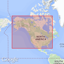
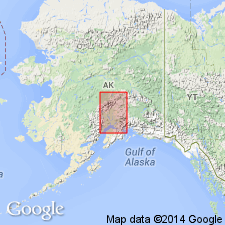
Name applied to coal-bearing Miocene beds best exhibited on shores of Kachemak Bay, Kenai Peninsula, Cook Inlet, southern AK. [Also called Kenai series]. Widely spread in British Columbia and over coast of Alaska and its adjacent islands. Shown on sketch map of Neocene formations in AK. [later restricted to coal-bearing rocks of Kenai Peninsula]. Consists of (1) Unga conglomerate, resting conformably on (2) coal-bearing beds. Capped by Miocene Astoria group [later abandoned in AK]. Age is Miocene based on fossil plants.
Source: GNU records (USGS DDS-6; Menlo GNULEX).
- Usage in publication:
-
- Kenai formation*
- Modifications:
-
- Revised
- Biostratigraphic dating
- AAPG geologic province:
-
- Alaska Southern region
Summary:
Kenai series revised [reduced in rank] as Kenai formation. Described as succession of soft, light-gray sandstones, and mud shales with interspersed coal seams. Age has been determined from plants and mollusks to be late Eocene to Oligocene.
Source: GNU records (USGS DDS-6; Menlo GNULEX).
- Usage in publication:
-
- Kenai formation*
- Modifications:
-
- Areal extent
- AAPG geologic province:
-
- Alaska Southern region
Summary:
Tertiary coal-bearing beds in area of report (Alaska Range) are mapped as informal units. Name Kenai formation has been restricted to rocks of the type locality on Kenai Peninsula.
Source: GNU records (USGS DDS-6; Menlo GNULEX).
- Usage in publication:
-
- Kenai formation*
- Modifications:
-
- Overview
- AAPG geologic province:
-
- Alaska Southern region
Summary:
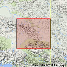
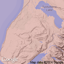
Type locality designated as Homer district, Kenai Peninsula, southern AK. Overview paper includes detailed lithology, distribution, stratigraphic sections, maps, structure, analyses of coal.
Source: GNU records (USGS DDS-6; Menlo GNULEX).
- Usage in publication:
-
- Kenai Group
- Modifications:
-
- Revised
- AAPG geologic province:
-
- Alaska Southern region
Summary:
Kenai Formation is raised in rank to Kenai Group and subdivided into (ascending): West Foreland Formation (new), Hemlock Conglomerate (new), Tyonek Formation (redefined), Beluga Formation (new), and Sterling Formation (new). Subsurface data shows group is at least 26,000 ft thick. Unconformably overlies Jurassic, Cretaceous, and older Tertiary rocks. Unconformably underlies Quaternary alluvium and glacial deposits. Age given as Tertiary.
Source: GNU records (USGS DDS-6; Menlo GNULEX).
- Usage in publication:
-
- Kenai Group*
- Modifications:
-
- Revised
- AAPG geologic province:
-
- Alaska Southern region
Summary:
Kenai Formation is revised to Kenai Group. May legend shows group includes (ascending); Hemlock Conglomerate, Tyonek Formation, Beluga Formation, and Sterling Formation. [Note that West Foreland Formation of Paleocene and Eocene age is not adopted as part of Kenai Group]. Age of group is Oligocene, Miocene, and Pliocene based on plant fossils and isotopic dating.
Source: GNU records (USGS DDS-6; Menlo GNULEX).
- Usage in publication:
-
- Kenai Group*
- Modifications:
-
- Age modified
- Biostratigraphic dating
- AAPG geologic province:
-
- Alaska Southern region
Summary:
Age of Kenai Group ranges from early Oligocene to Pliocene based on reevaluation of floral stages (Angoonian, Seldovian, Homerian and Clamgulchian).
Source: GNU records (USGS DDS-6; Menlo GNULEX).
For more information, please contact Nancy Stamm, Geologic Names Committee Secretary.
Asterisk (*) indicates published by U.S. Geological Survey authors.
"No current usage" (†) implies that a name has been abandoned or has fallen into disuse. Former usage and, if known, replacement name given in parentheses ( ).
Slash (/) indicates name conflicts with nomenclatural guidelines (CSN, 1933; ACSN, 1961, 1970; NACSN, 1983, 2005, 2021). May be explained within brackets ([ ]).