

- Usage in publication:
-
- Graphic-Kelly formation
- Modifications:
-
- Original reference
- Dominant lithology:
-
- Limestone
- AAPG geologic province:
-
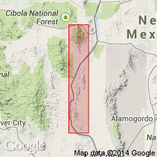
- Orogrande basin
Herrick, C.L., 1904, Laws of formation of New Mexico mountain ranges: American Geologist, v. 33, no. 5, p. 301-312.
Summary:
Pg. 310-312. Graphic-Kelly formation. Crystalline and light-colored lime, separated by close-grained, dense lime resembling lithographic stone known locally as "Silver-pipe" lime. The beds above the separating "Silver-pipe" lime are called Kelly lime [from Kelly mine], and the beds below it are called Graphic lime [from Graphic mine]. Overlain by Sandia formation and underlain by quartzite.
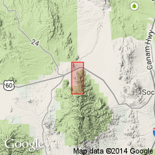
Occurs in Kelly mining district, Soccorro Co., central NM.
[Hyphenated Graphic-Kelly found objectionable and abandoned. See entry under Gordon, 1907.]
Source: US geologic names lexicon (USGS Bull. 896, p. 1079-1080).
- Usage in publication:
-
- Kelly limestone*
- Modifications:
-
- Principal references
- Revised
- Dominant lithology:
-
- Limestone
- AAPG geologic province:
-
- Orogrande basin
Summary:
Pg. 62-63; C.H. Gordon, 1907, Jour. Geol., v. 15, p. 807. Kelly limestone, of Magdalena Mountains, consists of 125 feet of subcrystalline limestone with compact 5-foot layer near middle called "Silver Pipe limestone" by miners. Most important ore bodies are just beneath "Silver Pipe limestone." It underlies Sandia formation and overlies pre-Cambrian rocks. Is same as Herrick's †Graphic-Kelly limestone [see also entry under Herrick]. So far as known is confined to Magdalena district. Cannot yet be correlated with Lake Valley limestone. Age is early Carboniferous [Mississippian].
Named from town of Kelly, Magdalena mining district, [Magdalena 15-min quadrangle], Socorro Co., central NM.
Source: US geologic names lexicon (USGS Bull. 896, p. 1079-1080).

- Usage in publication:
-
- Kelly limestone
- Modifications:
-
- Not used
- AAPG geologic province:
-
- Orogrande basin
Summary:
Pg. 27. Kelly limestone. Since its definite correlation with the Lake Valley limestone has been established, it seems preferable to discontinue use of local term, Kelly limestone, in Magdalena Mountains.
Source: US geologic names lexicon (USGS Bull. 1200, p. 1987).
- Usage in publication:
-
- Kelly limestone*
- Modifications:
-
- Areal extent
- AAPG geologic province:
-
- Orogrande basin
Summary:
Pg. 14-16 (Discussion of Carboniferous System rocks by V.T. Stringfield, A.H. Koschmann, and G.F. Loughlin), pl. 2.
Kelly limestone. In Magdalena mining district, New Mexico, for most part it is light bluish-gray, medium- to coarse-grained, thick-bedded, high-calcium limestone with persistent bed of dense argillaceous limestone in middle part known as "silver pipe" or "indicator." Thickness ranges from 90 to 135 feet; exceeds 110 feet in most places. Fossils. Poorly preserved and fragmented Mississippian megafossils [listed] tentatively identified by G.H. Girty; a Mississippian fossil plant ASTEROCALAMITES SCROBICULATUS identified by David White. Age is considered Mississippian.
Source: Publication; US geologic names lexicon (USGS Bull. 1200, p. 1987).
- Usage in publication:
-
- Kelly formation
- Modifications:
-
- Areal extent
- AAPG geologic province:
-
- Orogrande basin
- Basin-and-Range province
- Pedregosa basin
Summary:
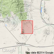
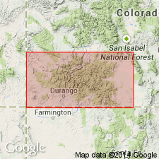
Areal extent of Kelly formation in southern NM discussed and displayed on areal extent map. Is exposed in a section measured in NE1/4 NE1/4 sec 36, T2S, R4W, in Magdalena district, Socorro Co, Orogrande basin, where it rests directly on pre-Cambrian rocks; is in Lemitar Mountains, Socorro Co, Orogrande basin; is in Mimbres Range, Cooks Range, and Silver City area, Grant and Luna Cos, Basin-and-Range province--this is a tentative identification, as rocks are lithologically quite different; and is shown on areal extent map as extending southwest into Hidalgo Co, Pedregosa basin. Kelly does not occur in Hueco Mountains or Franklin Mountains, southern Dona Ana and Otero Cos, NM, and El Paso Co, TX, Orogrande basin. Fauna is poorly developed; relative age tentatively considered late Osage (Mississippian). Kelly does not occur in areas where rocks of younger, Meramec age are exposed. In all areas of exposure Kelly is overlain by rocks of post-Mississippian age. Lithologically it in no way resembles Meramec rocks in NM, but it is quite similar to the underlying Lake Valley formation (revised in this report), and in the Mimbres Range can be separated from the Lake Valley only with difficulty. Measured sections, cross sections, and areal extent map.
Source: GNU records (USGS DDS-6; Denver GNULEX).
- Usage in publication:
-
- Kelly limestone
- Modifications:
-
- Not used
Summary:
Laudon and Bowsher (1949) have reported 15-30 ft of cherty crinoidal limestone without distinctive fossils overlying the Tierra Blanca member of Lake Valley formation in the southern part of Cooks Range (Luna Co, Basin-and-Range province). These beds were tentatively referred to Kelly limestone. The absence of faunal evidence, and the lack of any definitive break between the formations, has led the author to consider them to be part of Tierra Blanca member of Lake Valley formation, and they were so mapped.
Source: GNU records (USGS DDS-6; Denver GNULEX).

- Usage in publication:
-
- Kelly formation
- Modifications:
-
- Revised
- AAPG geologic province:
-
- Orogrande basin
Summary:
Pg. 3, 32-33. Kelly formation. [In southern Ladron Mountains, the lower contact of Kelly formation is extended downward about 60 feet. Rocks reallocated from underlying Caloso formation (restricted).] Described as crinoidal, slabby, light-buff to light-gray, richly fossiliferous limestone with nodular, white, fossiliferous chert. Thickness up to 60 feet. Disconformably overlies Kinderhook Caloso formation (restricted). Unconformably underlies Pennsylvanian Sandia Formation. Fossils [tentatively identified and listed] include Osage brachiopods. [Age is considered late Early Mississippian (Osagean).]
Source: Publication.
- Usage in publication:
-
- Kelly formation
- Modifications:
-
- Biostratigraphic dating
- AAPG geologic province:
-
- Orogrande basin
Armstrong, A.K., 1958, The Mississippian of west-central New Mexico: New Mexico Bureau of Mines and Mineral Resources Memoir, no. 5, [47 p.].
Summary:
Pg. 3, 5, 11, figs. 6, 8, 9. Kelly formation. Gray, crinoidal, and medium crystalline, with white to light-gray chert. Ranges in thickness from 0 to 75 feet in Magdalena, Lemitar, and Ladron Mountains. Disconformably overlies Caloso formation. Includes "Silver Pipe zone." Fossils [listed]; notably brachiopods CLEIOTHYRIDINA OBMAXIMA, SPIRIFER GRIMESI, SPIRIFER TENUICOSTATUS, and TETRACAMERA cf. T. SUBTRIGONA; blastoids ORBITREMITES FLOWERI, n.sp. and PENTREMITES CONOIDEUS; endothyrid PLECTOGYRA sp.; and coral ZAPHRIPHYLLUM CASTERI, n.sp. Age is late Early Mississippian; Keokuk (Osage) age based on fossils. (Specimens correlated with Mississippi Valley assemblages.)
Source: Publication; US geologic names lexicon (USGS Bull. 1200, p. 1987).
- Usage in publication:
-
- Kelly Limestone*
- Modifications:
-
- Revised
- Biostratigraphic dating
- AAPG geologic province:
-
- Orogrande basin
Summary:
Pg. 17-19. Kelly Limestone. Geographically restricted to Lemitar, Ladron, and Magdalena Mountains, and Coyote Hills of west-central New Mexico. Divided into (ascending): Caloso Member and unconformably overlying Ladron Member (new name) [see also entries under Caloso and Ladron]. Fossils [listed]. Formation lies within microfossil zones 8 and 9. Age is late Early Mississippian (Osagean).
Type section: outcrop on crest of Magdalena Mountains, [northeast of Kelly], in NE/4 SW/4 sec. 31, T. 2 S., R. 3 W., [Magdalena 7.5-min quadrangle], Socorro Co., central NM.
Source: Publication; Changes in stratigraphic nomenclature, 1976 (USGS Bull. 1435-A, p. A49-A50).
- Usage in publication:
-
- Kelly Limestone*
- Modifications:
-
- Age modified
- Biostratigraphic dating
- AAPG geologic province:
-
- Orogrande basin
Summary:
Pg. EE4-EE5 (fig. 3), EE13, EE20+ (appendix 1, 2), pl. Kelly Limestone. In northern Magdalena Mountains, central New Mexico, unconformably overlies Proterozoic metamorphic and igneous rocks. Unconformably underlies Lower Pennsylvanian (Bashkirian) Sandia Formation. Subdivided into (ascending) Calosa and Ladron Members, separated by an unconformity. Is partly equivalent to Arroyo Penasco Group of northern New Mexico, and Leadville Limestone of Colorado. Fossils. Conodonts (identified by J.E. Repetski and R.G. Stamm, USGS, n.d.) indicate lowest beds are no older than Mamet (1976) microfossil zone 8 (Tournaisian) and top beds are middle to late Meramecian (Visean). Formation lies within Mamet zones 8, 9, and 14. Age is late Early and Middle Mississippian (Tournaisian and Visean; Osagean and Meramecian).
Magdalena Mountains section (88N-1): at north end of range, at head of abandoned Jordan Canyon Road, 9,000 ft (2,743 m) elev.; measured on north side of road, in SW/4 and NW/4 , sec. 5, T. 3 S., R. 3 W.
Source: Publication.
For more information, please contact Nancy Stamm, Geologic Names Committee Secretary.
Asterisk (*) indicates published by U.S. Geological Survey authors.
"No current usage" (†) implies that a name has been abandoned or has fallen into disuse. Former usage and, if known, replacement name given in parentheses ( ).
Slash (/) indicates name conflicts with nomenclatural guidelines (CSN, 1933; ACSN, 1961, 1970; NACSN, 1983, 2005, 2021). May be explained within brackets ([ ]).