- Usage in publication:
-
- Kassler sandstone member*
- Modifications:
-
- Original reference
- Dominant lithology:
-
- Sandstone
- AAPG geologic province:
-
- Denver basin
Summary:
Pg. B31, figs. 10, 17, 19. Kassler sandstone member of South Platte formation of Dakota group. Throughout most of nonmarine phase of South Platte formation (new) in southern part of northern foothills area, the first sandstone subunit at top of South Platte lies on dip slope of hogback, and crest of hogback is formed by second sandstone subunit. Latter is here named Kassler sandstone member. It is dominant ledge-forming sandstone of formation from Golden quadrangle, where it is about 30 feet thick, south to Kassler quadrangle, where it is between 75 and 100 feet thick. North of Golden quadrangle, too thin to be mapped. Can be traced as far as El Dorado Springs quadrangle, where it is about 10 feet thick. To the north appears to grade gradually into marine siltstone and shale member. Age is Early Cretaceous.
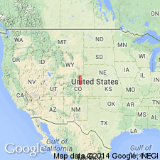
Type section: at end of the hogback, 0.5 mi north of the South Platte River, at Kassler [now Waterton], Jefferson Co., CO. It is part of composite type section of South Platte formation. In northern Front Range foothills.
Named from exposures near Kassler [now Waterton], Kassler quadrangle, Jefferson Co., CO.
Source: US geologic names lexicon (USGS Bull. 1200, p. 1972); supplemental information from GNU records (USGS DDS-6; Denver GNULEX).
For more information, please contact Nancy Stamm, Geologic Names Committee Secretary.
Asterisk (*) indicates published by U.S. Geological Survey authors.
"No current usage" (†) implies that a name has been abandoned or has fallen into disuse. Former usage and, if known, replacement name given in parentheses ( ).
Slash (/) indicates name conflicts with nomenclatural guidelines (CSN, 1933; ACSN, 1961, 1970; NACSN, 1983, 2005, 2021). May be explained within brackets ([ ]).

