- Usage in publication:
-
- Ivan limestone member
- Modifications:
-
- Named
- Dominant lithology:
-
- Limestone
- AAPG geologic province:
-
- Bend arch
Summary:
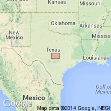
Named as a member of newly named Thrifty formation of Cisco group (revised) for town of Ivan, Stephens Co, TX on Bend arch. No type locality designated. In Brazos River Valley Thrifty is divided into following members (ascending): Avis sandstone; unnamed limestone, unnamed shale and sandstone; Ivan limestone; unnamed shale and sandstone; Blach Ranch limestone; unnamed shale; and Breckenridge limestone. Divided in the Colorado River Valley into following members (ascending): unnamed shale, sandstone, and limestone; Speck Mountain limestone; unnamed shale, sandstone, and limestone; and Breckenridge limestone. Ivan is a persistent limestone lentil appearing 35-80 ft above Avis sandstone [member] in vicinity of Ivan, Stephens Co. Not traceable very far to the northeast but southward it has been mapped into Eastland Co and appears to be represented in the Cretaceous sand area [all on Bend arch]. It is light yellowish to brownish gray, massive, locally nodular, and unfossiliferous. Ranges in thickness from 2-8 ft. A limestone occurs in places southeast of Breckenridge in the shale and sandstone interval between the Avis and Ivan members. It is distinguished from Ivan by numerous fossil corals but has been confused in some cases with the adjacent Gunsight limestone member [of Graham formation (both new)]. The position of this lowest limestone in the Thrifty is about 60 ft below the Ivan in this region. Stratigraphic chart. Pennsylvanian age.
Source: GNU records (USGS DDS-6; Denver GNULEX).

- Usage in publication:
-
- Ivan Limestone
- Modifications:
-
- Areal extent
- AAPG geologic province:
-
- Bend arch
Summary:
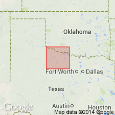
Mapped as a single line [as an unranked unit] in Thrifty and Graham Formations (mapped undivided) of Cisco Group in the southeastern part of the mapped area. Present in discontinuous outcrop north of Graham, in Young Co, TX on Bend arch. Locally called "Rocky Mound Limestone." Is gray to dark brown, coarse grained, with massive to irregular thin beds, very fossiliferous with fusulinids, crinoid fragments, brachiopods, and locally large gastropods. Is 1-5 ft thick. Is of Virgil (Late Pennsylvanian) age. Geologic map.
Source: GNU records (USGS DDS-6; Denver GNULEX).
For more information, please contact Nancy Stamm, Geologic Names Committee Secretary.
Asterisk (*) indicates published by U.S. Geological Survey authors.
"No current usage" (†) implies that a name has been abandoned or has fallen into disuse. Former usage and, if known, replacement name given in parentheses ( ).
Slash (/) indicates name conflicts with nomenclatural guidelines (CSN, 1933; ACSN, 1961, 1970; NACSN, 1983, 2005, 2021). May be explained within brackets ([ ]).

