The National Geologic Map Database is migrating to a new infrastructure. We apologize for any service disruptions during this process.
|
|---|


- Usage in publication:
-
- Irving formation*
- Modifications:
-
- Original reference
- Dominant lithology:
-
- Greenstone
- AAPG geologic province:
-
- Southern Rocky Mountain region
Summary:
Pg. 501-509. Irving formation. Greenstone complex,
including schists and massive basic rocks sometimes possessing a porphyritic structure, others partly mashed or brecciated, and a few distinctly granular, while no well-defined system of bedding or stratification could be made out. All rocks are of dull-greenish color and appear to have undergone extensive alteration. At two places massive quartzite was found, and at a number of localities extremely siliceous schists. Rarely light-gray gneiss and mashed quartzite occur. Overlain by Algonkian conglomerates and quartzites, from which they are separated by an erosion interval of unknown extent, the overlying Algonkian conglomerate containing quantities of pebbles of Irving greenstone. At first the Irving was assumed to be a part of the great Archean complex of schists and gneisses known to occur near by in Animas Canyon, but it is now regarded as early Algonkian.
Source: US geologic names lexicon (USGS Bull. 896, p. 1026-1027).
- Usage in publication:
-
- Irving greenstone*
- Modifications:
-
- Principal reference
- Dominant lithology:
-
- Quartzite
- Greenstone
- Schist
- AAPG geologic province:
-
- Southern Rocky Mountain region
Summary:
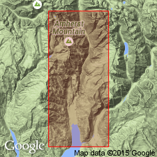
Irving greenstone. A complicated series of greenstone, greenstone porphyry, and greenstone schist, with subordinate quartz-mica schist and granite gneiss, and a few bands of quartzite, often mashed and schistose. Prominently exposed in southeastern part of quadrangle and composes Irving Peak. Distinguished from underlying Archean schists by distinctive character of certain of its more massive members and by presence of sedimentary rocks. Actual base nowhere seen. Thickness exposed appears to be at least 10,000 feet. Overlain unconformably by Vallecito conglomerate. Considered to be most probably of Algonkian age.
[GNC remark (ca. 1936, US geologic names lexicon, USGS Bull. 896, p. 1026-1027): On 1935 geol. map of Colorado this formation was assigned to Gunnison River series, which comprises the oldest exposed pre-Cambrian rocks in Colorado. The terms "Algonkian system" and "Archean system" having been discarded by the USGS, the Irving greenstone is now classified as pre-Cambrian.]
Source: US geologic names lexicon (USGS Bull. 896, p. 1026-1027).
- Usage in publication:
-
- Irving Formation*
- Modifications:
-
- Redescribed
- Overview
- Dominant lithology:
-
- Amphibolite
- Schist
- Gneiss
- Quartzite
- Iron-formation
- AAPG geologic province:
-
- Southern Rocky Mountain region
Summary:
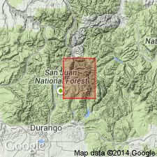
Renamed Irving Formation because formation contains very little greenstone. Includes rocks in western and northern part of Needle Mountains that were mapped by previous authors as Archean schist and gneiss. Mapped on sketch map in Needle Mountains of La Plata and San Juan Cos, CO in Southern Rocky Mountain region, as a unit younger than Vallecito Conglomerate and older than Twilight Gneiss. Contains amphibolite (presumably a metabasalt or meta-andesite), biotite- and epidote-bearing schist and gneiss (some derived from intermediate composition volcanic rocks), metamorphosed plutonic rocks, quartzite and feldspathic quartzite, metasiltstone, banded iron-formation, and muscovite-quartz-biotite schist. Most foliation and compositional layering trend north and dip steeply. Most of formation shows mild retrograde metamorphism. A distinctive 40 to 50 ft thick gray conglomerate lies 40 to 50 ft above base at Vallecito Creek. Conglomerate contains subangular to subround granules to cobbles of polygranular quartz and metavolcanic rock in a matrix of quartz, plagioclase, hornblende, and magnetite. Conglomerate lies on Vallecito about 1.1 mi to south. Farther south conglomerate is missing. Is probably several thousand ft thick. Precambrian age.
Source: GNU records (USGS DDS-6; Denver GNULEX).
- Usage in publication:
-
- Irving Formation*
- Modifications:
-
- Age modified
- AAPG geologic province:
-
- Southern Rocky Mountain region
Summary:
Age changed from Precambrian to Precambrian X. Map unit is at the southern border of the map, Hinsdale Co, CO in the Southern Rocky Mountain region.
Source: GNU records (USGS DDS-6; Denver GNULEX).
- Usage in publication:
-
- Irving Formation*
- Modifications:
-
- Overview
- AAPG geologic province:
-
- Southern Rocky Mountain region
Summary:
Redefined and application extended by Barker (1969). Listed with rocks of pre-1,700 m.y. (Precambrian X) metamorphic complex.
Source: GNU records (USGS DDS-6; Denver GNULEX).
- Usage in publication:
-
- Irving Formation
- Modifications:
-
- Revised
- AAPG geologic province:
-
- Southern Rocky Mountain region
Summary:
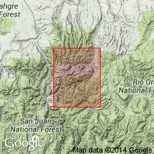
Contact relationship and depositional sequence of Middle Proterozoic rocks reinterpreted. Uncompahgre Formation thought to have been deposited before 1,640 m.y. and deformed before 1,430 m.y., and in thrust contact with the Irving. New relationship shown on Figure 1. Known in San Juan and La Plata Cos in the Southern Rocky Mountain region.
Source: GNU records (USGS DDS-6; Denver GNULEX).
- Usage in publication:
-
- Irving Formation*
- Modifications:
-
- Overview
- AAPG geologic province:
-
- Southern Rocky Mountain region
Summary:
Early Proterozoic metavolcanic Twilight Gneiss of Needle Mountains is the felsic counterpart of the amphibolitic western facies, the Irving Formation which is in the Southern Rocky Mountain region. Is older than Vallecito Conglomerate.
Source: GNU records (USGS DDS-6; Denver GNULEX).
For more information, please contact Nancy Stamm, Geologic Names Committee Secretary.
Asterisk (*) indicates published by U.S. Geological Survey authors.
"No current usage" (†) implies that a name has been abandoned or has fallen into disuse. Former usage and, if known, replacement name given in parentheses ( ).
Slash (/) indicates name conflicts with nomenclatural guidelines (CSN, 1933; ACSN, 1961, 1970; NACSN, 1983, 2005, 2021). May be explained within brackets ([ ]).