

- Usage in publication:
-
- Inkom Formation
- Modifications:
-
- First used
- AAPG geologic province:
-
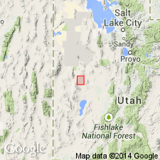
- Great Basin province
Summary:
First use of the Inkom Formation [credited to Crittenden and others (in press?)]. Age is Precambrian.
Source: GNU records (USGS DDS-6; Menlo GNULEX).
- Usage in publication:
-
- Inkom Formation*
- Modifications:
-
- Named
- Dominant lithology:
-
- Phyllite
- AAPG geologic province:
-
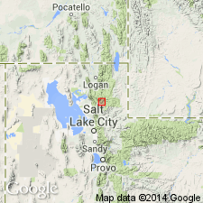
- Northern Rocky Mountain region
Summary:
Pg. 586, 591. Inkom Formation. Present in Pocatello area, Bannock County, southeastern Idaho, and possibly Huntsville area, Weber County, northern Utah. Consists of greenish phyllite that grades upward into greenish-gray to light-olive-gray argillite or slate, siltite, and very fine-grained quartzite. Contains a few beds of conglomerate or impure micaceous quartzite. Thickness at type section 305 m [approx. 1,000 feet]; ranges from 240 to 730 m [approx. 780 to 2,400 feet]. Tentatively assigned to the Brigham Group (revised) in the Huntsville area. Overlies Caddy Canyon Quartzite (new) (only tentatively in Huntsville area); lower contact placed at top of highest quartzite of Caddy Canyon, though some phyllite beds are present below it. Underlies Mutual Formation (extended into Pocatello area); upper contact placed at base of massive quartzite ledges of Mutual. Age is late Precambrian (Precambrian Z). (Inkom Formation adopted by the USGS.)
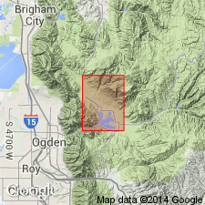
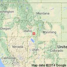
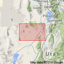
Type section: north of Portneuf River, in head of small canyon which joins river about a mile (2 km) west of town of Inkom, in northwest part of T. 7 S., R. 36 E., Bannock Co., ID (Northern Rocky Mountain region). Named from town of Inkom.
Source: GNU records (USGS DDS-6; Denver GNULEX, Menlo GNULEX); US geologic names lexicon (USGS Bull. 1520, p. 148-149); Changes in stratigraphic nomenclature, 1971 (USGS Bull. 1372-A, p. A10-A11).
- Usage in publication:
-
- Inkom Formation*
- Modifications:
-
- Revised
- AAPG geologic province:
-
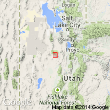
- Wasatch uplift
Summary:
Inkom Formation is definitely included in the Brigham Group in Utah. Age is Precambrian.
Source: GNU records (USGS DDS-6; Menlo GNULEX).
- Usage in publication:
-
- Inkom Formation
- Modifications:
-
- Areal extent
- Revised
- AAPG geologic province:
-
- Great Basin region
Summary:
Inkom Formation. Extended into the Sheeprock Mountains of north-central Utah (Great Basin region) as 1 of 4 formations of the Brigham Group. Thickness 30 to 145 m. Consists of olive-drab, liver-colored, blue or gray siltstone, shale, and slate, and interbeds of greenish-gray, very fine-grained, ripple-marked sandstone. In northwest part of mapped area, white, medium-grained quartzite is present in upper part. Upper part of the Inkom (this report) = lower argillite member of Cohenour's (1959) Mutual Formation. Overlies Caddy Canyon Quartzite and underlies Mutual Formation (both of Brigham). Age is Late Proterozoic. Report includes geologic map, stratigraphic sections.
Source: Modified from GNU records (USGS DDS-6; Denver GNULEX).
- Usage in publication:
-
- Inkom Formation
- Modifications:
-
- Revised
- AAPG geologic province:
-
- Northern Rocky Mountain region
Summary:
Assigned as 1 of 6 formations to the Brigham Group (group rank extended to southeast ID) in the northern Bannock and Portneuf Ranges and as 1 of 7 formations in the southern Portneuf and Bear River Ranges, Bannock and Bear Lake Cos, ID in the Northern Rocky Mountain region. Overlies Caddy Canyon Quartzite of Brigham; underlies Mutual Formation of Brigham. The lower contact is gradational and the upper contact is disconformable. Is also assigned to depositional sequence 2, a marine sequence. Is one of the most laterally persistent units in the Brigham. Cross section. Late Proterozoic age.
Source: GNU records (USGS DDS-6; Denver GNULEX).
- Usage in publication:
-
- Inkom Formation*
- Modifications:
-
- Age modified
- AAPG geologic province:
-
- Great Basin province
Summary:
Age of the Inkom Formation is revised from Proterozoic Z to Late Proterozoic.
Source: GNU records (USGS DDS-6; Menlo GNULEX).
For more information, please contact Nancy Stamm, Geologic Names Committee Secretary.
Asterisk (*) indicates published by U.S. Geological Survey authors.
"No current usage" (†) implies that a name has been abandoned or has fallen into disuse. Former usage and, if known, replacement name given in parentheses ( ).
Slash (/) indicates name conflicts with nomenclatural guidelines (CSN, 1933; ACSN, 1961, 1970; NACSN, 1983, 2005, 2021). May be explained within brackets ([ ]).