

- Usage in publication:
-
- Idavada Volcanics*
- Modifications:
-
- Named
- Dominant lithology:
-
- Volcanics
- Latite
- Obsidian
- Tuff
- Ash
- AAPG geologic province:
-
- Snake River basin
Summary:
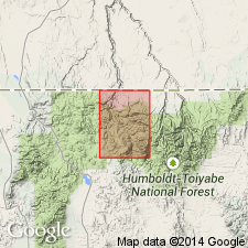
Pg. 1199 (fig. 1), 1200-1201, pI. 1 (geol. map). Idavada Volcanics. Formal proposal of name. Name applied to various nonmineralized silicia volcanic rocks, chiefly welded ash flows but including some bedded vitric rhyolitic tuffs and lava flows. Conformably overlies Miocene rocks. Underlies Poison Creek Formation of Idaho Group (redefined). Correlates in part with Jenny Creek Tuff and Cougar Point Tuff of Jarbidge Mountains. Along Goose Creek, Cassia County, Idaho, the Idavada Volcanics are exposed in section more than 3,000 feet thick (Salt Lake and Payette(?) formations of Mapel and Hail, 1959, USGS Bull. 1055-H) which overlies gold-bearing rhyolite. Idavada Volcanics have been discussed by other writers under a variety of names all of which are herein abandoned: Mount Bennett Rhyolite (Russell, 1902), Shoshone Falls Andesite, and Pillar Falls Mudflow (Stearns, 1932, 1936, 1955, Stearns and others, 1938). Kirkham (1931, Jour. Geol., v. 39, no. 3) combined Idavada Volcanics with older rhyolite under name Owyhee Rhyolite. These two rock units are also combined on geologic map of Idaho, but most of outcrop mapped in western Snake River Plain consists of Idavada Volcanics. Age is early Pliocene. Similar rocks in western Snake River Plain are partly middle Pliocene. Report includes stratigraphic chart, cross sections.
Type locality: escarpment parallel to Salmon Falls Creek, 10 mi northwest of Idavada, Twin Falls Co., ID. Named from Idavada, a place on the railroad near U.S. Highway 93, at the Idaho-Nevada State line.
Source: US geologic names lexicon (USGS Bull. 1350, p. 356-357); supplemental information from GNU records (USGS DDS-6; Denver GNULEX).
- Usage in publication:
-
- Idavada Volcanics
- Modifications:
-
- Incidental mention
- AAPG geologic province:
-
- Great Basin province
Summary:
Pg. 101. Idavada Volcanics. Incidental mention in discussion of stratified rocks in south-central Idaho. Inferred to be younger than Challis Volcanics.
Source: US geologic names lexicon (USGS Bull. 1350, p. 356-357).
- Usage in publication:
-
- Idavada volcanics
- Modifications:
-
- Revised
- AAPG geologic province:
-
- Great Basin province
Summary:
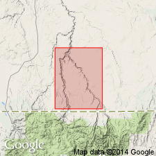
Pg. (table 1), 9-11. Idavada volcanics. As defined by Malde and Powers (1962), the Idavada is sufficiently varied in lithology so that it seems desirable to recognize it as a group. In Goose Creek basin [this report], Cassia County, Idaho, includes (ascending) Beaverdam (new), Jenny Creek, and Cougar Point formations. (Payette(?) and Salt Lake formations of Mapel and Hail, 1959, USGS Bull. 1055-H, not used in this report.) Thickness about 3,100 feet. Overlies Jarbidge rhyolite; underlies Banbury formation. Age is Miocene (Hemingfordian to Barstovian). Report includes stratigraphic charts.
Source: US geologic names lexicon (USGS Bull. 1350, p. 356-357); supplemental information from GNU records (USGS DDS-6; Denver GNULEX).
- Usage in publication:
-
- Idavada volcanics
- Modifications:
-
- Not used
- AAPG geologic province:
-
- Great Basin province
Summary:
Pg. M14. Malde and Powers (1962) have applied name Idavada volcanics to unit that includes Cougar Point welded tuff (new) and Jenny Creek tuff (new) and possibly other rocks not represented in Jarbidge quadrangle, Nevada.
Source: US geologic names lexicon (USGS Bull. 1350, p. 356-357).
- Usage in publication:
-
- Idavada Volcanics
- Modifications:
-
- Revised
- AAPG geologic province:
-
- Great Basin province
Summary:
Pg. 24, pI. 1 (geol. map). Idavada Volcanics. Geographically extended into Nevada where it is present in northern part of Rowland quadrangle, Elko County. The volcanics consist of lower pyroclastic beds and upper rhyolite flows with minor intercalated ash beds. The pyroclastics, up to 300 feet thick, consist of ash, tuff, tuffaceous sediments, and welded and vitric tuffs. The flows range in thickness from 10 to 50 feet and in many places overlap the pyroclastics and rest on older rocks. The Young America Gravel (new) lies between the late Miocene Jarbidge Rhyolite and the early Pliocene Idavada Volcanics.
Source: US geologic names lexicon (USGS Bull. 1350, p. 356-357).
- Usage in publication:
-
- Idavada Volcanics*
- Modifications:
-
- Geochronologic dating
- AAPG geologic province:
-
- Snake River basin
- Great Basin province
Summary:
Pg. 236. Idavada Volcanics. Rhyolitic tuffs, ash flows, clastic sediments, and minor basalt flows in western Snake River Plain, southern Idaho. Samples from type area (Idavada, Twin Falls Co.), and from near Goose Creek, Cassia Co., yielded K-Ar ages (on whole-rock) of 9.7 Ma, and 8.4 to 8.5 Ma, respectively; North American land mammal age Hemphillian [=Pliocene (Evernden and others, 1964, Amer. Jour. Sci., v. 262, p. 145-198), =Miocene (Berggren, 1972, Lethaia, v. 5, no. 2, p. 195-215)]. Report includes sample locality map, schematic stratigraphic-chronologic diagram, table of K-Ar ages.
Source: Publication.
- Usage in publication:
-
- Idavada Volcanics
- Modifications:
-
- Not used
Summary:
Not used in study area in southeast Owyhee Co, ID, Snake River basin. Replaced with informally named basalt of Indian Hot Springs which is lithologically distinct from Idavada and is exposed in Jarbidge and Bruneau River canyons in north part of mapped area. Because Idavada has been used to designate large areas of undivided rhyolite and basalt in southwestern ID outside its type area, term has lost much of its original usefulness.
Source: GNU records (USGS DDS-6; Denver GNULEX).
For more information, please contact Nancy Stamm, Geologic Names Committee Secretary.
Asterisk (*) indicates published by U.S. Geological Survey authors.
"No current usage" (†) implies that a name has been abandoned or has fallen into disuse. Former usage and, if known, replacement name given in parentheses ( ).
Slash (/) indicates name conflicts with nomenclatural guidelines (CSN, 1933; ACSN, 1961, 1970; NACSN, 1983, 2005, 2021). May be explained within brackets ([ ]).