

- Usage in publication:
-
- Hoodoo quartzite*
- Modifications:
-
- Originalreference
- AAPG geologic province:
-
- Northern Rocky Mountain region
Ross, C.P., 1932, Idaho correlation chart, compiled by G.C. Wilmarth, September, 1932: U.S. Geological Survey, 1 sheet., Chart to accompany USGS Bull. 896, 1938
Summary:
Hoodoo quartzite. White massive quartzite, 3,650+ feet thick, unconformably underlying schist of unknown thickness, believed to be of Algonkian age, and overlying Yellowjacket formation, both included in Belt series.
Type locality: Hoodoo Creek.
Source: US geologic names lexicon (USGS Bull. 896, p. 978).
- Usage in publication:
-
- Hoodoo quartzite*
- Modifications:
-
- Original reference
- Dominant lithology:
-
- Quartzite
- AAPG geologic province:
-
- Northern Rocky Mountain region
Summary:
Hoodoo Quartzite of Belt series. White, relatively pure and massive quartzite, 2,000 to 4,000 feet thick, overlying Yellowjacket formation. Named from exposures along Hoodoo Creek, in northwestern part of Casto quadrangle, Casto region, Lemhi County, southern central Idaho. Upper formation of Belt series. Age is pre-Cambrian (Belt; Algonkian). A.L. Anderson suggests (Idaho Bur. Mines and Geol. Pamphlet, no. 34, p. 10, June 1930) the rocks here named Yellowjacket formation and Hoodoo quartzite may correspond to lower and middle members of Prichard formation as identified by him in Orofino region.
Source: US geologic names lexicon (USGS Bull. 896, p. 978).
- Usage in publication:
-
- Hoodoo quartzite*
- Modifications:
-
- Areal extent
- AAPG geologic province:
-
- Northern Rocky Mountain region
Summary:
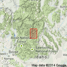
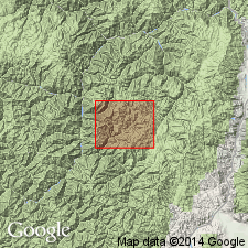
Pg. 7. Hoodoo quartzite of Belt series. Belt series in vicinity of middle Fork of Salmon River, includes Yellowjacket formation, at least 9,000 feet thick, overlain by Hoodoo quartzite over 3,560 feet thick. Age is Precambrian (Belt).
Source: US geologic names lexicon (USGS Bull. 1200, p. 1798).
- Usage in publication:
-
- Hoodoo Quartzite*
- Modifications:
-
- Areal extent
- AAPG geologic province:
-
- Northern Rocky Mountain region
Summary:
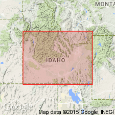
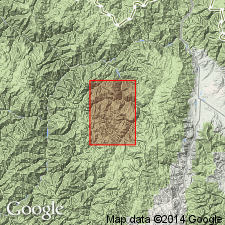
Hoodoo Quartzite of Belt Supergroup. Extended west into the Idaho Primitive Area of Valley, Idaho, and Lemhi Counties, Idaho.
Source: Modified from GNU records (USGS DDS-6; Denver GNULEX).
- Usage in publication:
-
- Hoodoo Quartzite*
- Modifications:
-
- Revised
- AAPG geologic province:
-
- Northern Rocky Mountain region
Summary:
Deposited in east-central ID in Northern Rocky Mountain region in the Belt miogeocline. Removed from Belt Supergroup, which is a sequence deposited in the Belt basin.
Source: GNU records (USGS DDS-6; Denver GNULEX).
- Usage in publication:
-
- Hoodoo Quartzite*
- Modifications:
-
- Principal reference
- Dominant lithology:
-
- Quartzite
- Marble
- AAPG geologic province:
-
- Northern Rocky Mountain region
Summary:
Hoodoo Quartzite. White to light-gray, massive quartzite that is composed of 80 to 90 percent well-rounded quartz grains and 10 percent feldspar. Thickness 1,100+ m (3,600 feet). Correlates with middle part of Prichard Formation of Belt Supergroup. Underlies unnamed argillaceous quartzite, siltite, and argillite sequence; overlies Yellowjacket Formation. Lower and upper contacts may be gradational though contact with Yellowjacket can be a high-angle strike-slip fault. Age is Middle Proterozoic.
Principal reference section (Ross' 1934 section, p. 16): near Yellowjacket mining district, along Yellowjacket and Shovel Creeks, in T. 19 N., R. 17 E. (unsurveyed), about 2 mi (3.2 km) northeast of the mine and mill, Lemhi Co., southern central ID.
Source: Modified from GNU records (USGS DDS-6; Denver GNULEX).
- Usage in publication:
-
- Hoodoo Quartzite
- Modifications:
-
- Areal extent
- AAPG geologic province:
-
- Northern Rocky Mountain region
Summary:
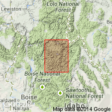
In Idaho cobalt belt area, Lemhi County, southern central Idaho, Hoodoo Quartzite gradationally overlies and underlies the siltite beds in lower unit of Yellowjacket Formation. Age is Middle Proterozoic.
Source: Publication.
- Usage in publication:
-
- Hoodoo Quartzite*
- Modifications:
-
- Areal extent
- AAPG geologic province:
-
- Northern Rocky Mountain region
Summary:
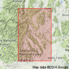
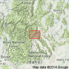
Hoodoo Quartzite. Recognized in exposures west of Iron Lake fault, Lemhi County, southern central Idaho. Conformably overlies Yellowjacket Formation (restricted); conformably underlies unnamed argillaceous quartzite.
Source: Publication.
For more information, please contact Nancy Stamm, Geologic Names Committee Secretary.
Asterisk (*) indicates published by U.S. Geological Survey authors.
"No current usage" (†) implies that a name has been abandoned or has fallen into disuse. Former usage and, if known, replacement name given in parentheses ( ).
Slash (/) indicates name conflicts with nomenclatural guidelines (CSN, 1933; ACSN, 1961, 1970; NACSN, 1983, 2005, 2021). May be explained within brackets ([ ]).