The National Geologic Map Database is migrating to a new infrastructure. We apologize for any service disruptions during this process.
|
|---|


- Usage in publication:
-
- Herkimer limestone*
- Modifications:
-
- Named
- Dominant lithology:
-
- Limestone
- AAPG geologic province:
-
- Great Basin province
Summary:
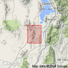
Named after the Herkimer shaft, east of Quartzite Ridge in T10S, R3W, Juab Co, UT in the Great Basin province. No type locality designated. Previously considered part of Mammoth or Eureka limestone. Crops out along the Dagmar limestone (new) which is older than the Herkimer as far as the south wall of Jenny Lind Canyon. Ranges from 225 to 235 ft thick. Is composed of mottled shaly limestone of bluish-black, dense carbonaceous limestone mottled by thin discontinuous layers or blotches of yellow-brown material rich in iron and clay. No fossils found. Is older than the Bluebird dolomite (new). Geologic map. Cross sections.
Source: GNU records (USGS DDS-6; Denver GNULEX).

- Usage in publication:
-
- Herkimer limestone*
- Modifications:
-
- Overview
- AAPG geologic province:
-
- Wasatch uplift
- Great Basin province
Summary:
Present in Utah Co on the Wasatch uplift and in Juab Co in the Great Basin province. Ranges from 350 to 430 ft thick. A section 427.5 ft thick measured in NW1/4 sec 35, T9S, R3W where formation conformably underlies Bluebird dolomite. Divisible into lower, shale, and upper members. Trilobite fragments identified in shale member. Assigned to Middle Cambrian on basis of stratigraphic position between Middle Cambrian formations. Probably deposited in a slowly sinking geosyncline in shallow agitated water deduced from presence of oolites and pisolites. Geologic map. Correlation diagrams. ENTER REMARKS INFORMATION INTO THIS WINDOW. MAXIMUM CHARACTERS PER LINE IS 60. MAXIMUM NUMBER OF LINES IS 25.
Source: GNU records (USGS DDS-6; Denver GNULEX).
For more information, please contact Nancy Stamm, Geologic Names Committee Secretary.
Asterisk (*) indicates published by U.S. Geological Survey authors.
"No current usage" (†) implies that a name has been abandoned or has fallen into disuse. Former usage and, if known, replacement name given in parentheses ( ).
Slash (/) indicates name conflicts with nomenclatural guidelines (CSN, 1933; ACSN, 1961, 1970; NACSN, 1983, 2005, 2021). May be explained within brackets ([ ]).