

- Usage in publication:
-
- Helena limestone*
- Modifications:
-
- Original reference
- Dominant lithology:
-
- Limestone
- AAPG geologic province:
-
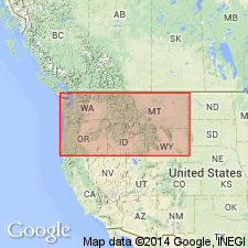
- Northern Rocky Mountain region
Summary:
Pg. 199-215. Helena limestone. More or less impure bluish-gray and gray limestone, in thick layers; 2,400 feet thick. Underlies Marsh shale and overlies Empire shale. Age is pre-Cambrian (Belt).
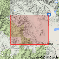
Exposed in upper part of city of Helena [Lewis and Clark Co.] and on hill slopes to east, Belt Mountains, western central MT.
Source: US geologic names lexicon (USGS Bull. 896, p. 937).
- Usage in publication:
-
- Helena dolomite
- Modifications:
-
- Redescribed
- Dominant lithology:
-
- Dolomite
- AAPG geologic province:
-
- Northern Rocky Mountain region
Summary:
Redescribed as Helena dolomite (formerly Helena limestone) of Belt series. Consists of buff-weathering, dark gray aphanitic dolomite. Around borders of Boulder batholith and of Marysville stock, formation is present in wide aureoles of white and cream, diopsidic and tremolitic hornfels. Does contain limestone, some siliceous limestone oolite, and beds of conglomerate up to 2 ft thick. Has COLLENIA biostromes up to 10 ft thick near base. About 4,000 ft thick. Small geologic map of Marysville district, Lewis and Clark Co., MT in the Northern Rocky Mountain region. Precambrian age.
Source: GNU records (USGS DDS-6; Denver GNULEX).
- Usage in publication:
-
- Helena Formation
- Modifications:
-
- Overview
- AAPG geologic province:
-
- Northern Rocky Mountain region
Summary:
Helena Formation of Helena area, Siyeh Formation of Glacier National Park, and the Newland Limestone of the Bonner area of the Precambrian Belt Supergroup (Northern Rocky Mountain region) are thought to be lateral equivalents. Geologic map.
Source: GNU records (USGS DDS-6; Denver GNULEX).

- Usage in publication:
-
- Helena Formation*
- Modifications:
-
- Areal extent
- Overview
- AAPG geologic province:
-
- Northern Rocky Mountain region
Summary:
Middle Belt carbonate (Precambrian) above the Ravalli Group and beneath the Missoula Group changes facies from almost pure dolomite (Helena Formation) in the east one-third of the Belt basin to clastic carbonatic rock (Wallace Formation) in the west part of the basin--all in Northern Rocky Mountain region. Replaces use of Siyeh Limestone; extends from Whitefish Range to Highland Mountains, MT; underlies Snowslip Formation whereas Wallace underlies Miller Peak Formation in middle area and Striped Peak Formation in west area (ID, WA). Helena and Wallace are equivalent to Kitchener Formation of the Purcell Supergroup. See figures 4 and 6 for correlation with other formations.
Source: GNU records (USGS DDS-6; Denver GNULEX).

- Usage in publication:
-
- Helena Dolomite*
- Modifications:
-
- Revised
- Redescribed
- Dominant lithology:
-
- Dolomite
- Mudstone
- Limestone
- AAPG geologic province:
-
- Northern Rocky Mountain region
Summary:
Name changed from Helena Formation to Helena Dolomite in report area. Rocks above Helena Dolomite assigned to Missoula Group. Rocks below Helena Dolomite (which are no older than the Spokane Formation in Sun River area) assigned to the Ravalli Group. Helena Dolomite, formerly part of Missoula Group, is removed from the Missoula and retained as a formation, not associated with a group, in the Belt Supergroup. Helena mapped along west side of map area in Teton Co, MT, and Lewis and Clark Co, MT in Northern Rocky Mountain region. Section 463+ ft thick measured west of South Fork of Sun River described. Is 625 ft thick at Deer Creek. Basal beds of Helena are gray sandy shale, red argillite, dolomite and sandstone. The middle part of the Helena composed of thin beds of gray dolomitic mudstone interbedded with gray finely crystalline ledge-forming dolomite, some coarse-grained oolites, and conglomerate of stromatolites. Upper half is gray, very finely crystalline, massive dolomite, calcitic dolomite, and dolomitic limestone. A cyclical deposit. Stratigraphic chart. Of Precambrian age.
Source: GNU records (USGS DDS-6; Denver GNULEX).
- Usage in publication:
-
- Helena Formation*
- Modifications:
-
- Age modified
- AAPG geologic province:
-
- Northern Rocky Mountain region
Summary:
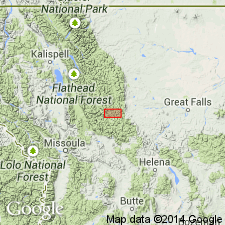
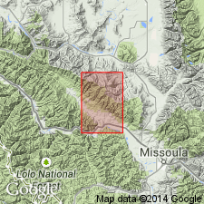
Is one of eleven formations of the Belt Supergroup mapped in the report area. Age changed from Precambrian to Precambrian Y, the age term used for rocks that range in age from 1,600 to 800 m.y. old. Is about 10,000 ft thick. Is equivalent to Wallace Formation to west. The name Newland Limestone was misapplied to these rocks by Nelson and Dobell (1961) in the Bonner quad. Lower contact with Empire Formation of Belt gradational; contact mapped as base of dominantly dolomitic rusty-weathering beds. Upper contact conformable with Miller Peak Formation of Belt; contact placed at base of interlayered red and green argillite and above the gray and greenish-gray beds of the Helena. Mapped at southwest corner of quad, Mineral Co, and at east side of quad in Sanders and Missoula Cos, MT in Northern Rocky Mountain region.
Source: GNU records (USGS DDS-6; Denver GNULEX).
- Usage in publication:
-
- Helena Dolomite*
- Modifications:
-
- Age modified
- AAPG geologic province:
-
- Northern Rocky Mountain region
Summary:
Shown on correlation chart as of Proterozoic Y age (previously Precambrian Y), the age designation for rocks that are 1,600 to 900 m.y. old. Used as a name in the Northern Rocky Mountain region.
Source: GNU records (USGS DDS-6; Denver GNULEX).
For more information, please contact Nancy Stamm, Geologic Names Committee Secretary.
Asterisk (*) indicates published by U.S. Geological Survey authors.
"No current usage" (†) implies that a name has been abandoned or has fallen into disuse. Former usage and, if known, replacement name given in parentheses ( ).
Slash (/) indicates name conflicts with nomenclatural guidelines (CSN, 1933; ACSN, 1961, 1970; NACSN, 1983, 2005, 2021). May be explained within brackets ([ ]).