The National Geologic Map Database is migrating to a new infrastructure. We apologize for any service disruptions during this process.
|
|---|


- Usage in publication:
-
- Hamakua volcanic series*
- Modifications:
-
- Original reference
- Dominant lithology:
-
- Basalt
- AAPG geologic province:
-
- Hawaii
Summary:
Pgs. 211-217. Hamakua volcanic series. Chiefly olivine basalts with a few intercalated thin ash beds. Greatest exposed thickness 650 feet at Maula Gulch. Base not exposed. Underlies Laupahoehoe volcanic series (new); in places contact is erosional unconformity. Older than Pahala ash on Mauna Loa. [Age is considered late(?) Tertiary and Quaternary.]
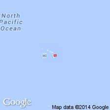
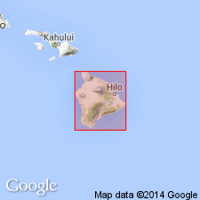
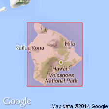
Named for exposures along coast of Hamakua District, northwest of Hilo, Island of Hawaii, HI, which is designated as type locality.
[Hawaiian spelling: Hāmākua District (U.S. Board on Geographic Names, ca. 2000).]
Source: US geologic names lexicon (USGS Bull. 1200, p. 1651); supplemental information from GNU records (USGS DDS-6; Menlo GNULEX).
- Usage in publication:
-
- Hamakua volcanic series*
- Modifications:
-
- Age modified
- AAPG geologic province:
-
- Hawaii
Summary:
Forms the major part of mountain [Mauna Kea, Island of Hawaii]. Usually carries blanket of tan colored vitric Pahala Ash 4 to 15 ft thick which separates it from overlying Laupahoehoe volcanic series. Stratigraphic chart assigns Pliocene and early and middle Pleistocene age.
Source: GNU records (USGS DDS-6; Menlo GNULEX).
- Usage in publication:
-
- Hamakua volcanic series*
- Modifications:
-
- [Principal reference]
- AAPG geologic province:
-
- Hawaii
Summary:
Pgs. 152-157, 195-196 (measured section). Hamakua volcanic series. Separated into two members: lower consists largely of olivine with abundant primitive picrite-basalt; upper largely olivine basalt but associated with it are andesites and picrite-basalts of augite-rich type. Underlies Pahala ash. Type section described in detail, thickness 246+ feet. Age is Pleistocene.
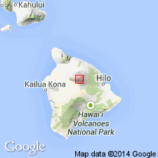
Type section: in southern wall of Laupahoehoe [Stream] gulch, along highway [in vicinity of Lat. 19 deg. 59 min. 15 sec. N., Long. 155 deg. 14 min. 45 sec. W., Papaaloa 7.5-min quadrangle, Mauna Kea Volcano, Island of Hawaii, HI].
[Additional locality information from USGS historical topographic map collection TopoView, accessed on September 7, 2023.]
Source: Publication; US geologic names lexicon (USGS Bull. 1200, p. 1651); GNU records (USGS DDS-6; Menlo GNULEX).
- Usage in publication:
-
- Hamakua volcanic series*
- Modifications:
-
- Areal extent
- AAPG geologic province:
-
- Hawaii
Summary:
Measured section along road up S wall of Laupahoehoe Gulch [near Laupahoehoe on Hamakua coast of Island of Hawaii] is divided into upper and lower members.
Source: GNU records (USGS DDS-6; Menlo GNULEX).

- Usage in publication:
-
- Hamakua volcanic series*
- Modifications:
-
- Age modified
- AAPG geologic province:
-
- Hawaii
Summary:
Hamakua volcanic series. In part younger than, and probably in part coeval with Pololu volcanic series. Older than Pahala ash. Probably correlative with Kahuku and Hilina volcanic series. No fossils. Age is considered late(?) Tertiary and Quaternary.
Source: Modified from GNU records (USGS DDS-6; Menlo GNULEX).
- Usage in publication:
-
- Hamakua volcanic series*
- Modifications:
-
- Paleomagnetics
- AAPG geologic province:
-
- Hawaii
Summary:
"All lavas now exposed on the island [of Hawaii] are less than 1 m.y. old (Pleistocene)." 26 flows of Hamakua volcanic series were sampled along S side of Laupahoehoe Gulch (essentially the lower member because the upper was too weathered).
Source: GNU records (USGS DDS-6; Menlo GNULEX).

- Usage in publication:
-
- Hamakua Group
- Modifications:
-
- Revised
- AAPG geologic province:
-
- Hawaii
Summary:
Divided into Hopukani Formation (pre-Pohakuloa lava flows) (new) and Pohakuloa Formation. Hopukani Formation is characterized as volcanic unit. Pohakuloa Formation (which includes Pohakuloa drift) is characterized as glacial unit. Pohakuloa Formation is overlain by Liloe Formation of Laupahoehoe Group.
Source: GNU records (USGS DDS-6; Menlo GNULEX).
- Usage in publication:
-
- Hamakua Group
- Modifications:
-
- Revised
- Reference
- Geochronologic dating
- AAPG geologic province:
-
- Hawaii
Summary:
Part 2, p. 980-1093. Hamakua Group. Formerly Hamakua Volcanic Series of Stearns and Macdonald (1946). Divided into (ascending): lower member of Stearns and Macdonald (1946), not studied or renamed here; Hopukani Formation, = upper member of Stearns and Macdonald (1946), and locally exposed Pohakuloa Formation, = Pohakuloa drift and pre-Pohakuloa drift of Wentworth and Powers, 1941 (GSA Bull., v. 52, 1193-1218). Underlies Laupahoehoe Group. Age is Pleistocene. Carbon-14 and K-Ar methods estimate 382,100 +/-60,600 yr to approximately 278,500 +/-68,500 yr B.P. (the ages of the Pre-Kilohanan rocks and Kilohanan stage) for age of Hamakua Group.
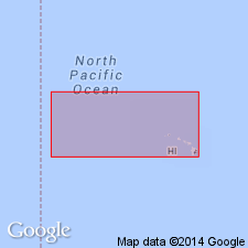
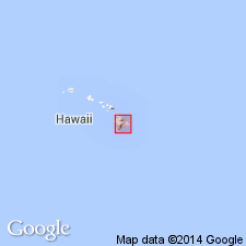
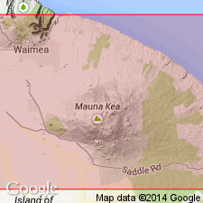
Reference section (=Hopukani Formation reference section, Pohakuloa Formation type section): west wall of Pohakuloa Gulch where channel floor reaches 2,935 m [approx. 9,629 feet] elevation, east of Waihu Spring, [approx. Lat. 19 deg. 46 min. 45 sec. N., Long. 155 deg. 30 min. 15 sec. W., Ahumoa 7.5-min quadrangle, Mauna Kea Forest Reserve, south slope of Mauna Kea Volcano, Hawaii Co., Island of Hawaii, HI] (Wentworth and Powers, 1941, p. 1210).
[See also Porter, 1973, GSA Bull., v. 84, no. 6, p. 1923-1940; Porter, 1974, NASA Space Sci. Div., Ames Research Center, Hawaiian Planetary Conf. Gdbk., p. 239-246.]
Source: Publication; supplemental information from GNU records (USGS DDS-6; Menlo GNULEX).

- Usage in publication:
-
- Hamakua Volcanics*
- Modifications:
-
- Revised
- AAPG geologic province:
-
- Hawaii
Summary:
Pgs. 62-63, 76-77 (table 1.12). Hamakua Volcanics. Because the use of Hamakua as unit of group rank, Hamakua Volcanic Series (Stearns and Macdonald, 1946) and Hamakua Group (see Porter, 1979, GSA Bull., v. 90, no. 7, pt. 2, p. 980-1093), is not consistent with approach used for rest of volcanoes of Hawaii, it is here reduced to formation rank and renamed Hamakua Volcanics. Subdivisions are reduced to member rank and renamed to reflect overall nature of their lithologies. Hamakua Volcanics is divided into (ascending): unnamed lower member, Hopukani Volcanic Member, and Pohakuloa Glacial Member. Age is considered Pleistocene, based on K-Ar and radiocarbon dating (see Porter, 1979, GSA Bull., v. 90, no. 7, pt. 1, p. 609-611; pt. 2, p. 980-1093).
Source: GNU records (USGS DDS-6; Menlo GNULEX).
- Usage in publication:
-
- Hamakua Volcanics*
- Modifications:
-
- Revised
- AAPG geologic province:
-
- Hawaii
Summary:
Unit stratigraphically extended to include overlying Waihu Glacial Member (formerly of Laupahoehoe Volcanics) and basaltic rocks of now-abandoned Waikahalulu Volcanic Member (of Laupahoehoe Volcanics). Includes two newly-named members: Hopukani Springs Volcanic Member and Liloe Spring Volcanic Member. Also still includes Pohakuloa Glacial Member. Age is Pleistocene.
Source: Modified from GNU records (USGS DDS-6; Menlo GNULEX).
For more information, please contact Nancy Stamm, Geologic Names Committee Secretary.
Asterisk (*) indicates published by U.S. Geological Survey authors.
"No current usage" (†) implies that a name has been abandoned or has fallen into disuse. Former usage and, if known, replacement name given in parentheses ( ).
Slash (/) indicates name conflicts with nomenclatural guidelines (CSN, 1933; ACSN, 1961, 1970; NACSN, 1983, 2005, 2021). May be explained within brackets ([ ]).