The National Geologic Map Database is migrating to a new infrastructure. We apologize for any service disruptions during this process.
|
|---|


- Usage in publication:
-
- Guthrie dolomite
- Modifications:
-
- Original reference
- Dominant lithology:
-
- Dolomite
- AAPG geologic province:
-
- Permian basin
Summary:
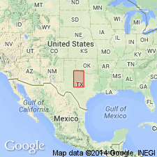
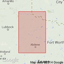
Pg. 26, pl. 1. Guthrie dolomite. Two beds of white dolomite, upper of which is 1 to 6 feet thick and locally fossiliferous. The lower member is usually separated from the upper by a sandy gypsum 1 to 5 feet thick. It grades locally into gypsum. This member is usually 1 foot thick, but in some areas attains a thickness of 5 feet. Underlies town of Guthrie, King County, central northern Texas, and outcrops along South Wichita River or Salt River east of town. Included in Double Mountain group. Younger than Quanah gypsum and older than McCauley dolomite of Fisher County. [Age is Permian.]
Source: US geologic names lexicon (USGS Bull. 896, p. 892).
- Usage in publication:
-
- Guthrie dolomite
- Modifications:
-
- Areal extent
- AAPG geologic province:
-
- Palo Duro basin
- Permian basin
Summary:
Pg. 948, pl. 9. Guthrie dolomite. Present in King County, central northern Texas. Lies 150 feet below Childress dolomite and 90 feet above Acme dolomite, and in midst of Dog Creek shale interval. The Acme dolomite can be correlated with reasonable certainty with McCaulley beds of Fisher County. Age is Permian.
Source: US geologic names lexicon (USGS Bull. 896, p. 891).

- Usage in publication:
-
- Guthrie Dolomite
- Modifications:
-
- Overview
- Areal extent
- Age modified
- AAPG geologic province:
-
- Palo Duro basin
- Permian basin
Summary:
Guthrie Dolomite is shown as topmost unit [unranked] of the Blaine Formation, topmost formation of Pease River Group of Guadalupe Series (Permian) [this is an age modification--units of Pease River Group previously assigned to Leonard Series]. Blaine includes following [unranked] units: unnamed dolomite beds, Mangum Dolomite, Acme Dolomite, and Guthrie Dolomite (all separately mapped). Mangum, Acme, and Guthrie consist of units 2 to 8 ft thick, white, tan, and yellow, argillaceous, fine- to coarse-grained, thin- to medium-bedded, ripple-marked, desiccation-cracked; molds of pelecypods and large ammonoids and nautiloids locally abundant in coarse-grained beds. The unnamed dolomite beds are white, tan, and yellow, argillaceous, fine-grained, thin- to medium-bedded in units 1 to 3 ft thick, ripple-marked, desiccation-cracked; locally contains pelecypod and cephalopod molds. Locally, in Foard and Hardeman Cos, Blaine Formation pervasively faulted and locally folded owing to gypsum and salt? dissolution (karst), preventing accurate tracing of dolomite beds. Areas of relatively pronounced gypsum karst are mapped. Most dolomite beds within karst areas are mapped but mainly unnamed. Upper part of Blaine does not crop out in map area; dolomites mapped as single lines in King and Knox Cos (Permian basin) and Foard and Hardeman Cos (Palo Duro basin), north-central TX. Geologic map. Permian (Guadalupian) age.
Source: GNU records (USGS DDS-6; Denver GNULEX).
- Usage in publication:
-
- Guthrie Dolomite Bed
- Modifications:
-
- Revised
- Reference
- AAPG geologic province:
-
- Palo Duro basin
Summary:
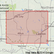
Assigned as a bed in the Dog Creek Shale of El Reno Group. Reference section designated as in bluff in SE1/4 SW1/4 NE1/4 sec 11, T1N, R26W and southwest-flowing creek in SW1/4 SE1/4 sec 1 to NE1/4 NE1/4 SE1/4 sec 1, Harmon Co, OK in the Palo Duro basin where it overlies unnamed green-gray and red-brown shale of the Dog Creek and underlies the informally named Guthrie dolomite bed [two names should not be derived from the same geographic feature] of the Dog Creek. Consists of gray microgranular, platy, highly weathered and honeycombed dolomite 2 ft thick at reference section. In two other measured sections described, it is 0.1 and 2.7 ft thick. The thickest section of the dolomite is interbedded with gypsum and it has pelecypod molds. Locally, it can be 4 ft thick; thins to northeast and along south flanks of Anadarko basin. Permian age.
Source: GNU records (USGS DDS-6; Denver GNULEX).

- Usage in publication:
-
- Guthrie Dolomite [unranked]
- Modifications:
-
- Mapped 1:250k
- Dominant lithology:
-
- Dolomite
- AAPG geologic province:
-
- Palo Duro basin
- Permian basin
Summary:
Guthrie Dolomite [unranked] in middle part of Blaine Formation. Separately mapped in Cottle, King, and Stonewall Counties, Texas. Age is Permian.
Source: Publication.
For more information, please contact Nancy Stamm, Geologic Names Committee Secretary.
Asterisk (*) indicates published by U.S. Geological Survey authors.
"No current usage" (†) implies that a name has been abandoned or has fallen into disuse. Former usage and, if known, replacement name given in parentheses ( ).
Slash (/) indicates name conflicts with nomenclatural guidelines (CSN, 1933; ACSN, 1961, 1970; NACSN, 1983, 2005, 2021). May be explained within brackets ([ ]).