The National Geologic Map Database is migrating to a new infrastructure. We apologize for any service disruptions during this process.
|
|---|


- Usage in publication:
-
- Grove Church Shale
- Modifications:
-
- Named
- Dominant lithology:
-
- Shale
- Limestone
- AAPG geologic province:
-
- Illinois basin
Summary:
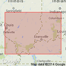
Named Grove Church Shale (also Formation). Composed of gray calcareous shale and shaly limestone. 16 ft thick at type section. Maximum thickness known is 65 ft. Topmost Mississippian formation in Illinois basin. Underlain by Goreville Limestone Member of Kinkaid Limestone; overlain by Pennsylvanian rocks. Occurs in southeast IL, southwest IN, and possibly in 2 or 3 counties in KY.
Source: GNU records (USGS DDS-6; Reston GNULEX).

- Usage in publication:
-
- Grove Church Shale
- Modifications:
-
- Overview
- AAPG geologic province:
-
- Illinois basin
Summary:
Current (1975) usage of Illinois Geological Survey is Grove Church Shale. It is a gray fossiliferous shale and includes interbedded fossiliferous limestone. Maximum known thickness is 67 ft in Johnson Co., IL. Underlain by Kinkaid Limestone; overlain by Pennsylvanian rocks.
Source: GNU records (USGS DDS-6; Reston GNULEX).

- Usage in publication:
-
- Grove Church Shale
- Modifications:
-
- Overview
- AAPG geologic province:
-
- Illinois basin
Summary:
Current (1986) usage of Indiana Geological Survey is Grove Church Shale of Buffalo Wallow Group (topmost formation). Youngest known Mississippian formation. In Indiana, known only in subsurface in Posey Co. where it is predominantly drab fossiliferous shale of various shades of medium and dark gray and green. The shale is thin bedded to platy and quite soft. Several thin beds of limestone as thick as 2 ft are interbedded in the shale. Maximum known thickness is 50 ft. Conformably overlies Kinkaid Limestone. Contact with overlying Pennsylvanian rocks may or may not be conformable.
Source: GNU records (USGS DDS-6; Reston GNULEX).

- Usage in publication:
-
- Grove Church Member
- Modifications:
-
- Revised
- Overview
- AAPG geologic province:
-
- Illinois basin
Summary:
Authors here revise Grove Church Shale (of Swann, 1963) as Grove Church Member of Kinkaid Limestone as it does not meet the test of mappability required by the 1983 Code. Interbedded shale and limestone of the Grove Church are lithologically similar to the rest of the Kinkaid and therefore unit is assigned as upper member. Unit is found in outcrop immediately south of the Eddyville quad in gullies about 600 ft from the south line, 1,500 ft from the east line, sec. 4, T12S, R6E, Waltersburg quad. Thickness of 71 ft taken from Jenkins #1 Mohler well. Consists primarily of olive gray to greenish gray, lightly mottled, partly calcareous shale. Limestone beds in lower part less than 1 ft thick. Limestone bed in upper part measures up to 18 ft thick. Ascending Negli Creek Limestone, Cave Hill, and Goreville Limestone Members also traceable in outcrop and subsurface in southern IL. Unconformably underlies Morrowan Caseyville Formation. Age is Chesterian.
Source: GNU records (USGS DDS-6; Reston GNULEX).
For more information, please contact Nancy Stamm, Geologic Names Committee Secretary.
Asterisk (*) indicates published by U.S. Geological Survey authors.
"No current usage" (†) implies that a name has been abandoned or has fallen into disuse. Former usage and, if known, replacement name given in parentheses ( ).
Slash (/) indicates name conflicts with nomenclatural guidelines (CSN, 1933; ACSN, 1961, 1970; NACSN, 1983, 2005, 2021). May be explained within brackets ([ ]).