

- Usage in publication:
-
- Grinnell argillite*
- Modifications:
-
- Original reference
- Dominant lithology:
-
- Argillite
- AAPG geologic province:
-
- Northern Rocky Mountain region
Summary:
Pg. 316, 322. Grinnell argillite. Argillite, dark red, shaly, sometimes arenaceous, ripple-marked, sun-cracked. Thickness 1,000 to 1,800 feet. Conformably overlain by Siyeh limestone. Overlies Appekunny argillite. It is possible more detailed stratigraphic study may develop fact that Grinnell and Appekunny argillites are really phases of one great formation, and that line of distinction between them is one diagonal to stratification. Age is pre-Cambrian (Belt).
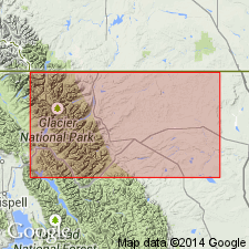
Type locality: Mount Grinnell, at head of Swift Current Valley, Glacier National Park, Glacier Co., northwestern MT, where it is 1,800 feet thick. Also well exposed on Appekunny and Robertson Mountains.
Source: US geologic names lexicon (USGS Bull. 896, p. 62).
- Usage in publication:
-
- Grinnell formation
- Modifications:
-
- Areal extent
- AAPG geologic province:
-
- Northern Rocky Mountain region
Summary:
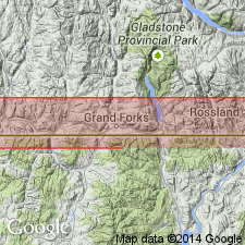
Areally extended by mapping northward into BC in the Northern Rocky Mountain region as fourth formation from base (of 8) of Lewis series. Conformably overlies Appekunny formation of Lewis series. Conformably underlies Siyeh formation of Lewis series. Section 1,600 ft thick measured on southwest side of King Edward Peak above the Flathead valley about 3 mi north of the Boundary line where Grinnell consists of red to red-gray, thin-bedded metargillite and quartzitic sandstone. A 20 ft thick amygdaloidal lava flow probably related to the Purcell lava occurs 355 ft below top. Sun cracks and ripple marks common. Geologic map. Assigned to the Lower Cambrian?.
Source: GNU records (USGS DDS-6; Denver GNULEX).
- Usage in publication:
-
- Grinnell formation
- Modifications:
-
- Revised
- AAPG geologic province:
-
- Northern Rocky Mountain region
Summary:
Is a formation in the Belt series of Algonkian or Proterozoic age. Divided into Red Gap (base) and Rising Bull (top) members in the Glacier National Park, MT in the Northern Rocky Mountain region, and Waterton Lakes National Park, AT. [Not possible to determine exact areal extent.] Overlies Appekunny formation and underlies Siyeh formation. This report is the first published report to use the terms Red Gap and Rising Bull members.
Source: GNU records (USGS DDS-6; Denver GNULEX).

- Usage in publication:
-
- Grinnell formation
- Modifications:
-
- Overview
- Revised
- AAPG geologic province:
-
- Northern Rocky Mountain region
Summary:
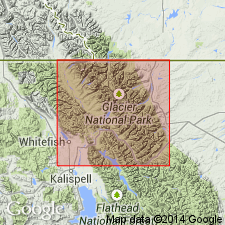
Is the upper formation of the Ravalli group of the Belt series. Overlies Scenic Point Member of Appekunny formation. Underlies Siyeh formation of Piegan group (new) of Belt series. Type locality stated as being at head of Grinnell Point (called Stark Point on some maps) at head of Swiftcurrent, formerly called McDermott Lake. Measured section in Blackiston Valley, Waterton Lakes Park, AT, Canada separable into Rising Wolf member (base) (reassigned from Appekunny formation), Red Gap, and Rising Bear members. Is 1,600+/-ft thick in Blackiston Valley. Is 2,200 ft thick on Mt. Grinnell in Glacier National Park in Northern Rocky Mountain region. Thickens west to 3,400+ ft. Of pre-Cambrian age.
Source: GNU records (USGS DDS-6; Denver GNULEX).

- Usage in publication:
-
- Grinnell Argillite†
- Modifications:
-
- Abandoned
Summary:
Abandoned in favor of its stratigraphic and lithologic equivalent, the Spokane Formation of Ravalli Group of Belt Supergroup of Precambrian age in the Northern Rocky Mountain region.
Source: GNU records (USGS DDS-6; Denver GNULEX).
- Usage in publication:
-
- Grinnell Formation*
- Modifications:
-
- Reinstated
- AAPG geologic province:
-
- Northern Rocky Mountain region
Summary:
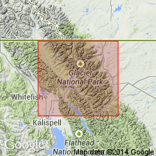
Grinnell Formation of Belt Supergroup. Reinstated, after usage of Ross (1959), in Glacier National Park and adjacent areas, Glacier and Flathead Counties, northwestern Montana. Replaces Spokane Formation of Mudge (1977). Contains abundant beds of white quartz arenite on east side of park and interlaminated siltite and argillite on west side. Thickness 530 to 790 m. Overlies Appekunny Formation and underlies Empire Formation, both of Belt Supergroup. Age is Middle Proterozoic.
Source: Publication.
For more information, please contact Nancy Stamm, Geologic Names Committee Secretary.
Asterisk (*) indicates published by U.S. Geological Survey authors.
"No current usage" (†) implies that a name has been abandoned or has fallen into disuse. Former usage and, if known, replacement name given in parentheses ( ).
Slash (/) indicates name conflicts with nomenclatural guidelines (CSN, 1933; ACSN, 1961, 1970; NACSN, 1983, 2005, 2021). May be explained within brackets ([ ]).