- Usage in publication:
-
- Grier Limestone Member*
- Modifications:
-
- Named
- Dominant lithology:
-
- Limestone
- AAPG geologic province:
-
- Cincinnati arch
Summary:
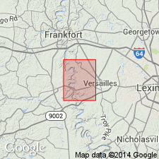
Named for Grier Creek in southern part of the Tyrone quadrangle, Woodford Co., KY. Type section is in exposures along Shyrock Ferry Road from 1/2 to 3/4 mi south-southwest of Grier Creek Church. Consists of light- to yellowish-gray, medium- to coarse-grained, thin-bedded, slightly phosphatic, fossiliferous limestone; minor shale. Conformably underlain by Logana Member, conformably overlain by Brannon Limestone Member. Same rocks previously called Logana, Jessamine, and Benson limestones.
Source: GNU records (USGS DDS-6; Reston GNULEX).

- Usage in publication:
-
- Grier Limestone Member*
- Modifications:
-
- Overview
- AAPG geologic province:
-
- Cincinnati arch
Summary:
The Grier Limestone Member of the Lexington Limestone consists of thin- and irregularly bedded to nodular-bedded, poorly sorted, fossiliferous limestone. Fossils include brachiopods, bryozoans, gastropods, ostracodes, crinoids, pelecypods, and trilobites. Thickness is 100 to 180 feet. In northern outcrop area the Grier conformably overlies and intertongues with the Logana Member of the Lexington Limestone and in the southern area overlies the Curdsville Limestone Member of the Lexington Limestone; through most of central KY, unit conformably underlies and intertongues with the Tanglewood Limestone Member of the Lexington Limestone, but in south-central area, it underlies the Brannon Member of the Lexington. The environment of deposition is interpreted to be shallow, moderately agitated water with normal salinity and well aerated.
Source: GNU records (USGS DDS-6; Reston GNULEX).

- Usage in publication:
-
- Grier Limestone Member*
- Modifications:
-
- Age modified
- AAPG geologic province:
-
- Cincinnati arch
Summary:
Grier Limestone Member of Lexington Limestone is Champlainian (Kirkfieldian and Shermanian) in age.
Source: GNU records (USGS DDS-6; Reston GNULEX).
For more information, please contact Nancy Stamm, Geologic Names Committee Secretary.
Asterisk (*) indicates published by U.S. Geological Survey authors.
"No current usage" (†) implies that a name has been abandoned or has fallen into disuse. Former usage and, if known, replacement name given in parentheses ( ).
Slash (/) indicates name conflicts with nomenclatural guidelines (CSN, 1933; ACSN, 1961, 1970; NACSN, 1983, 2005, 2021). May be explained within brackets ([ ]).

