

- Usage in publication:
-
- Greyson shales*
- Modifications:
-
- Original reference
- Dominant lithology:
-
- Shale
- AAPG geologic province:
-
- Northern Rocky Mountain region
Summary:
Pg. 199-215. Greyson shales. Consist of (descending): (1) dark-gray siliceous and arenaceous shales, with interbedded bands of buff sandy shales and occasional layers of hard compact greenish-gray and drab siliceous rock; (2) bluish-gray, almost fissile shales; (3) dark coarse siliceous and arenaceous shales; (4) quartzites interbedded with shales in Deep Creek Canyon, 90 feet; (5) intraformational conglomerates, 10 feet in Deep Creek Canyon. Total thickness 3,000 feet. Underlies Spokane shales and overlies Newland limestone. Age is pre-Cambrian (Belt).
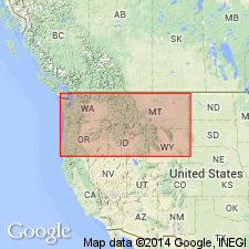
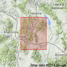
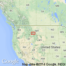
Type locality: on side of ridge between Deep and Greyson Creeks, southeast of Townsend, [Teton Co.], Belt Mountains, western central MT.
Source: US geologic names lexicon (USGS Bull. 896, p. 879).

- Usage in publication:
-
- Greyson member
- Modifications:
-
- Revised
- AAPG geologic province:
-
- Northern Rocky Mountain region
Summary:
First published use as the lower member (rather than as a formation beneath the Spokane) of the Spokane formation in its western facies of the Piegan group (new) of the Belt series. No explanation for rank change given. Areal extent of Greyson member not stated. Overlies the Granite Park member of the Siyeh formation of the Piegan. Underlies the Prickly Pear member (new) of the Spokane. Is 2,300 to 3,000 ft thick in the western facies in which it is composed of gray and greenish-gray, thinly bedded shale, conglomerate and pink sandstone. Of pre-Cambrian age.
Source: GNU records (USGS DDS-6; Denver GNULEX).
- Usage in publication:
-
- Greyson shale
- Modifications:
-
- Revised
- AAPG geologic province:
-
- Northern Rocky Mountain region
Summary:
A uniform brown-black to purple silt shale, is thought to be the same unit called Greyson shale. Is 2,700 ft thick in the Whitehall area, Jefferson Co, MT in Northern Rocky Mountain region. Overlies and intertongues with LaHood formation (named in this report), also of the Belt series. Is conformably overlain by Flathead sandstone. Is of pre-Cambrian age.
Source: GNU records (USGS DDS-6; Denver GNULEX).
- Usage in publication:
-
- Greyson Shale
- Modifications:
-
- Overview
- AAPG geologic province:
-
- Northern Rocky Mountain region
Summary:
Coarse-grained arkose and conglomerate of the LaHood Formation crop out in a narrow zone from the northern half of the Bridger Range to and across the Highland Mountains, in Northern Rocky Mountain region, Jefferson Co, MT. Grades northward into fine-grained carbonate, argillite, siltite, and quartzite of Belt Series. Belt rocks included are Neihart Quartzite, Chamberlain Shale, Prichard Formation, Newland Limestone, and lower part of Greyson Shale. Greyson is of Precambrian age.
Source: GNU records (USGS DDS-6; Denver GNULEX).

- Usage in publication:
-
- Greyson Shale*
- Modifications:
-
- Overview
- AAPG geologic province:
-
- Northern Rocky Mountain region
Summary:
Is a unit used in the Northern Rocky Mountain region. Stratigraphic position and correlation with other Precambrian formations of the Belt Supergroup of the U.S. and of the Purcell Supergroup of Alberta and British Columbia, Canada shown on figures 4, 5, and 8.
Source: GNU records (USGS DDS-6; Denver GNULEX).
- Usage in publication:
-
- Greyson Formation*
- Modifications:
-
- Areal extent
- AAPG geologic province:
-
- Northern Rocky Mountain region
Summary:
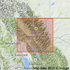
Names Greyson Formation and Appekunny Argillite or Formation have been applied to the same rocks of Belt Supergroup in Glacier National Park, Glacier Co, MT in Northern Rocky Mountain region. Name Greyson is the older name and is used in preference to Appekunny, a name abandoned. Overlies Altyn Formation (formerly Altyn Limestone). Underlies Spokane Formation. Of Precambrian Y age. Assigned to Ravalli Group of Belt Supergroup.
Source: GNU records (USGS DDS-6; Denver GNULEX).
- Usage in publication:
-
- Greyson Formation
- Modifications:
-
- Not used
- AAPG geologic province:
-
- Northern Rocky Mountain region
Summary:
Greyson Formation. Restricted from Glacier National Park, Glacier and Flathead Counties, northwestern Montana. Confined to west-central part of Montana (Helena embayment), where it is composed mostly of thinly laminated siltite and dark-greenish-black argillite. In Glacier National Park, Greyson is replaced with Appekunny Formation (after usage of Ross, 1959) which includes thick beds of quartz arenite, hummocky cross-stratified siltite, and mudcracked argillite.
Source: Publication.
For more information, please contact Nancy Stamm, Geologic Names Committee Secretary.
Asterisk (*) indicates published by U.S. Geological Survey authors.
"No current usage" (†) implies that a name has been abandoned or has fallen into disuse. Former usage and, if known, replacement name given in parentheses ( ).
Slash (/) indicates name conflicts with nomenclatural guidelines (CSN, 1933; ACSN, 1961, 1970; NACSN, 1983, 2005, 2021). May be explained within brackets ([ ]).