


- Usage in publication:
-
- Green Lake Limestone Member
- Modifications:
-
- Named
- Dominant lithology:
-
- Limestone
- Chert
- AAPG geologic province:
-
- Idaho Mountains province
Summary:
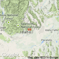
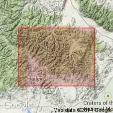
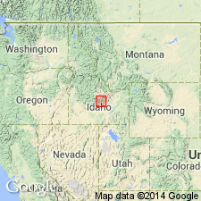
Name applied to a 100 to 400 ft thick limestone that lies about 100 ft below top of Muldoon Canyon Formation of Copper Basin Group (rank raised). Gradationally overlies and underlies unnamed gray argillite of Muldoon Canyon. Named for Green Lake. Type section designated and measured at SE1/4 NE1/4 NW1/4 sec 5, T4N, R22E, Custer Co, ID in the Idaho Mountains province. Is 335 ft thick at type. Consists of gray-black, silty, micritic limestone in beds 1-6 in thick that weather grayish-orange. Base and top of member defined where limestone predominates over argillite. Thin beds and nodules of chert in middle part may make up 40 percent of that part of member. Thins north and south of type. Age assignment of Early Pennsylvanian given on basis of stratigraphic position.
Source: GNU records (USGS DDS-6; Denver GNULEX).
- Usage in publication:
-
- Green Lake Limestone Member
- Modifications:
-
- Age modified
- AAPG geologic province:
-
- Idaho Mountains province
Summary:
Considered to be a member of Muldoon Canyon Formation of Copper Basin Group in the northern Pioneer Mountains, Custer Co, ID in the Idaho Mountains province. Age modified from Early Pennsylvanian to Late Mississippian [reason not stated]. Nomenclature chart. Stratigraphic figure.
Source: GNU records (USGS DDS-6; Denver GNULEX).
- Usage in publication:
-
- Green Lake Limestone Member*
- Modifications:
-
- Revised
- Age modified
- AAPG geologic province:
-
- Idaho Mountains province
Summary:
Revised in association from member of Muldoon Canyon Formation of Copper Basin Group to member of Copper Basin Formation. Overlies and underlies unnamed parts of Copper Basin Formation. Mapped as unit of Glide Mountain plate on southwest side of Copper Basin, north-central part of study area, Custer Co, ID in the Idaho Mountains province. Consists of about 250 ft of thinly bedded argillite, silty limestone and bioclastic limestone with a late Kinderhookian conodont fauna. [Age modified from Late Mississippian to Early Mississippian, late Kinderhookian.] Is similar to Drummond Mine Limestone Member of Copper Basin in the Copper Basin plate.
Source: GNU records (USGS DDS-6; Denver GNULEX).
- Usage in publication:
-
- Green Lake Limestone Bed*
- Modifications:
-
- Revised
- AAPG geologic province:
-
- Snake River basin
Summary:
Reduced to bed rank because Muldoon Canyon reduced to member of newly named Argosy Creek Formation of Copper Basin Group. Occurs in area of Pioneer Mountains, Blaine Co, ID (Snake River basin) west of Copper Basin thrust fault. Assigned Early Mississippian (Kinderhookian and Osagean?) age based on ammonoids and conodonts.
Source: GNU records (USGS DDS-6; Denver GNULEX).
For more information, please contact Nancy Stamm, Geologic Names Committee Secretary.
Asterisk (*) indicates published by U.S. Geological Survey authors.
"No current usage" (†) implies that a name has been abandoned or has fallen into disuse. Former usage and, if known, replacement name given in parentheses ( ).
Slash (/) indicates name conflicts with nomenclatural guidelines (CSN, 1933; ACSN, 1961, 1970; NACSN, 1983, 2005, 2021). May be explained within brackets ([ ]).