

- Usage in publication:
-
- Grayson marl member*
- Modifications:
-
- Overview
- AAPG geologic province:
-
- Fort Worth syncline
- South Oklahoma folded belt
Summary:
Pg. 114-115, 121-124, 245, 246-249, 266-271, pls. 7, 18. Grayson marl member of Denison formation. Restricted Main Street limestone to beds underlying Grayson marl, or to those called "Choctaw limestone" by Cragin. He defined Grayson marl as grayish marls, lighter colored than Main Street limestone, 15 to 60 feet thick, and as forming top member of Denison formation. Age is Early Cretaceous (Comanche). This is definition followed by the USGS.
Source: US geologic names lexicon (USGS Bull. 896, p. 863).
- Usage in publication:
-
- Grayson Formation*
- Modifications:
-
- Mapped 1:62.5k
- Dominant lithology:
-
- Claystone
- Sandstone
- Siltstone
- AAPG geologic province:
-
- Permian basin
Summary:
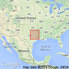
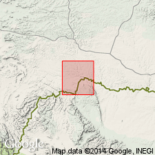
Is formation mapped in eastern Brewster and southwest Terrell Cos, TX in Permian basin. Del Rio Clay, of former usage, not used in this report. [No explanation given for choice of nomenclature; probably a result of Imlay's (1944) general use of the Grayson nomenclature, which was misinterpreted as abandonment of the Del Rio by some subsequent workers. Del Rio nomenclature is currently appropriate for south-central to west TX area.] Overlies Georgetown Limestone; underlies erosional unconformity below Buda Limestone. Map unit described as mostly claystone, poorly exposed, with subordinate sandstone and siltstone. Claystone has some silty beds, is yellowish gray and greenish gray weathering to dark reddish brown, laminated, and contains seams of gypsum and nodules of iron oxides. Sandstone and siltstone is light yellowish gray weathering to dark yellowish orange, well-sorted; glauconitic; friable to firmly cemented with calcite; thin bedded; sparsely fossiliferous. Thickens southwestward from 30 ft to 80 ft. Age is Late Cretaceous.
Source: GNU records (USGS DDS-6; Denver GNULEX).
- Usage in publication:
-
- Grayson Formation
- Modifications:
-
- Biostratigraphic dating
- AAPG geologic province:
-
- Ouachita folded belt
Summary:
Grayson Formation of Washita Group. Twenty-seven species of cephalopods (nautiloids, cephalopods, and 1 belemnoid) are identified from an exposure of the Grayson Formation at the Waco Dam Spillway, McLennan County, north-central Texas. Here the Grayson consists of (ascending): calcareous claystone interbedded with mudstone, about 5 m thick; claystone interlaminated with pyritic or limonitic seams, about 4 m thick; calcareous claystone interbedded with siltstone, about 6 m thick; and nodular wackestone, about 1 m thick. Total thickness about 16 m. Disconformably underlies Pepper Shale. Age is late Early to early Late Cretaceous (Albian to Cenomanian). Lowest beds carry a late Albian ammonite fauna; the remainder of formation carries early Cenomanian ammonites MANTELLICERAS cf. M. CANTIANUM Spath, M. SAXBII (Sharpe), SHARPEICERAS MEXICANUM (Bose), and (?)PARACALYCOCERAS sp. Previously these mantellicerid ammonites have only been reported from the Buda Limestone which overlies the Grayson elsewhere in north-central Texas.
Source: Publication.

- Usage in publication:
-
- Grayson Marl
- Modifications:
-
- Areal extent
- AAPG geologic province:
-
- Fort Worth syncline
- Ouachita folded belt
- Strawn basin
Summary:
Grayson Marl. Mostly calcareous clay and marl, blocky, yellowish gray and medium gray; some 0.25- to 1.0-foot limestone beds in upper one-third, very fine-grained, fossiliferous; weathers yellowish brown, forms gentle slope. Thickness 60 to 100 feet, thins northward. Lies above Main Street Limestone and below Woodbine Formation. Age is Early Cretaceous.
Not separately mapped. Grayson Marl and Main Street Limestone [undifferentiated] mapped [in Denton, Hill, Johnson, and Tarrant Cos., eastern TX].
Source: Publication.

- Usage in publication:
-
- Grayson Marl
- Modifications:
-
- Areal extent
- Dominant lithology:
-
- Marl
- Limestone
- AAPG geologic province:
-
- Fort Worth syncline
- Ouachita folded belt
- South Oklahoma folded belt
Summary:
Pamphlet [p. 4]. Grayson Marl. In Texas, mostly marl, light-greenish-gray to medium-gray, weathers to grayish-yellow; thin interbeds of limestone near top, gray, nodular, slightly sandy, fossiliferous; thickness 15 to 60 feet. Lies above Main Street Limestone and below Woodbine Formation. [Age is late Early to early Late Cretaceous.]
In Oklahoma, marlstone, gray to light-greenish-gray, interbeds of gray to white nodular limestone, fossiliferous with abundant ILYMATOGYRA ARIETINA (Roemer) and TEXIGRYPHAEA GRAYSONANA (Stanton); thickness 0 to 27 feet. Lies above Bennington Limestone and below Woodbine Formation. [Age is late Early to early Late Cretaceous.]
Not separately mapped. Grayson Marl mapped undifferentiated with Main Street Limestone (Texas) and Bennington Limestone (Oklahoma), [in Red River area and southward to southern boundary of map sheet, in Cooke, Denton, and Grayson Cos., central northern TX, and Bryan and Marshall Cos., southeastern OK].
Source: Publication.
For more information, please contact Nancy Stamm, Geologic Names Committee Secretary.
Asterisk (*) indicates published by U.S. Geological Survey authors.
"No current usage" (†) implies that a name has been abandoned or has fallen into disuse. Former usage and, if known, replacement name given in parentheses ( ).
Slash (/) indicates name conflicts with nomenclatural guidelines (CSN, 1933; ACSN, 1961, 1970; NACSN, 1983, 2005, 2021). May be explained within brackets ([ ]).